Tuesday 29 March 2022

Skulferatu #64 - Path to Oxroad Bay, North Berwick, East Lothian


I haven’t walked down the path to Oxroad Bay for a few years.  Last time I walked along it, there had been a landslide and part of the path had fallen away.  This led to a slightly dangerous walk along a ledge with a sheer drop of twenty to thirty feet to the rocks below. 


My walk along the path began as an easy wander down the side of a field that lies on the road to Seacliff Beach.  The path runs by an old, stone wall and Tantallon Castle dominates the view on the way along.  I then made my way down through a gap at the end of the field and on to the steep path that leads down to the bay.


A photo showing a view of the grass at the side of a ploughed field and a path and a wall leading down with Tantallon Castle and the Bass Rock in the background.  Photo by Kevin Nosferatu for the Skulferatu Project.
View of Tantallon Castle and Bass Rock on path to Oxroad Bay


View of Tantallon Castle from path to Oxroad Bay.  Photo by Kevin Nosferatu for the Skulferatu Project.
View of Tantallon Castle from path to Oxroad Bay


As I made my way down, I could see that there had been numerous landslides since the last time I had ventured that way and the path was now a muddy slide that in places ran to the cliff edge.  It didn’t look to safe, but hey, everyone needs a bit of danger in their life to really appreciate being alive. So, I made my way down, leaning to the side away from the cliff edge just in case I slipped and fell.  Better splattered with mud that splattered on the rocks.


A photo of a view of Tantallon Castle and the cliffs beneath it, taken from the path to Oxroad Bay.  Photo by Kevin Nosferatu for the Skulferatu Project.
View of Tantallon Castle and cliffs from path to Oxroad Bay


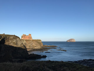
A photo of a view of Tantallon Castle and the cliffs beneath it, with the Bass Rock in the sea in the background, taken from the path to Oxroad Bay.  Photo by Kevin Nosferatu for the Skulferatu Project.
View of Tantallon Castle and Bass Rock from path to Oxroad Bay


It wasn’t the most comfortable journey down, but I made it and then realised I’d have to go back up that way again.  That spoilt the joy of being in the seclusion of the bay a bit.  And it was secluded.  The tide was quite high, so the bay was completely cut off with cliffs towering above on all sides.  


The cliffs around Oxroad Bay are mainly made up of volcanic rock, however, there is a band containing cementstones in which lots of fossils have been found.  These have mainly been fragments of fish, though various species of pteridosperms and lycopods have also been discovered in them.  


Not being much of a fossil collector, I walked around the bay in the morning sunshine and watched the sea birds wading in the few feet of mud exposed by the sea.  They called out in alarm on seeing me wandering along the beach, a big, clumsy human in a bright waterproof jacket with a bunnet on his head.


A photo of the steep path that leads down from the land above to Oxroad Bay.  Photo by Kevin Nosferatu for the Skulferatu Project.
Path leading down to Oxroad Bay


A photo of a view of Tantallon Castle and the Bass Rock from Oxroad Bay.  Photo by Kevin Nosferatu for the Skulferatu Project.
View of Tantallon Castle and Bass Rock from Oxroad Bay


I found some rocks to sit on and closed my eyes.  The winter sun warmed my face and the soothing lap of the waves made me feel at one with everything around me.  Then I remembered I had to get back up the path again.  Reverie ruined, I got up and made my way back round to the path and began my ascent.  On looking at it again I realised there were only really two bits that were bad.  In total maybe ten feet of the path and for some reason I decided that running up would be easiest, as being light of foot and fast would present the least danger.  It worked, and soon I was back up on the main path.


As I made my way back, I stopped by the old wall running along the path and left a Skulferatu in a gap by a love heart shaped stone.


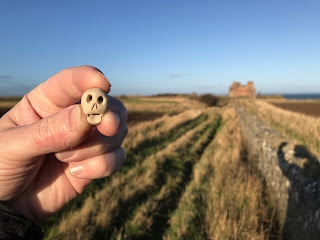
A photo of a small ceramic skull (Skulferatu 64) being held up with a wall, a field and Tantallon Castle in the background.  Photo by Kevin Nosferatu for the Skulferatu Project.
Skulferatu #64


A photo of a stone wall with a ploughed field behind it.  The sky is a cold blue.  Photo by Kevin Nosferatu for the Skulferatu Project.
Wall along the path to Oxroad Bay


A photo of a small ceramic skull (Skulferatu 64) in a gap in the stone wall, by a love heart shaped stone.  Photo by Kevin Nosferatu for the Skulferatu Project.
Skulferatu #64 in a gap in the wall


A photo of a small ceramic skull (Skulferatu 64) in a gap in the stone wall.  Photo by Kevin Nosferatu for the Skulferatu Project.
Skulferatu #64 in a gap in the wall


TomTom map showing location of Skulferatu #64 along path to Oxroad Bay.
Map showing location of Skulferatu #64


The coordinates for the location of the Skulferatu are –


Latitude 56.052649

Longitude -2.6472330


I used the following sources for information on the fossils at Oxroad Bay –


UK Fossils Network

UK Fossils - North-Berwick


Article and photographs are copyright of © Kevin Nosferatu, unless otherwise specified.

Tuesday 22 March 2022

Skulferatu #63 - Newhaven Railway Station Building, Craighall Road, Edinburgh


When I’m out cycling or walking along the paths, through and round Edinburgh, on which the old city railway lines used to run, there is a building that has always tended to catch my eye.  It stands on pillars over Hawthornvale Path and looks a bit like a Victorian Boy Scouts hut.  This building was originally Newhaven Railway Station and was for the former Caledonian Railway line.  This line ran from Edinburgh Princes Street Station, which was at the West End of Princes Street next to the Caledonian Hotel, to North Leith Station, which was on Commercial Street in Leith. 


A photograph showing a low building with cars parked outside of it.  This is Newhaven Station Building on Craighall Road, Edinburgh.  The building was once a station for the now defunct Caledonian Railway Line that ran through Edinburgh.  Photograph by Kevin Nosferatu for the Skulferatu Project
Newhaven Station Building on Craighall Road, Edinburgh


A photograph showing an ivy covered telegraph pole next to Newhaven Station.  There are no wires connected to the pole.  Photograph by Kevin Nosferatu for the Skulferatu Project
Old telegraph pole next to Newhaven Station


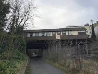
A photograph of Newhaven Station from Hawthornvale Path.  The path runs underneath the station on what was once the railway line, but is now for pedestrians and cyclists.  Photograph by Kevin Nosferatu for the Skulferatu Project
Newhaven Station from Hawthornvale Path


A photograph of Newhaven Station from Hawthornvale Path.  The path runs underneath the station on what was once the railway line, but is now for pedestrians and cyclists.  Photograph by Kevin Nosferatu for the Skulferatu Project
Newhaven Station from Hawthornvale Path


Newhaven Railway Station was opened in 1879 and closed on the 26th of April 1962.  It is the only station building to have survived of the five stations that were on the Caledonian line.  It originally had stairs leading down to the platforms, though these have now been removed.


After the railway line closed the station building was used as premises for a joinery business, a taxi firm and then lay derelict for a while. It has now been restored and is a business centre renting out desk space.


On my walk today I scrambled up the slope under the station building and past the ruins of a brick hut that is now the depository for hundreds of discarded, empty beer cans.  Then I went on up to one of the stone supports for the building and there I left a Skulferatu in one of the hollows.    


A picture of a small ceramic skull (Skulferatu 63) being held up with Newhaven Railway Station building in the background.  Photograph by Kevin Nosferatu for the Skulferatu Project
Skulferatu #63


A photo showing the pillars underneath the station building and a ruined brick hut that is covered in graffiti.  Photograph by Kevin Nosferatu for the Skulferatu Project
Underneath the station building


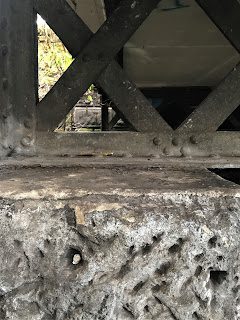
A picture of a small ceramic skull (Skulferatu 63) in the stone part of one of the support pillars for the Newhaven Station building.  Photograph by Kevin Nosferatu for the Skulferatu Project
Skulferatu #63 in hollow of stone support


A close up picture of a small ceramic skull (Skulferatu 63) in the stone part of one of the support pillars for the Newhaven Station building.  Photograph by Kevin Nosferatu for the Skulferatu Project
Skulferatu #63 in hollow of stone support


Google Map showing location of Skulferatu #63


The coordinates for the location of the Skulferatu are –


Latitude 55.976620

Longitude -3.1966390


I used the following sources for information on Newhaven Railway Station–


Canmore

Edinburgh, Craighall Road, Newhaven Station | Canmore


Doors Open Day

Newhaven Station (doorsopendays.org.uk)


Newhaven Business Station

Newhaven Business Station, Edinburgh | Desk Space to Rent

Tuesday 15 March 2022

Skulferatu #62 - Electricity Substation 33/11KV, Cowgate, Edinburgh


I used to walk through the Cowgate every week day on my way to work.  I would trudge up in the morning and then back down again in the evening.  Daily I would pass by the big, black/brown doors of this building, the hum of the machinery inside drowned out by the constant growl of the passing traffic.


A photo of a stone building with large arched windows that look almost church like - this is the Cowgate Electricity Substation.  Photo by Kevin Nosferatu for the Skulferatu Project.
The Cowgate Electricity Substation


A photo of the Cowgate Electricity Substation.  Photo by Kevin Nosferatu for the Skulferatu Project.
The Cowgate Electricity Substation


During the summer months the doors of this building would gradually become plastered in posters and flyers for various Fringe shows on at the Edinburgh Festival.  Sometimes one of them would catch my attention and maybe even make me think of going to that show, but most of the time I just trudged by on my way to or back from the misery that was my horrible job. 


One year it just seemed to rain non-stop.  I got soaked twice a day on my commute to and from work and was constantly dodging away from the huge puddles on the road, to try and avoid the dirty water spray from the passing cars. There was a particularly nasty puddle near to this building and I quickly learnt to watch and wait for a gap in the traffic before hurriedly skittering past it. 


I also did get to see lots of wonderful and weird things on my walk.  There was the fox who use to stroll down the pavement in the morning.  He wasn’t bothered by passing pedestrians like myself, he just trotted on to wherever he was going.  There were occasionally semi-naked Pagans tripping back from some hippie happening in Holyrood, blue people with flowers in their hair and grass stains on the little clothing they wore.  Sometimes there were performers returning home from an early morning/late night show or a night on the town.  Their stage make up smeared and their eyes bleary with the excesses of the Festival.  Then there was the old drunk, always immaculately attired in a suit and tie, who sang folk songs to himself and would wave hello to me as he drank his first bottle of strong cider of the day.  Often there was a little gathering of people, who had just left one of the nearby hostels, and were huddled up in the shelter of the stairwell at High School Yards.  Some quietly contemplating life, others arguing, some drinking and always a couple at the back with the silver foil out and lighters going as they prepared to shoot up.  Then, every Monday morning, there was the procession of private ambulances making their way to the mortuary in the Cowgate to drop off all the sudden deaths from that weekend.  I could always tell if there had been a murder or suspicious death by the number of police cars parked outside.  And of course, each year, just after the Festival and Fringe, there were the confused looking students, newly arrived and trying to work out how they could get to where they were meant to be going.  For the first week of the new term all the clubs in the Cowgate would have 'Fresher’s Nights' and every morning that week the pavement would be a multi-coloured, slippery carpet of spew.


Once, around Halloween time, as I walked to work, I saw a trail of bloody footprints that started almost at the entrance of the substation building.  The footprints of small, bare feet went on up through the Cowgate to Guthrie Street, where they stopped.  In my mind I could picture a werewolf, bloody from a night hunting, transforming back into its human form and trudging home.  The sort of macabre image of the dark goings on of All Hallows’ Eve.  They were probably though, the footprints of someone who had been dancing in ill-fitting shoes and taken them off when their feet got too sore.


A photo of a notice on the door of the substation that reads - SP Distribution Part of the Scottish Power Group In Emergency Phone 0845 2727 999 Quoting Substation Name Cowgate Primary 33/11KV. Photo by Kevin Nosferatu for the Skulferatu Project.
Notice on the substation door


A photo showing the view up Robertson’s Close at side of the substation showing a cobbled road going up hill past the substation on the right of the picture with older looking houses and buildings in the distance. Photo by Kevin Nosferatu for the Skulferatu Project.
View up Robertson’s Close at side of the substation


A photo showing the vents in the side wall of the Electricity Substation at the Cowgate.  There is some graffiti spray painted on to these. Photo by Kevin Nosferatu for the Skulferatu Project.
Vents in the wall of the substation


Anyway, back to the substation - there’s actually very little I know about this building other than inside it is busy working away providing electricity for a chunk of Edinburgh’s Old Town.  It is functional and unloved.  Its doors are a sometime hoarding for posters and its walls are a sometimes canvas for graffiti.  These same walls have been pissed against by generations of drunken men making their way home from boozy nights out. It is one of those buildings that is just there doing what it was designed to do.    


A faded looking Hipstamatic photo of the Cowgate Substation and view up Niddry Street South, a cobbled lane running up the right hand side of the building.  Photo by Kevin Nosferatu for the Skulferatu Project.
Cowgate Substation and view up Niddry Street South


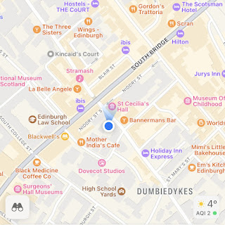
I left the Skulferatu that accompanied me on my walk in a gap in the side wall of the building, by a drainpipe.


A photo showing a small ceramic skull (Skulferatu #62) being held up with a view in the background looking down Robertson's Close in Edinburgh with the wall of the Cowgate Substation on the left of the photo. Photo by Kevin Nosferatu for the Skulferatu Project.
Skulferatu #62


A photo showing a small ceramic skull (Skulferatu #62) in a gap in the wall of the Electricity Substation in the Cowgate. Photo by Kevin Nosferatu for the Skulferatu Project.
Skulferatu #62 in gap in substation wall


A close up photo showing a small ceramic skull (Skulferatu #62) in a gap in the wall of the Electricity Substation in the Cowgate. Photo by Kevin Nosferatu for the Skulferatu Project.
Skulferatu #62 in gap in substation wall


TomTom Map showing location of Skulferatu #62
Map showing location of Skulferatu #62


The coordinates for the location of the Skulferatu are –


Latitude 55.948537

Longitude -3.186055


Article and photographs are copyright of © Kevin Nosferatu, unless otherwise specified.


Tuesday 1 March 2022

Skulferatu #61 - Craiglockhart Castle, Glenlockhart Road, Edinburgh


It was one of those days that promises to be warm but ends up freezing your ears off.  I found this out as I went for a stroll around the slippery and sludgy mud paths of Craiglockhart Hill.  The higher up I got, the more my ears stung with the cold breeze.  If only I’d thought to bring a hat with me, just in case.  Coming down off the hill I made my way over to the grounds of Napier University and the ruins of Craiglockhart Castle.


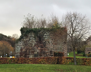
A photo showing a squat, square stone building, Craiglockhart Castle, that is in ruins.  There is a doorway blocked off with stone and in the distance many signs and lampposts as the ruin sits by the car park of Napier University in Edinburgh.   Photo by Kevin Nosferatu for the Skulferatu Project.
The ruins of Craiglockhart Castle


A photo showing the stone wall of Craiglockhart Castle and within the wall is the pattern of the doorway now blocked off with stone and above that, to the right, there is a slit window. Photo by Kevin Nosferatu for the Skulferatu Project.
The doorway to the castle


A photo showing vegetation growing out the top of Craiglockhart Castle. Photo by Kevin Nosferatu for the Skulferatu Project.
The roof of the castle – overgrown with vegetation


A photo showing a squat, square stone building, Craiglockhart Castle, that is in ruins.  There is a doorway blocked off with stone and vegetation grows out of the top of the building. Photo by Kevin Nosferatu for the Skulferatu Project.
The ruins of Craiglockhart Castle


Some castles are just ruins, others are completely f*cked.  Craiglockhart Castle is one of the latter.  Not much remains of the castle now, it is just a crumbling square of stone walls with some vegetation growing out of it.  To be honest, it wasn’t really ever much of a castle, but was more just a small, four storey tower house with pretentions.  Now only the first storey and part of the second storey remain.


A photo showing a view of the ruins Craiglockhart Castle with the road to the car park running past it.  Photo by Kevin Nosferatu for the Skulferatu Project.
The ruins of Craiglockhart Castle


A photo showing a view of the ruins Craiglockhart Castle and a slit window within the stone walls. Photo by Kevin Nosferatu for the Skulferatu Project.
The ruins of Craiglockhart Castle


A photo showing a view of the ruins Craiglockhart Castle with a slit window in the walls and vegetation growing out from the top of it. Photo by Kevin Nosferatu for the Skulferatu Project.
The ruins of Craiglockhart Castle


A photo showing a view of the ruins Craiglockhart Castle in the grounds of Napier University, Edinburgh. Photo by Kevin Nosferatu for the Skulferatu Project.
The ruins of Craiglockhart Castle


Not much is known about the history of the castle, and theories about it are that it was either built for the Kincaid family in the 12th Century or in the 15th Century for the Lockharts of Lee.  Nobody really knows and its story is now lost in the mists of time.  I’m sure many interesting things happened here, intrigues, love affairs, scandals, and deaths.  Maybe it was even the site of the first contact between man and traveller from outer space, but we will never know, as all the memories of this building are now gone.  Gone with those who once lived here.  Gone and forgotten.


And on that cheery note, I left the Skulferatu that accompanied me on my walk in one of the many thousands of gaps and holes in the crumbling walls of the castle.


A picture of a small ceramic skull (Skulferatu 61) being held up with Craiglockhart Castle in the background. Photo by Kevin Nosferatu for the Skulferatu Project.
Skulferatu #61


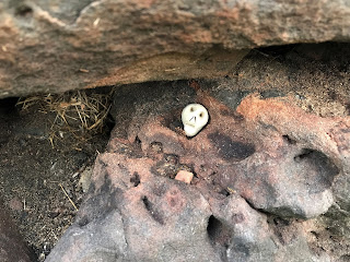
A picture of a small ceramic skull (Skulferatu 61) in an indentation in the worn stone of the walls of Craiglockhart Castle. Photo by Kevin Nosferatu for the Skulferatu Project.
Skulferatu #61 in a gap in the castle walls


A close up picture of a small ceramic skull (Skulferatu 61) in an indentation in the worn stone of the walls of Craiglockhart Castle. Photo by Kevin Nosferatu for the Skulferatu Project.
Skulferatu #61 in a gap in the castle walls


TomTom Map showing location of Skulferatu #61 at Craiglockhart Castle, Edinburgh
Map showing location of Skulferatu #61


The coordinates for the location of the Skulferatu are –


Latitude 55.919290

Longitude -3.238320


I used the following sources for information on Craiglockhart Castle –


Canmore

Craiglockhart Castle | Canmore


Gazetteer for Scotland

Craiglockhart Castle: Overview of Craiglockhart Castle (scottish-places.info)


The Castellated and Domestic Architecture of Scotland from the Twelfth to the Eighteenth Century

Volume Three

By David MacGibbon and Thomas Ross

1887