Tuesday 29 June 2021

Skulferatu #35 - Ha Lighthouse (Hawkcraig Point Range Front Light), Aberdour


On a lovely, sunny bank holiday Monday I went for a walk along the Fife Coastal Path from Burntisland to Aberdour.  My walk took me past Silver Sands Beach, which was packed with people making the best of the sun and the easing of the Covid restrictions.  I carried on round to the rocky outcrop of Hawkcraig Point and made my way round to Ha Lighthouse.  This lighthouse stands on the rocks overlooking the sea and, on a clear day, has some great views out over the Forth to Inchcolm Island and Edinburgh.   Most of Edinburgh was however obscured by the remnants of the morning haar.


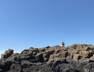
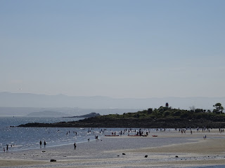
View over Silver Sands Beach to Hawkcraig Point and Ha Lighthouse on a sunny day with lots of people out on the beach.  Photo by Kevin Nosferatu for The Skulferatu Project.
View over Silver Sands Beach to Hawkcraig Point and Ha Lighthouse


Rocks up to Ha Lighthouse, Aberdour.  Photo by Kevin Nosferatu for The Skulferatu Project.
Rocks up to Ha Lighthouse


Ha Lighthouse (Hawkcraig Point Range Front Light), Aberdour.  Photo by Kevin Nosferatu for The Skulferatu Project.
Ha Lighthouse (Hawkcraig Point Range Front Light)


I can find very little information about this lighthouse other than it is one of two lights on Hawkcraig Point, this being the Front Light and…wait for it…the other being the Rear Light.  Original names or what!  These two automated lights mark the deep water channel from the east end of Mortimer’s Deep to the Forth Deepwater Channel.  This deep water channel being used by the oil tankers making their way up the Forth from Braefoot Terminal where they have been pumped full of a cargo of liquefied petroleum gas.  Not really the type of ship you want hitting anything and leaking its cargo into the sea.


Other than that, the only exciting details I can find are that Ha Lighthouse is 13 feet high and when the light is on it flashes on for 2.5 seconds and off for 2.5 seconds.  And for those of you who haven’t fallen asleep yet, I can let you know that the rear lighthouse is 26 feet high, and its light also flashes on and off for 2.5 seconds.


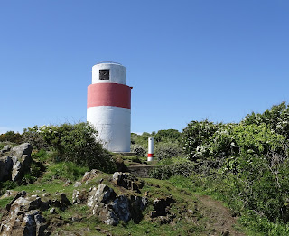
Ha Lighthouse (Hawkcraig Point Range Front Light) sitting amongst the rocks.  .Photo by Kevin Nosferatu for The Skulferatu Project.
Ha Lighthouse (Hawkcraig Point Range Front Light)


Ha Lighthouse with Hawkcraig Point Range Rear Light in background.  Photo by Kevin Nosferatu for The Skulferatu Project.
Ha Lighthouse with Hawkcraig Point Range Rear Light in background


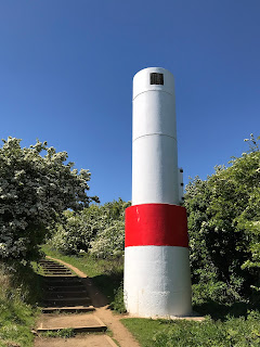
Hawkcraig Point Range Rear Light - an automated lighthouse painted white and red with stairs running up the grassy hill at the side of it.  Photo by Kevin Nosferatu for The Skulferatu Project.
Hawkcraig Point Range Rear Light


Near to where the lighthouses stand is where, from 1915 to 1919, HMS Tarlair was based.  This was not a ship, but rather an experimental research base.  Here the Royal Navy had their main hydrophone research and training facility.  The hydrophones were underwater microphones used to listen out for U-boats and were the forerunner to today’s sonar systems.  The work carried out here led to major technological advances in the detection of submarines and was one of the first collaborations between military and civilian scientists and researchers.


There is not much left of this facility now other than a few concrete bases for the huts and part of a pier.


I left the Skulferatu that accompanied me on today’s walk in the cliff face down from the lighthouse.


Skulferatu #35 being held up for show with Ha Lighthouse in the background.  Photo by Kevin Nosferatu for The Skulferatu Project.
Skulferatu #35


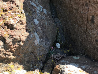
Skulferatu #35 on a ledge in the cliff face below Ha Lighthouse, Aberdour.  Photo by Kevin Nosferatu for The Skulferatu Project.
Skulferatu #35 in cliff face below Ha Lighthouse


View from cliff face where Skulferatu #35 was left, view over a sun lit sea out over the Forth.  Photo by Kevin Nosferatu for The Skulferatu Project.
View from cliff face where Skulferatu #35 was left


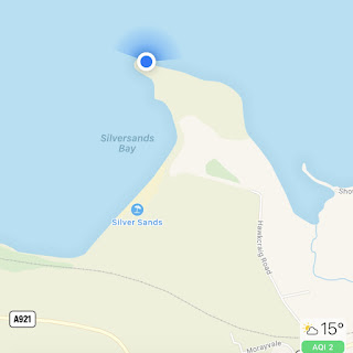
TomTom Map showing location of Skulferatu #35
Map showing location of Skulferatu #35


The coordinates for the location of the Skulferatu are –


Latitude 56.050336

Longitude -3.284126


I used the following sources for information on the lighthouse –


Lighthouses of Southeastern Scotland

Lighthouses of Southeastern Scotland


Lighthouse Digest Magazine

Lighthouse Explorer Database - Hawkcraig Point Range Front Light


Information board at Hawkcraig Point


Tuesday 15 June 2021

Skulferatu #34 - Tranent Doocot, Dovecot Brae, Tranent, East Lothian


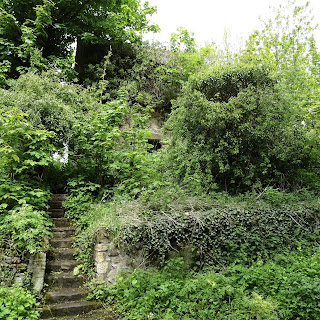
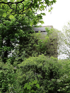
I took a cycle out to Tranent in East Lothian and stopped off along Dovecot Brae, by a crumbling, old building that is now virtually hidden amongst trees and undergrowth.  If it weren’t for the stairs leading up from the road, it would be easy to go right past this place and not even notice it was there.  At first this building, Tranent Doocot, appears to have no great importance or relevance, but there is a dark history associated with the man who ordered its construction.


Stairs leading up to Tranent Doocot, which is almost hidden in the deep green of trees and undergrowth.  Photograph by Kevin Nosferatu for The Skulferatu Project.
Stairs leading up to Tranent Doocot, which is almost hidden in trees and undergrowth


Tranent Doocot – almost hidden in trees and undergrowth.  The Doocot has a dark history associated with the man who ordered its construction, David Setoun or Seton, as he is now known, was one of the main instigators in starting what later became known as the North Berwick Witch Trials.  Photograph by Kevin Nosferatu for The Skulferatu Project.
Tranent Doocot – almost hidden in trees and undergrowth


According to J Sands in his book published in 1881 'Sketches of Tranent in the Olden Times', Tranent Doocot used to bear the name of David Setoun and the date 1587.  In the present day, this inscription is completely illegible, which is not a bad thing given that David Setoun or Seton, as he is now known, was one of the main instigators in starting what later became known as the North Berwick Witch Trials. 


Entrance to Tranent Doocot.  Photograph by Kevin Nosferatu for The Skulferatu Project.
Entrance to Tranent Doocot


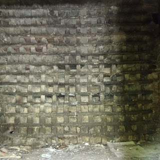
Pigeonholes inside the doocot for the birds to nest in.  Photograph by Kevin Nosferatu for The Skulferatu Project.
Pigeonholes inside the doocot for the birds to nest in.


David Seton was the Deputy Bailiff in Tranent to Lord Seton and to make things nice and confusing David Seton also had a son called David.  In various descriptions of him, David Seton Snr appears to be a mean spirited, suspicious man who believed that his woes and financial difficulties were caused by others committing ungodly acts against him.  He, and his family resided in Tranent in a house that was commonly known as the Royal George, and in their employment was a maid servant called Geillis Duncan.   Duncan is believed to have been in her early to mid-teens when employed by Seton and is described as being '...young and comely, and distinguished for her readiness to attend the sick and infirm, and for her wonderful skill in curing diseases.' 
 
In November 1590 David Seton became suspicious of Duncan’s growing reputation as a healer and became convinced that witchcraft must be involved.  He then questioned her about this, and she denied the accusations.  Not satisfied with this Seton gathered together some associates and together they tortured Duncan.  First, they used an item called the 'pilliwinks' on her, or what we would today call thumbscrews.  These crushed the thumbs and caused great pain.  However, despite this Duncan would not confess.  Seton and his associates then bound and wrenched her head with a rope to cause her extreme agony, but still, she would confess nothing. They then stripped and shaved her and examined her body for the mark of the Devil, as it was believed that those in the service of Satan had a mark put upon them that was insensible to pain and did not bleed when pricked.  On 'finding' this mark on Duncan's neck Seton and his cronies stated that she then admitted that her looking after the sick had been done at the suggestion of the Devil and that her curing of disease was done by witchcraft.  She went on to name thirty accomplices.  Duncan, and all those she had named, were then imprisoned.
 
Terrified, tormented and tortured those imprisoned soon confessed to a multitude of bizarre crimes including attempting to bring about the death of King James VI.  The strange and wonderful story that emerged was that the coven of witches met in the house of Barbara Napier in Edinburgh.  Napier was a member of Edinburgh high society and was Lady-in-Waiting to the Countess of Angus.  She had fallen out with the Countess and had then supposedly brought about the death of the Earl of Angus through the use of witchcraft.  As well as meeting at Napier’s house, there had been a meeting of around two hundred witches at Acheson's Haven (now Morrison's Haven, Prestongrange) and later another meeting at the Kirk of North Berwick.  The Devil presided over these gatherings and Dr John Fian, a schoolteacher from Prestonpans, acted as the secretary.  The coven had met to devise a plan to destroy the ship that carried the newly married King James and his wife Anne from Denmark to Leith.  At one of these meetings another member of Edinburgh high society, Euphame MacCalzean, handed a waxen image of King James to the Devil and hinted that the Earl of Bothwell, with whom she was closely connected, would be the new king.
 
After the meeting at North Berwick a group of witches and wizards set sail in sieves to meet the Royal ship.  During their voyage they boarded a passing ship and after helping themselves to food and drink, sunk it.  They then carried on with their voyage and on sighting the Royal ship the Devil handed a cat, that had earlier been baptised, to Dr Fian and ordered him to throw it into the sea and cry 'Halo!'  On his doing this a tremendous storm arose and being convinced that nothing but a miracle could save the Royal ship from destruction, the Devil and all those gathered returned to North Berwick.  There they marched with their sieves in their hands to the Kirk.  Geillis Duncan led the procession playing a quick step on the Jews Harp.  At the Kirk they all entered, and the Devil preached a sermon to them from the pulpit.  He asked all those assembled to do all the evil in their power and that if they did so, they'd be handsomely rewarded.  He then bent over the pulpit and asked those assembled to kiss his buttocks as a token of their allegiance.  They all did so before making their way out into the churchyard where they feasted on the dead and were given parts of human bodies by the Devil as powerful charms.  Geillis Duncan then played a reel on the Jews Harp called - 'Cummer, go ye before Cummer, go ye.'
 
All those seized and accused of witchcraft were tortured horribly to make them confess to their roles in the plot.  Dr Fian, the alleged secretary to the Devil and cat thrower, had his legs crushed in the 'bootikens' until 'the blood and marrow spouted out'.  His fingernails were then pulled out and pins pushed into his fingers, however unlike many of the others, he refused to confess to anything. 
 
King James took a keen interest in all the proceedings of these witch trials, as he fully believed that an attempt had been made on his life by Satan and his little helpers.  Though why Satan would be interested in the King of a small, poor country at the arse end of Europe is anyone's guess.  You would have thought that given the chaos that would later be caused by King James' son Charles, that the Devil would have been only too keen to keep James and his offspring on the throne.  Though maybe, unlike God, the Devil does not reside outside of time and is therefore unaware of what is to come.  Anyway, getting back to the story - King James attended to see the witnesses examined and put to torture and also had Geillis Duncan brought to Holyrood Palace in Edinburgh.  There he had her play the reel on the Jews Harp that she had played for the Devil and all the assembled witches and wizards at North Berwick.
 
Various trials then took place and on 26 December 1590 John Fian was tried and found guilty of numerous charges including being involved in the plot against King James.  He was sentenced to death and it appears that he may have been taken to Castle Hill and strangled and burned there later on the same day.
 
Barbara Napier was tried and found guilty of consulting with witches and was sentenced to death.  On 10 May 1591 she was taken to Castle Hill, Edinburgh where she was bound to a stake to be strangled and burned.  However, she claimed to be pregnant and was given a stay of execution.  It is unclear what then happened to her.
 
Euphame MacCalzean was found guilty of being a witch and consulting with witches.  She was sentenced to death, though cruelly and unusually was sentenced to death by being burned alive.  The sentence was carried out on Castle Hill on the 25 June 1591.
 
No trial records have ever been recovered for Geillis Duncan.  However, she was convicted of witchcraft and was executed on 4 December 1591 at Castle Hill in Edinburgh, presumably like the others by being strangled and then burned to ashes.  She was executed along with Bessie Thomson, another woman convicted of witchcraft, and both recanted their confessions prior to execution.  On being asked why she had confessed and named others such as Barbara Napier and Euphame MacCalzean in her confessions Duncan stated that she had been made to by the two David Setons in Tranent and others, but that it was all lies and for this she begged God's forgiveness.
 
Many of those named by Duncan went on to name others involved in the so called plot against the King, and by 1593 over 70 people had been implicated and many had been executed.  Now, I may be being very cynical about the reasons for many of these people being accused, as I am aware that there were many religious, political, and socio-economic things going on at this time.  However, it is very interesting to note that Dr John Fian had been in a long running dispute with David Seton, while Euphame MacCalzean was Seton’s sister-in-law.  Seton was angry with her, as she had inherited money from a relative that he thought should have been bequeathed to him.  So, at the very least Seton would appear to be guilty of capitalising on a situation, he had started, for revenge against enemies, perceived and real.
 
 
*           *           *
 
Tranent Doocot stands near to Tranent Old Parish Church and was built to house 1122 pairs of pigeons.  The pigeons were a good supply of fresh meat for the local population, who would take the young pigeons, as their meat was the most tender and juicy.  The building has been partially restored but is again in a state of disrepair.  I'm glad that the name of David Seton has faded from this building, as it is a name that deserves to be forgotten.  Instead let us remember the names of those who died in an age of paranoia, religious intolerance, and political intrigue.
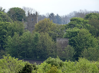
 

Tranent Old Parish Church with Doocot on right hand side.  Photograph by Kevin Nosferatu for The Skulferatu Project.
Tranent Old Parish Church with Doocot on right hand side


I left a Skulferatu here for Geillis Duncan and all the others who were persecuted and murdered for imaginary crimes created in the overactive imaginations of jealous or malicious peers and a paranoid ruling class.


Skulferatu #34 outside Tranent Doocot.  Photograph by Kevin Nosferatu for The Skulferatu Project.
Skulferatu #34


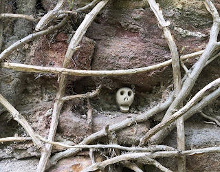
Skulferatu #34 in hollow of wall at Tranent Doocot.  Photograph by Kevin Nosferatu for The Skulferatu Project.
Skulferatu #34 in hollow of wall at Tranent Doocot


Skulferatu #34 in hollow of wall at Tranent Doocot.  Photograph by Kevin Nosferatu for The Skulferatu Project.
Skulferatu #34 in hollow of wall at Tranent Doocot


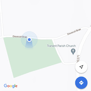
Google map showing location of Skulferatu #34 at Tranent Doocot
Map showing location of Skulferatu #34


The coordinates for the location of the Skulferatu are –


Latitude 55.950036

Longitude -2.957936


I used the following sources for the tale of Geillis Duncan -


Witchcraft in Early Modern Scotland

edited by Lawrence Normand and Gareth Roberts (2000)


Sketches of Tranent in the Olden Times

by J Sands (1881)

Available digitally at https://electricscotland.com/history/tranent/chapter03.htm


Tranent and its Surroundings

by P McNeill (1884)

https://archive.org/details/tranentitssurrou02mnei/mode/2up


Geillis Duncan, Witch

https://engole.info/geillis-duncan-witch/


Wikipedia - Morrison's Haven

Morrison's Haven - Wikipedia


Article and photographs are copyright of © Kevin Nosferatu, unless otherwise stated.
Tuesday 8 June 2021

Skulferatu #33 - Kirkgate Cemetery, by Loch Leven, Kinross


On a rather chilly and misty day I took a trip over to Loch Leven.  For once there was no rain and no wind, so I made the best of it and took my bike with me.  There is a path around the Loch for walking or cycling on, it is about 20 km in total so is perfect for a leisurely cycle.  So, for the first cycling trip of the year that suited me well.


After my cycle I dropped off at Kirkgate Cemetery, also known by the unglamorous name of Kinross East Burying Ground.  The cemetery sits by the banks of the loch and has a great view over to Loch Leven Castle.  This castle, which was built in the 1300s, was one of the many in which Mary Queen of Scots was held prisoner.  It was here that she was forced to abdicate in favour of her son James.  After several botched attempts she escaped from the castle, raised an army, fought and lost a battle, and fled to England hoping for help from her cousin, Queen Elizabeth I.  I think we all know how that turned out for her…


Watch Tower at entrance to Kirkgate Cemetery, Kinross with Loch Leven in the background.  Photograph by Kevin Nosferatu for The Skulferatu Project.
Watch Tower at entrance to Kirkgate Cemetery


Old and crumbling gravestones at Kirkgate Cemetery, Kinross.  Photograph by Kevin Nosferatu for The Skulferatu Project.
Gravestones at Kirkgate Cemetery


Old gravestone in Kirkgate Cemetery, Kinross with the Bruce Mortuary Chapel behind it.  Photograph by Kevin Nosferatu for The Skulferatu Project.
Old gravestone with the Bruce Mortuary Chapel behind it


View over graveyard to Castle Island on Loch Leven.  Photograph by Kevin Nosferatu for The Skulferatu Project.
View over graveyard to Castle Island


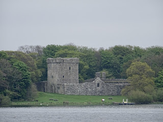
Loch Leven Castle sitting on Castle Island in Loch Leven, Kinross.  Photograph by Kevin Nosferatu for The Skulferatu Project.
Loch Leven Castle


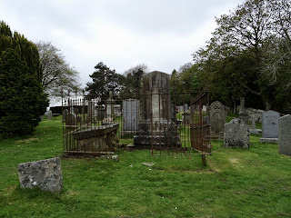
The cemetery, apart from having some lovely views, is quite picturesque with its ancient graves, tombs and lots of crumbling gravestones with faded carved skulls on them.  The parish church of Kinross used to stand in these grounds, though there are now no remains of it.  It is thought that it probably stood in the site now occupied by the Bruce Mortuary Chapel.


I left the Skulferatu that accompanied me on my cycle in a hole in the wall of the burial ground.


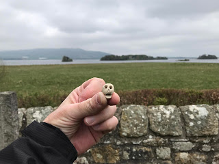
Skulferatu #33 at Kirkgate Cemetery - looking out over Loch Leven to Castle Island.  Photograph by Kevin Nosferatu for The Skulferatu Project.
Skulferatu #33


Skulferatu #33 in hole in the wall at Kirkgate Cemetery, Kinross.  Photograph by Kevin Nosferatu for The Skulferatu Project.
Skulferatu #33 in hole in the wall at Kirkgate Cemetery, Kinross


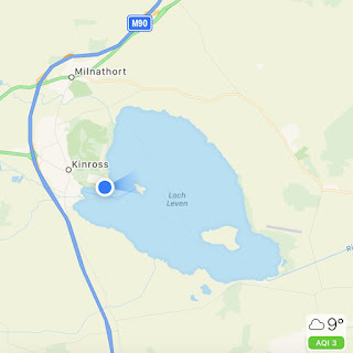
Map showing location of Skulferatu #33 in Kirkgate Cemetery by Loch Leven, Kinross
Map showing location of Skulferatu #33


The coordinates for the location of the Skulferatu are –


Latitude 56.200980

Longitude -3.406014


Tuesday 1 June 2021

Skulferatu #32 - Berwick Lighthouse, Berwick Pier, Berwick upon Tweed


If you have ever travelled on the East Coast Railway line from Edinburgh down towards London, you will have passed through Berwick upon Tweed.  After pulling out from the station you may have noticed the pier and the rather iconic lighthouse out on your left side as the train begins to build up speed and shoot off down the line.  If you have the time, take a trip to Berwick upon Tweed one day and have a good walk around.  There is plenty to see in Berwick itself and across the bridge in Spittal there is a lovely, big sandy beach and also a bit further along, a clifftop path, which I think eventually takes you to Holy Island.  Or you could just take a rather bracing walk out on the pier to Berwick Lighthouse where the North Sea winds will batter you, no matter how calm the day is in the town.


Berwick Pier and Lighthouse as seen from Spittal with a rotting wooden structure in the mud of low tide at the forefront of the photo.  Photo by Kevin Nosferatu for the Skulferatu Project.
Berwick Pier and Lighthouse as seen from Spittal


Photo by Kevin Nosferatu for the Skulferatu Project.
Berwick Lighthouse as seen from Berwick town


Photo by Kevin Nosferatu for the Skulferatu Project.
Berwick Lighthouse – view from the pier


Berwick Lighthouse was built in 1826 to a design by Joseph Nelson.  He was also responsible for the building of the lighthouses at Lundy and Longstone.  The lighthouse took eight months to build and was opened with much pomp and ceremony.  The light was turned on for the first time on 10 October 1826.


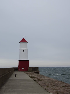
Berwick Lighthouse, a red and white lighthouse on the end of a pier in Berwick upon Tweed.  Photo by Kevin Nosferatu for the Skulferatu Project.
Berwick Lighthouse


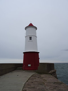
Berwick Lighthouse, a red and white lighthouse on the end of a pier in Berwick upon Tweed.  Photo by Kevin Nosferatu for the Skulferatu Project.  Photo by Kevin Nosferatu for the Skulferatu Project.
Berwick Lighthouse


Berwick Lighthouse, a red and white lighthouse on the end of a pier in Berwick upon Tweed.  Photo by Kevin Nosferatu for the Skulferatu Project.Photo by Kevin Nosferatu for the Skulferatu Project.
Berwick Lighthouse


In 1927 the lighthouse made the news because it was being run by a woman (Yup, that was big news back then!).  The lighthouse keeper at that time had taken ill and his daughter stood in for her father for a few weeks carrying out his duties at the lighthouse.  Something she said she enjoyed though did find a little lonely, as there was not even a wireless there to keep her company.


The keepers often worked in the lighthouse during extreme weather. In 1937 William Cowe described his experiences to a reporter from the Berwick Advertiser of working there while a severe storm raged outside.   He described how huge waves had pounded into the building making it sway, while other waves had been so big that they had crashed right over the top of the lighthouse.  The seas had been so rough that at times the pier had been under at least four feet of water.  However, Cowe had felt quite safe within the lighthouse and the light had not failed once during the storm.


In 1947 the lighthouse was automated, and the keepers were no longer required.


The lighthouse has featured in works by artists such as L S Lowry and Emrys Williams.  Given its iconic looks and the ever-changing seascape and skyscape around it, it will no doubt continue to inspire artists for years to come.


Today, on yet another grey and cold day, I took a walk to Spittal Beach and then back and around Berwick before heading over to the pier and along to the lighthouse.  I battled through the howling wind and past group after group of cold tourists, who like me, were just desperate to be out and about.  On reaching the lighthouse I left the Skulferatu that had accompanied me on my walk around Berwick by one of the metal structures on the pier wall.


Skulferatu #32 at Berwick Lighthouse on the pier in Berwick upon Tweed.  Photo by Kevin Nosferatu for the Skulferatu Project
Skulferatu #32


Skulferatu #32 in rusting iron structure on wall of Berwick Pier near to the lighthouse.  Photo by Kevin Nosferatu for the Skulferatu Project.
Skulferatu #32 on metal structure on pier wall


Close up of Skulferatu #32 in rusting iron structure on wall of Berwick Pier near to the lighthouse.  Photo by Kevin Nosferatu for the Skulferatu Project.
Close up of Skulferatu #32


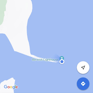
Google Map showing location of Skulferatu #32 at Berwick Lighthouse, Berwick upon Tweed
Google Map showing location of Skulferatu #32


The coordinates for the location of the Skulferatu are –


Latitude 55.764873

Longitude -1.984140


I used the following sources for information on the lighthouse –


The Berwick Advertiser – Thursday 3 March 1927

Berwickshire News and General Advertiser – Tuesday 1 May 1928

The Berwick Advertiser – Thursday 4 February 1937

Berwickshire News and General Advertiser – Tuesday 4 February 1947


Historic England website -

Historic England - The Pier and Lighthouse, Berwick-upon-Tweed


British Listed Buildings website -

Pier and Lighthouse, Berwick-upon-Tweed, Northumberland


Article and photographs are copyright of © Kevin Nosferatu, unless otherwise specified.