Tuesday 28 December 2021

Skulferatu #54 - Morton Castle, Thornhill, Dumfries and Galloway


Morton Castle is not the easiest place to find, which despite being a pain in the arse, actually adds to its charm and also to a sense of it being in a more remote and undiscovered location.  On our trip there our Sat Nav took us to a row of houses and told us we had reached our destination.  We were in fact still a couple of kilometres away, and it wasn’t until driving a bit further on and having checked the various map apps on our phones that we managed to find where we wanted to go.  A narrow, winding, single track road then led us to a small parking area.  From there it was a short walk down the path of the Morton Heritage and Nature Trail to the ruins of the castle. 


A photograph of the ruins of Morton Castle standing on a hill above Morton Loch.  Photograph by Kevin Nosferatu for the Skulferatu Project.
The ruins of Morton Castle above Morton Loch


The ruins of Morton Castle stand on the south west slopes of the Lowther Hills and overlook Morton Loch.  The castle was originally a two storeyed hall block with a four storey turreted gatehouse at the west end of the building and an angle tower at the east end.  The lower storey of the building would have consisted of a kitchen, a storage area, and a lower hall, while the first floor would have housed the great hall.  The private chambers of the lord of the castle and his family would have been in the tower at the east of the building.


A view of the ruins of Morton Castle in the distance, surrounded by a grassed area.  Photograph by Kevin Nosferatu for the Skulferatu Project.
The ruins of Morton Castle


A photo of the ruined western tower of Morton Castle with a tree at the side of it and hills in the background.  Photograph by Kevin Nosferatu for the Skulferatu Project.
Western Tower of Morton Castle


A photo showing the stone outer wall of Morton Castle leading along to a tower.  Photograph by Kevin Nosferatu for the Skulferatu Project.
View along walls of Morton Castle to the western tower


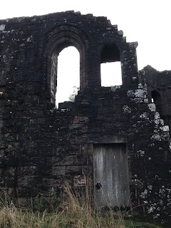
A photo of a wooden doorway and a ruined wall with two empty windows above the door.  This is one of the outer walls of Morton Castle.  Photograph by Kevin Nosferatu for the Skulferatu Project.
Doorway into the rear wall of the castle


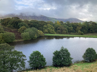
A view of a body of water surrounded by grass and a wooded area.  This being a view from the entrance into Morton Castle.  Photograph by Kevin Nosferatu for the Skulferatu Project.
View of Morton Loch from the castle


Sketch of the ruins of Morton Castle circa 1886 - taken from the book The Castellated and Domestic Architecture of Scotland from the Twelfth to the Eighteenth Century by David MacGibbon and Thomas Ross, published in 1886
Sketch of the ruins of Morton Castle circa 1886 (MacGibbon and Ross)


The site on which the castle sits is thought to have been where a stronghold was built by Dunegal, Lord of Nithsdale in the Twelfth Century.  These lands were later granted to Thomas Randolph, the nephew of King Robert I.  The castle itself is believed to have been built in the early Fourteenth Century and was mentioned in 1357 in a treaty with England to release King David II from captivity.  The treaty called for the demolition of several castles in South West Scotland, Morton Castle being one of them.  It is unclear how much of the castle was demolished at that time. 


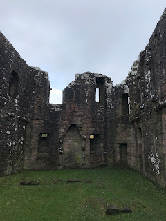
A photo showing the interior walls of the ruins of Morton Castle.  The floor of the castle is an area of cut grass.  Photograph by Kevin Nosferatu for the Skulferatu Project.
Interior of the castle facing towards the eastern tower


A photo showing a ruined wall - it is curved and in it are doorways and windows.  Photograph by Kevin Nosferatu for the Skulferatu Project.
Ruins of the Eastern Tower


A photo showing a view through a hole in the shape of a spade in a wooden door in the eastern tower of Morton Castle.  It shows some trees and a body of water.  Photograph by Kevin Nosferatu for the Skulferatu Project.
View out of the doorway in the eastern tower


A photograph of a view over Morton Loch showing trees in the foreground and hills in the background.  This being a view from the eastern tower of Morton Castle.  Photograph by Edie Lettice for the Skulferatu Project.
View from eastern tower of castle over Morton Loch


A photograph showing graffiti carved into the wood of one of the castle doors.  It is mainly initials and dates.  Photograph by Kevin Nosferatu for the Skulferatu Project.
Graffiti on one of the castle doors


In 1372 the castle and the lands around it were passed through marriage to the Douglas family, who later became Earls of Morton.  It is believed that parts of the castle were rebuilt in the early Fifteenth Century.  The castle was then leased out to another branch of the Douglas family, though does not seem to have been their primary residence and may have been used mainly as a hunting lodge.  It appears that it later fell into disuse and by 1714 was abandoned.  Much of the stone was then taken away and used for constructing farm buildings.  The castle was acquired by the Duke of Queensberry and was later passed down to the Dukes of Buccleuch.  It then passed into state care under a guardianship agreement in 1975.


I left the Skulferatu that accompanied me on my trip in a crack in one of the outside walls of the castle.


A photo of a small ceramic skull (Skulferatu 54) being held up.  The ruins of Morton Castle are in the background.  Photograph by Kevin Nosferatu for the Skulferatu Project.
Skulferatu #54


A photo showing a small ceramic skull (Skulferatu 54) in a crack in the outside wall of Morton Castle.  Photograph by Kevin Nosferatu for the Skulferatu Project.
Skulferatu #54 in crack in exterior wall of the castle


A photo showing a close up of a small ceramic skull (Skulferatu 54) in a crack in the outside wall of Morton Castle.  Photograph by Kevin Nosferatu for the Skulferatu Project.
Skulferatu #54 in crack in exterior wall of the castle


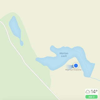
TomTom Map showing location of Skulferatu #54
Map showing location of Skulferatu #54


The coordinates for the location of the Skulferatu are –


Latitude 55.274466

Longitude -3.747266


I used the following sources for information on Morton Castle –


Historic Environment Scotland – Statement of Significance Morton Castle

Morton Castle Statement of Significance


Canmore – Morton Castle

Morton Castle | Canmore


Information Boards at Site


The Castellated and Domestic Architecture of Scotland from the Twelfth to the Eighteenth Century

By David MacGibbon and Thomas Ross

1886


Tuesday 21 December 2021

Skulferatu #53 - New Glencrieff Mine, Wanlockhead, Dumfries and Galloway


On a chilly, damp and dreich day, I took to the winding roads up to the highest village in Scotland.  Not a wee place in the Highlands as you might suspect, but rather in the rolling hills and glens of Dumfries and Galloway.  The village of Wanlockhead, as well as laying claim to being the highest in Scotland, is a place with a past deeply entrenched in the old industry of mining.  The mining of lead.  And on any walk around or out of the village you will come across the remains of buildings or machines connected to mining.


Beam Engine and Miners Cottages, Wanlockhead


After popping into the Museum of Lead Mining for a stroll around and a coffee, I took a walk out of the village to one of the old mines.  As I walked, the mist rolled in from the hills around me giving the landscape an eerie quality.  It made me feel like I was walking through a scene in an old black and white thriller and also reminded me of a tale I’d just come across in the museum about the Wanlockhead ghost.  And I do like a good ghost story.  The tale goes that in the winter of 1877 a teenage girl called Jenny Miller set out from a farm a few miles away to attend her sister’s wedding at Wanlockhead.  On her back Jenny carried a wicker basket in which was a teapot she had bought with her hard earned savings as a wedding present for her sister.  As she walked over the hills a blizzard came in.  Determined to get to the wedding, Jenny battled her way through the snow and freezing winter wind, but unable to see where she was going, lost her way and stumbled and fell into an old mine working.  Trapped there, she succumbed to her injuries from the fall and the cold of the brutal winter weather.  For several days her family and friends searched for her, eventually finding her poor, frozen corpse where she had fallen.  A cairn was then built nearby in her memory, and on top of the cairn was placed a stone with Jenny’s name on it.  


A photograph of the face of a Mannequin of Jenny Miller in the Museum of Lead Mining.  Jenny looks a bit unhappy, probably because she died in the hills and became a ghost.  Photograph by Kevin Nosferatu for the Skulferatu Project.
Mannequin of Jenny Miller in the Museum of Lead Mining


Around a hundred years later a visitor to the area was taking a summer stroll through the hills when the swirling mists suddenly descended.  He then saw a young woman walking towards him with a wicker basket on her back.  As she approached him, he could see that she was wearing very old fashioned clothes and appeared to be quite distressed.  He walked towards her to ask if she was okay and heard her say - look in the stones.  She then disappeared into the mist.  Baffled by this the visitor, on his return to the village of Wanlockhead, recounted his tale to some locals who told him about Jenny Miller and the cairn built for her.  They then took him out to the cairn, though could not see the stone with Jenny’s name carved on it.  Remembering that Jenny had said to look in the stones, the visitor did, and he found the stone with Jenny’s name on it in there, broken in two.  


The stone now sits in the Museum of Lead Mining next to a mannequin of poor Jenny Miller, whose forlorn and lonely ghost wanders forever lost in the mists of the hills. 


***


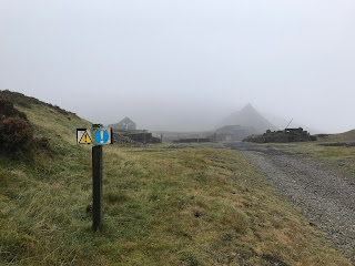
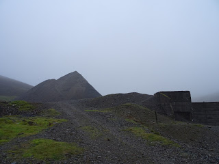
A couple of kilometres out of the village I came to the ruined buildings and slag heaps of the New Glencrieff Mine.  As I walked around it the silence and grey light of the mist gave it an almost dreamscape quality.  You could imagine it being the sort of place you might just bump into a ghost or two.


A photograph of a small warning sign with the ruined buildings and slag heap of the long abandoned New Glencrieff Mine in the distance.  Photograph by Kevin Nosferatu for the Skulferatu Project.
New Glencrieff Mine – almost lost in the mist


A picture of the remains of a demolished building - part of the remains are two rows of bricks that look a bit like towers sticking up out of the rubble.  Photograph by Kevin Nosferatu for the Skulferatu Project.
Remains of a demolished building


A picture of a ruined building and slag heap at the site of New Glencrieff Mine.  Photograph by Kevin Nosferatu for the Skulferatu Project.
Ruined building and slag heap


A picture of a ruined building and slag heap at the site of New Glencrieff Mine.  Photograph by Kevin Nosferatu for the Skulferatu Project.
Ruined building and slag heap


Picture of the grey, rubble path leading up to the grey slag heap at New Glencrieff Mine.  Photograph by Kevin Nosferatu for the Skulferatu Project.
Path leading up to the slag heap


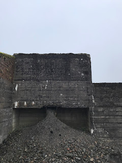
A picture of the remains of a building by the slag heap at New Glencrieff Mine.  The building had rubble in it that has poured down from a chute.  Photograph by Kevin Nosferatu for the Skulferatu Project.
Remains of building by the slag heap


A photo of the slag heap at New Glencrieff Mine.  Photograph by Edie Lettice for the Skulferatu Project.
The slag heap at New Glencrieff Mine


A photo of some ruined buildings at New Glencrieff Mine.  Photograph by Edie Lettice for the Skulferatu Project.
Ruined buildings at New Glencrieff Mine


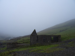
A picture of the rubble path up to the ruined building that was once the winding engine house.  Photograph by Kevin Nosferatu for the Skulferatu Project.
Path up to the Winding Engine House


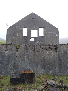
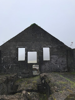
a picture of the ruins of the Winding Engine House at New Glencrieff Mine, Wanlockhead.  Photograph by Kevin Nosferatu for the Skulferatu Project.
Ruins of the Winding Engine House


Workings at the New Glencrieff Mine began in 1718 and various companies then utilised it throughout the years to extract huge amounts of lead.  One of the shafts of the mine extends down 240 fathoms (around 1440 feet or 440 metres), which is pretty bloody deep.  The mine closed in 1931 and then re-opened again for a brief period in the 1950s.  It was the last mine to close in Wanlockhead, and over its lifetime it was reckoned that over 105,000 tonnes of lead had been extracted and smelted from it.


Ruins of the Winding Engine House.  Photograph by Kevin Nosferatu for the Skulferatu Project.
Ruins of the Winding Engine House


Ruins of the Winding Engine House.  Photograph by Kevin Nosferatu for the Skulferatu Project.
Ruins of the Winding Engine House


Inside the ruins of the Winding Engine House.  Photograph by Kevin Nosferatu for the Skulferatu Project.
Inside the ruins of the Winding Engine House


I left the Skulferatu that accompanied me on my walk in a hole in the wall of one of the ruined mine buildings.


A photo of a small ceramic skull (Skulferatu 53) being held up with the ruins of the Winding Engine House in the background.  Photograph by Kevin Nosferatu for the Skulferatu Project.
Skulferatu #53


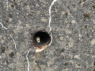
Picture of a small ceramic skull (Skulferatu 53) in a hole in the wall of the Winding Engine House.  Photograph by Kevin Nosferatu for the Skulferatu Project.
Skulferatu #53 in a hole in wall at ruins of the Winding Engine House


Picture of a small ceramic skull (Skulferatu 53) in a hole in the wall of the Winding Engine House.  Photograph by Kevin Nosferatu for the Skulferatu Project.
Skulferatu #53 in a hole in wall at ruins of the Winding Engine House


Picture of a small ceramic skull (Skulferatu 53) in a hole in the wall of the Winding Engine House.  Photograph by Kevin Nosferatu for the Skulferatu Project.
Skulferatu #53 in a hole in wall at ruins of the Winding Engine House


Google Map showing the location of Skulferatu #53
Map showing the location of Skulferatu #53


The coordinates for the location of the Skulferatu are –


Latitude 55.400310

Longitude -3.795050


I used the following sources for information on the tale of Jenny Miller and New Glencrieff Mine –


Museum of Lead Mining, Wanlockhead, Dumfries and Galloway

https://www.leadminingmuseum.co.uk/


Tourist Info at the site

Tuesday 7 December 2021

Skulferatu #52 - XT-Craft Midget Submarine Wrecks, Aberlady Bay, East Lothian


About a mile away from the picturesque village of Aberlady, there is a rather lovely walk through a nature reserve that stretches along the coast on one side of Aberlady Bay.  The path through this takes you through a wooded area and out onto a stretch of land covered in sea grasses and reeds.  From there it leads onto some huge sand dunes and a gorgeous sandy beach that seems to stretch out forever at low tide.  Today, I walked out there from Aberlady.  The sun shone through a wind that howled in from the sea and it was both warm and freezing at the same time.  Typical British beach weather basically.


As I made my way out along the beach towards the retreating sea, I took off my socks and shoes and walked though pitted puddles in the sand to the watery graves of two submarines. 


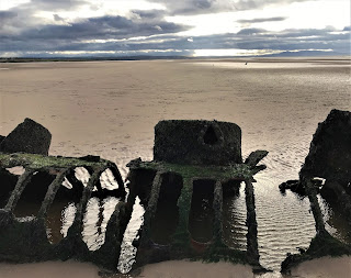
A picture of the skeletal remains of a wrecked submarine lying on the sands of the beach at Aberlady Bay, East Lothian.  In the distance can be seen the concrete block it was tethered to, along with the remains of another submarine.  Photograph by Kevin Nosferatu for the Skulferatu Project.
Remains of one of the submarines with the other away in the distance


These are not as you may think German submarines sunk during World War II but are rather a couple of British mini submarines that were used by the RAF for target practice.


A picture of the remains of one of the wrecked XT-Craft midget submarines lying on its side in the sands at Aberlady Bay.  Photograph by Kevin Nosferatu for the Skulferatu Project
Remains of one of the wrecked XT-Craft midget submarines


They are the remains of two XT-Craft midget submarines.  These are training versions of the X-Craft submarines which were built in Britain during the Second World War and were designed to defend harbours and attack targets.  They were used on the attack of the German battleship Tirpitz in 1943 and were used during the D-Day landings to carry out beach reconnaissance and act as navigational beacons.


A picture of the rusting and seaweed covered remains of the hatch of one of the wrecked submarines.  Photograph by Kevin Nosferatu for the Skulferatu Project
The hatch of one of the wrecked submarines


A photo of a rusting metal tower on the wrecked remains of the submarine.  Photograph by Kevin Nosferatu for the Skulferatu Project.
Detail of one of the wrecked submarines


A photo of the skeletal and rusting remains of one of the submarines with the metal ribs of the vessel on show.  Photograph by Kevin Nosferatu for the Skulferatu Project.
Rusting remains of one of the submarines


A photo of the inside of the rusting remains of one of the submarines.  Photograph by Kevin Nosferatu for the Skulferatu Project.
Inside view of one of the submarines


A photo of one of the wrecked submarines in silhouette with clouds above stretching off into the distance.  Photograph by Kevin Nosferatu for the Skulferatu Project.
View of one of the wrecked submarines on the beach


In 1946 these two submarines were towed out to Aberlady bay and moored to concrete blocks.  They were then used to test the effectiveness of 20mm cannon shells, which were fired at them by RAF aircraft.  The film of these tests taking place is available on YouTube at –


After the tests were completed the damaged remains of the submarines were left to rust away in the sea.


I left the Skulferatu that accompanied me on my walk in a hole in the rusting interior of one of the submarines.


A photograph of a small, ceramic skull (Skulferatu 52) being held in a hand with one of the wrecked submarines lying on the beach in the background.  Photograph by Kevin Nosferatu for the Skulferatu Project.
Skulferatu #52


A photograph showing the rusting and barnacle covered interior of submarine where Skulferatu 52 was left.  There is a small, round hole in the centre of the rusting metal.  Photograph by Kevin Nosferatu for the Skulferatu Project.
Interior of submarine where Skulferatu #52 was left


A photograph of the small, ceramic skull (Skulferatu 52) lying in the small hole in the rusting metal of the wrecked submarine.  Photograph by Kevin Nosferatu for the Skulferatu Project.
Skulferatu #52 inside the wreck of one of the submarines


TomTom Map showing location of Skulferatu #52
Map showing location of Skulferatu #52


The coordinates for the location of the Skulferatu are –


Latitude 56.022681

Longitude -2.880941


I used the following sources for information on the submarines –


Canmore

X-craft: Aberlady Bay, Firth Of Forth | Canmore


Aberlady Heritage

Midget Submarines, Aberlady Bay, Summary Report by Alison Boutland