Tuesday 27 July 2021

Skulferatu #38 - Torness Nuclear Power Station, Dunbar, East Lothian


A postcard showing various views around Torness Nuclear Power Station.  Photo by Kevin Nosferatu for the Skulferatu Project
Have a Nuclear Time at Terrific Torness!


Is it wrong to have a favourite nuclear power station?  Well, I do, and it is Torness Nuclear Power Station situated just a few miles down the road from the town of Dunbar.  It can be reached by car along the A1, or by walking out from Dunbar and then along the coastal path of the John Muir Way.  I took the coastal route and walked there, past Barns Ness Lighthouse, and along through the sandy paths with the sharp grasses that grow there.  Following the coast around I then came to the lime kilns at Skateraw and going up and over the hill by them, arrived at the coastal concrete walkways that lead round and past the power station and on to Torness Point and Thorntonloch Beach.


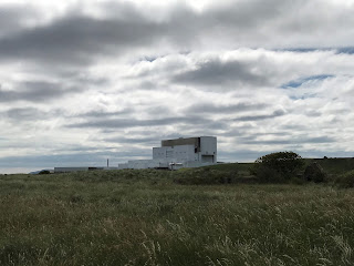
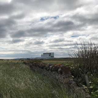
Wall and fields of tall grass stretching off into distance with the large structure of Torness Nuclear Power Station rising up in the background.  Photo by Kevin Nosferatu for the Skulferatu Project
Rural walk to Torness Nuclear Power Station


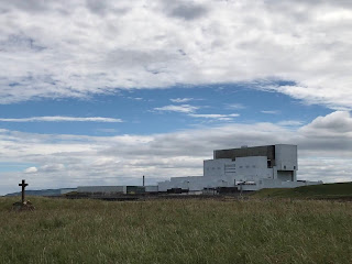
Flat grass land stretching off into distance with the large structure of Torness Nuclear Power Station rising up in the background.  Photo by Kevin Nosferatu for the Skulferatu Project
Rural walk to Torness Nuclear Power Station


Torness Nuclear Power Station as seen from Skateraw - a memorial cross rises from the tall grasses on one side and the structure of the power station dominates the other.  Photo by Kevin Nosferatu for the Skulferatu Project
Torness Nuclear Power Station as seen from Skateraw


Torness Nuclear Power Station as seen from Skateraw - on one side of the bay is a bare rock surface leading to the water and on the other side is the power station.  Photo by Kevin Nosferatu for the Skulferatu Project
Torness Nuclear Power Station as seen from Skateraw


The lower and upper walkway around the coast by the power station were constructed as a sea defence.  Part of this defence are the thousands of distinctive looking concrete blocks that rise up from the sea to the wall of the lower walkway.  These blocks are known as Dolos Units and are used as protection against the erosive force of the waves and rough seas.  They work by dissipating the energy from the wave by deflecting it to the side and thus lessening any erosion or damage. These blocks and the bare concrete of the walkways create quite a stark, yet dramatic feature in the landscape.


Torness Nuclear Power Station as seen from the walkway pier - at the front of the picture are the concrete Dolos leading down to a bay in which sits a lifeboat and on the other side of the water is the power station.  Photo by Kevin Nosferatu for the Skulferatu Project
Torness Nuclear Power Station as seen from the walkway pier


Walkway and Dolos - a picture showing the grey concrete of the walkway, the wall around it and the concrete Dolos.  The sky in the background is bright with white clouds.  Photo by Kevin Nosferatu for the Skulferatu Project
Walkway and Dolos


Lower walkway around grounds of Torness Nuclear Power Station.  Picture shows the concrete walkway and walls with a cloudy sky in the background.  Photo by Kevin Nosferatu for the Skulferatu Project
Lower walkway around grounds of the power station


Torness Nuclear Power Station was the last of the United Kingdom’s second generation nuclear power plants to be commissioned, and it is one of the seven remaining nuclear power stations in the UK.  Like all the remaining nuclear power stations, Torness was built beside the sea, as nuclear reactors need access to large quantities of water to keep the core at a stable temperature.  The sea water is also used to generate steam to drive a turbine which in turn powers the generator.


Torness Nuclear Power Station - a picture showing the white structure of the power station and how it almost blends into the clouds above.  Photo by Kevin Nosferatu for the Skulferatu Project
Torness Nuclear Power Station


Construction began on Torness in 1980 and by 1988 the power station had been completed and was generating electricity.  The power station has two Advanced Gas-cooled Reactors and supplies around 1,190MW (megawatts) to the National Grid.  In 2019 it generated more than 10TWh (Terawatt-hours), which was enough to power 2.5 million homes. 


Torness is expected to operate until around 2030 before being decommissioned.


I left the Skulferatu that accompanied me on today’s walk amongst the rocks forming part of the sea defences by the beach at the southeast side of the power station.


Torness Nuclear Power Station as seen from beach by Torness Point - picture shows sand dune and grass with the power station in the background with a sky of white clouds.  Photo by Kevin Nosferatu for the Skulferatu Project
Torness Nuclear Power Station as seen from beach by Torness Point


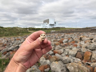
Skulferatu #38 - picture shows a small, clay skull being held up with Torness Power Station in the background.  Photo by Kevin Nosferatu for the Skulferatu Project
Skulferatu #38


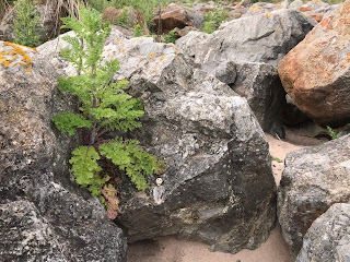
Skulferatu #38 on rock by Torness Point - picture shows small, clay skull on a rock.  Photo by Kevin Nosferatu for the Skulferatu Project
Skulferatu #38 on rock by Torness Point


Skulferatu #38 on rock by Torness Point - picture shows small, clay skull on a rock.  Photo by Kevin Nosferatu for the Skulferatu Project
Skulferatu #38 on rock by Torness Point


Skulferatu #38 on rock by Torness Point - picture shows small, clay skull on a rock, amongst lots of rocks with Torness Nuclear Power Station in the background.  Photo by Kevin Nosferatu for the Skulferatu Project
Skulferatu #38 on rock by Torness Point


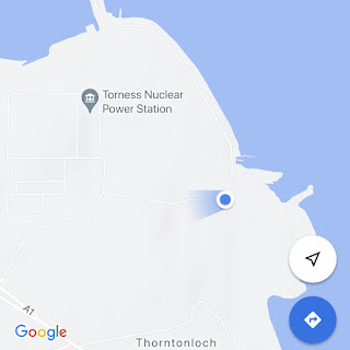
Map showing location of Skulferatu #38


The coordinates for the location of the Skulferatu are –


Latitude 55.966443

Longitude -2.399051


I used the following sources for information on Torness Nuclear Power Station –


EDF Energy – Torness

Torness Power Station


Nuclear Generation in the UK

Published by EDF Energy


East Lothian Courier – 3 September 2020


Wikipedia

Torness Nuclear Power Station

Dolos


Article and photographs are copyright of © Kevin Nosferatu, unless otherwise specified.


Monday 19 July 2021

Skulferatu #37 - Cramond Island, Edinburgh


I only discovered the joys of the walk out to and around Cramond Island during lockdown.  It was one of these places that I had always meant to go to though never quite got round to doing it.  I had cycled and walked along the front at Cramond and passed the causeway out to the island many times but had just never ventured out there.  One of the few joys of lockdown though was discovering new places to walk and making a point of actually going to places in my locale.  So, for maybe the third time in a year I went on a stroll out there today.  Before setting out I checked the tide times, crucial to avoid getting trapped on the island and wasting the time of the local Lifeboat crew.  I then took a stroll along the causeway to the island.


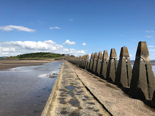
The causeway out to Cramond Island is a rough concrete path, raised a few feet up from the sand.  It is covered in cockles, and I found myself dancing around the path trying not to squash them.  Running along the side of the causeway is a very distinctive looking barrier of concrete pylons, this was built in WWII as an anti-boat barrier.


Causeway out to Cramond Island, Edinburgh with large, concrete pylons stretching out along it.  Photo by Kevin Nosferatu for the Skulferatu Project.
Causeway out to Cramond Island


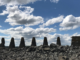
Concrete Pylons built in WWII as an anti-boat barrier with a cloudy sky above them.  Photo by Kevin Nosferatu for the Skulferatu Project.
Concrete Pylons built in WWII as an anti-boat barrier


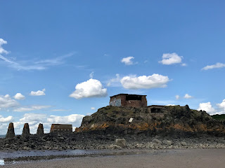
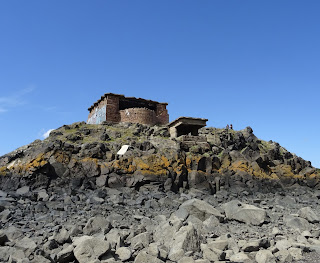
Gun emplacement at the South Side of Cramond Island, by the Causeway and concrete pylons. Photo by Kevin Nosferatu for the Skulferatu Project.
Gun emplacement at the South Side of Cramond Island, by the Causeway


Gun emplacement at the South Side of Cramond Island, Edinburgh.  Photo by Kevin Nosferatu for the Skulferatu Project
Gun emplacement at the South Side of Cramond Island


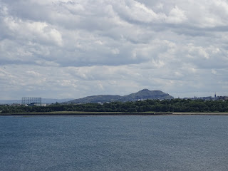
View over to A view over the sea from Cramond Island to Granton gasworks with Arthur’s Seat and Edinburgh in the background.  Photo by Kevin Nosferatu for the Skulferatu Project
View over to Granton and Arthur’s Seat from Cramond Island


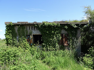
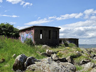
On the island there is a path that takes you all the way around, past a host of abandoned concrete and brick buildings.  These are the remains of the fortifications that were built here during WWII and are the buildings that housed various gun emplacements and anti-shipping searchlights.  On one of the beaches are two huge concrete blocks, these were anchor points for an anti-submarine net that stretched over to Inchcolm Island and then over to the Fife coast.  


Abandoned WWII building on Cramond Island.  The building is overgrown and disappearing into the undergrowth. Photo by Kevin Nosferatu for the Skulferatu Project
Abandoned WWII building on the island


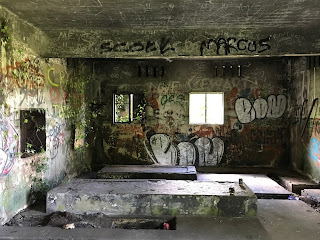
Inside view of one of the abandoned WWII buildings on Cramond Island.  It is a concrete shell covered in graffiti.  Photo by Kevin Nosferatu for the Skulferatu Project
Inside view of one of the abandoned WWII buildings


Abandoned WWII buildings on Cramond Island, Edinburgh.  Photo by Kevin Nosferatu for the Skulferatu Project
Abandoned WWII buildings on the island


Abandoned WWII buildings on Cramond Island, Edinburgh.  Photo by Kevin Nosferatu for the Skulferatu Project
Abandoned WWII buildings on the island


View over the Forth to Fife from the empty concrete window of one of the abandoned WWII buildings on Cramond Island, Edinburgh.  Photo by Kevin Nosferatu for the Skulferatu Project
View over the Forth to Fife from one of the buildings 


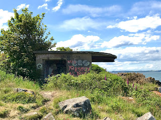
Bunker at north side of Cramond Island, Edinburgh.  The outside of the wall of the bunker is colourful with graffiti. Photo by Kevin Nosferatu for the Skulferatu Project
Bunker at north side of the island


Bunkers at north side of Cramond Island, Edinburgh.  Photo by Kevin Nosferatu for the Skulferatu Project
Bunkers at north side of the island


Abandoned WWII building on north side of Cramond Island, Edinburgh.  Photo by Kevin Nosferatu for the Skulferatu Project.
Abandoned WWII building on north side of island


A set of large heavy doors covered in rust lie next to a small, demolished building on Cramond Island, Edinburgh.  Photo by Kevin Nosferatu for the Skulferatu Project.
Ruined building and rusting doors


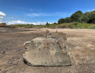
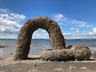
Two large concrete blocks on the beach that were anchor points for an anti-submarine net.  Photo by Kevin Nosferatu for the Skulferatu Project
Concrete blocks on beach that were anchor points for an anti-submarine net


Detail of one of the concrete blocks on the beach at Cramond Island that were anchor points for an anti-submarine net.  Photo by Kevin Nosferatu for the Skulferatu Project
Detail of one of the concrete blocks


The WWII buildings left on Cramond Island pale in comparison to those that can be seen on the island of Inchmickery which sits between Cramond Island and the Fife Coast.  The island there is so covered in the concrete remains of WWI and WWII fortifications that it looks like a large battleship sitting out in the Forth.  At one point in time Inchmickery was famed for its oyster beds and the ‘rich profusion of sea-weed, mosses and lichens, on its beach and surface.’  Now these have pretty much all disappeared.


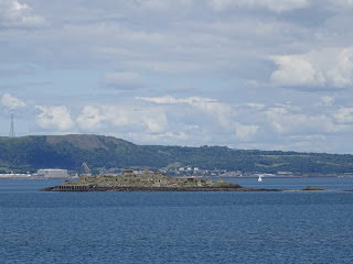
A view from Cramond Island of Inchmickery Island which is so heavily fortified that it looks like a battleship sitting out at sea.  Photo by Kevin Nosferatu for the Skulferatu Project.
Inchmickery Island


Cramond Island has a history stretching back into the mists of time.  It is believed that the Romans would have used the island during their time in Cramond, however no archaeological evidence of this has been found. 


View out over the causeway and southern gun emplacement from top of hill on Cramond Island, Edinburgh.  Photo by Kevin Nosferatu for the Skulferatu Project
View out over the causeway from top of hill on Cramond Island


In 1596 the island was the site of a duel which ended a long running feud.  The feud came about after Mary Queen of Scots had fled to England leaving behind various factions in Scotland who were hostile to each other.  Some supported the Queen, while others supported James Stewart, the Earl of Moray, who was acting as the Regent.  One of those who supported the Queen was Stephen Bruntfield, the Laird of Craighouse, while one of those who supported the Regent was Robert Moubray, Laird of Barnbougle and an arch enemy of Bruntfield.  In 1572, Moubray, who was hoping to ingratiate himself with the Regent, lay siege to Bruntfield’s castle at Craighouse.  Bruntfield held out for a while but surrendered to Moubray when he was promised by the Regent that his life would be spared, and he would keep his property and estates.  Moubray however saw Bruntfield’s surrender as a perfect opportunity to get rid of someone he despised, and while escorting him to Edinburgh, to meet with the Regent, he ran him through with his sword and murdered him.  Bruntfield’s widow was so overcome with grief at the death of her husband that she retired to her rooms within Craighouse Castle, draped them in black and never left them again.  According to those who knew her, she then spoke of nothing but having revenge on Moubray for the murder of her husband.   This obsession with revenge she passed on to each of her three sons who each took a turn in duelling with Moubray.  The eldest, Stephen, was the first to try his hand and Moubray slew him at a duel just outside Holyrood Palace.  A couple of years later, her middle son, Roger, fought a duel with Moubray and seemed to be gaining the upper hand, but he slipped and fell and Moubray struck off his head as he lay on the ground.  A few years after this, the youngest son, Henry, also challenged Moubray to a duel.  There was some debate about whether a duel could be fought given that Moubray had already fought twice over the same issue, but as Moubray was keen to fight again it was agreed that the duel could go ahead.  On Cramond Island, a spot was chosen close to the northern beach with a raised area behind it where spectators could gather.  The duel then took place, and it was bloody and long with both duellists seriously wounding each other.  Eventually as both were stumbling with fatigue Henry found a last reserve of strength, lunged with his dagger drawn at Moubray and stabbed him through the heart.  Moubray gave a sigh of surprise at having lost and fell down dead.  Henry’s mother, on hearing the news that Moubray had been killed and she had been revenged, promptly dropped down dead as well.  Henry then later married Moubray’s niece and inherited much of Moubray’s wealth and property.  


Cramond Island has also been the scene of many tragedies involving ships coming to grief on the rocks around it, or people being drowned when caught by the tide while making the crossing to and from the island.  In 1954 a Gunner who was stationed on the island, drowned while making his way back after a day’s leave.  The incoming tide caught him as he tried to wade out to the island and his body was found the next day lying in a rock pool.


For many years, the island was used for farming and grazing sheep.  Though now uninhabited, up until the 1930s people lived on the island, and an article in the West Lothian Courier of 1923 describes it as being the only inhabited island in the Forth.  It goes on to describe there being ‘several small red-tiled cottages upon the island.  In the most sheltered corner they lie, and were built, it is said, out of the remains of a large house which used to stand there.’ 


It was rumoured that there was an underground passage on the island that led, get this for a nice and vague description, ‘somewhere’.  This secret passage was described as having been lost for centuries and it is probably no surprise to hear that no trace of this has ever been found.


The island was also one of the favourite haunts of the author Robert Louis Stevenson and in his youth he and one of his friends would regularly canoe from Granton out to Cramond Island.


Cramond Island has also been the site of the DIY ‘Island of Punk’ festival.  The festival lasts for a day with the audience helping the bands to carry their equipment across the causeway to the island.  Various punk bands have played there including local Edinburgh favourites such as Oi Polloi and Bloco Vomit.


On my trek today around the island I left the Skulferatu that accompanied me in the ruined wall of the Duck House, a building that was once a shelter for shooting parties and later rented out as holiday accommodation.  Now it is little more than a wall facing out to the Forth Bridges.


Remains of the Duck House, Cramond Island.  A wall next to some rocks is all that remains of this hunting shelter come holiday accommodation.  Photo by Kevin Nosferatu for the Skulferatu Project.
Remains of the Duck House


Skulferatu #37 on Cramond Island  being held up by the Duck House.  Photo by Kevin Nosferatu for the Skulferatu Project
Skulferatu #37


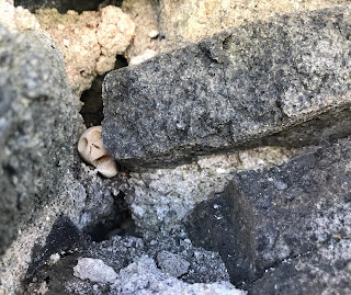
Skulferatu #37 in crack in wall at the Duck House, Cramond Island, Edinburgh.  Photo by Kevin Nosferatu for the Skulferatu Project
Skulferatu #37 in crack in wall at the Duck House


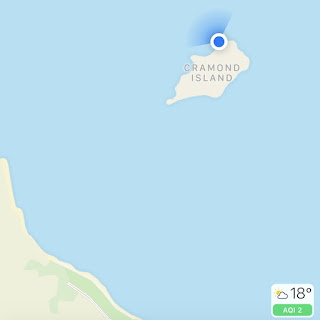
Map showing location of Skulferatu #37 on Cramond Island, Edinburgh
Map showing location of Skulferatu #37


The coordinates for the location of the Skulferatu are –


Latitude 55.994815

Longitude -3.291634


I used the following sources for information on Cramond Island -


Cassels Old and New Edinburgh, Vol 3

By James Grant

1883


The Book of Scottish Story

Various Authors

1896


The Scotsman 4th June 1925

Favourite Haunts of R.L.S.


West Lothian Courier – Friday, August 3, 1923

Cramond Island – An Appreciation


Belfast Telegraph – Monday, August 16, 1954


Wikipedia

Wikipedia - Cramond Island


Article and photographs are copyright of © Kevin Nosferatu, unless otherwise specified.
 

Tuesday 6 July 2021

Skulferatu #36 - Crichton Castle, Crichton, Midlothian


Today I went for a wander out of Edinburgh and along to the ruins of Crichton Castle.  The ruins sit just outside the village of Crichton, on a terrace that overlooks the picturesque scenery of the valley of the Tyne. 


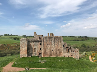
View of Crichton Castle, Midlothian on a hill with gorse bushes flowering in yellow in the foreground.  Photo by Kevin Nosferatu for the Skulferatu Project.
View of Crichton Castle


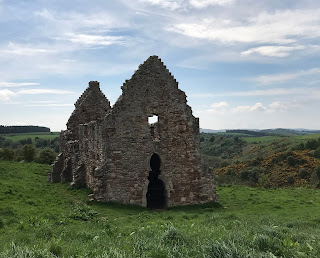
Crichton Castle from hill above.  Photo by Kevin Nosferatu for the Skulferatu Project.
Crichton Castle from hill above


The stable block with the castle in background.  Photo by Kevin Nosferatu for the Skulferatu Project.
The stable block with the castle in background


The stable block is a very ornate building that stands near to Crichton Castle, Midlothian.  Photo by Kevin Nosferatu for the Skulferatu Project.
The stable block


In the Fourteenth Century a keep was built on this spot by the Crichton family.  In the Fifteenth Century the castle building was extended around this by Sir William Crichton and then later by others who had either inherited or were granted the castle and its lands.  Sir Walter Scott wrote of the castle in his narrative poem Marmion and also wrote a history of the castle, informing his readers that – ‘it was built at different times, and with a very differing regard to splendour and accommodation.  The older part of the building is a narrow keep, or tower, such as formed the mansion of a lesser Scottish Baron; but so many additions have been made to it, that there is now a large courtyard, surrounded by buildings of different ages.  The eastern front of the court is raised above a portico, and decorated with entablatures, bearing anchors.  All the stones of this front are cut into diamond facets, the angular projections of which have an uncommonly rich appearance.  The inside of this part of the building appears to have contained a gallery of great length and uncommon elegance.  Access was given to it by a magnificent staircase, now quite destroyed…  Unfortunately, I didn’t get to see the interior of the castle today, as it was closed due to Covid restrictions.  However, I did find a drawing of the courtyard.


View of the courtyard - taken from The Castellated and Domestic Architecture of Scotland


The first recorded owner, Sir William Crichton, was a man who was remarkable for his time, having risen to prominence through politics rather than through warfare.  He became the Lord Chancellor under King James I and later he also became the guardian of James II.    He was a man involved in various intrigues and his main claim to fame, or infamy, would appear to be that he took part in organising the ‘Black Dinner’.  This was when the Sixth Earl of Douglas and his younger brother were invited to dine with young King James II and as they ate were seized, dragged away and brutally murdered.  Their great uncle, James Douglas, who had also been involved in the plot against them, then inherited their wealth and titles making him one of the most powerful men in Scotland at that time.


In the early 1480s the Crichton family fell out of favour and their lands were forfeited with the castle being given to Sir John Ramsay.  He then fell out of favour and in 1488 the castle was given to Patrick Hepburn, who later became the Earl of Bothwell.  The castle stayed with Hepburn’s family for a few generations, but in 1568 they fell out of favour, and it was again forfeited.  It was then handed over to Francis Stewart, the ‘bastard’ grandson of James V.  He carried out extensive work on the castle including having the decorative diamond faced façade added in the courtyard and a rather grand stable building built next to the castle.  However, guess what, he was then accused of witchcraft and plotting against King James VI.  He fled to Naples and in 1592 his properties, including the castle, were forfeited.  The castle was then reinstated to Stewart’s son, and he sold it on to the Hepburn’s of Humbie. It then passed through various owners who all seem to have just left it to crumble and fall into ruin.  The castle is now in the care of Historic Environment Scotland.


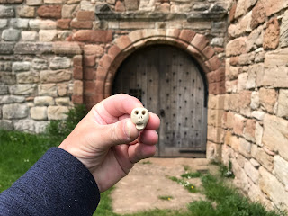
I left the Skulferatu that accompanied me on today’s walk in a crack in the wall on the outside of the castle.


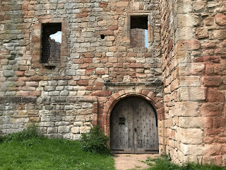
Front entrance door to Crichton Castle.  The heavy, wooden door is closed.  Photo by Kevin Nosferatu for the Skulferatu Project.
Front entrance door to the castle


Skulferatu #36 being held up in front of the door to Crichton Castle.  Photo by Kevin Nosferatu for the Skulferatu Project.
Skulferatu #36


Skulferatu #36 in crack in wall of Crichton Castle.  Photo by Kevin Nosferatu for the Skulferatu Project.
Skulferatu #36 in crack in wall of castle


Close up of Skulferatu #36 in crack in wall of Crichton Castle.  Photo by Kevin Nosferatu for the Skulferatu Project.
Close up of Skulferatu #36 in crack in wall of castle


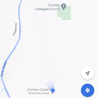
Map showing location of Skulferatu #36 at Crichton Castle, by Crichton, Midlothian.
Map showing location of Skulferatu #36


The coordinates for the location of the Skulferatu are –


Latitude 55.839688

Longitude -2.991259


I used the following sources for information on the castle –


The Castellated and Domestic Architecture of Scotland from the Twelfth to the Eighteenth Century

Volume One

By David MacGibbon and Thomas Ross

1887


The Ruined Castles of Midlothian

By John Dickson

1894


The Scots Magazine and Edinburgh Literary Miscellany

1st August 1808


Wikipedia – Crichton Castle

Wikipedia - Crichton Castle