Showing posts with label WWII. Show all posts

Tuesday 20 September 2022

Skulferatu #82 - Braefoot Battery, Braefoot Point, Aberdour, Fife


On a sunny, but very windy day, I took the train out to Aberdour and then walked along the Fife Coastal Path towards Dalgety Bay.  The path wound its way through woods where birds chirped, insects buzzed, and everything swayed slightly in the stiff breeze.  The path then led me through a field, where I ended up by Braefoot Terminal.  A rather charming looking area of high fences and security where liquefied petroleum gas is stored and pumped out into the large tankers that dock there.  Following a path by one of the security fences I made my way into Braefoot Plantation, where the remains of Braefoot Battery lie.


A photo of a one storey concrete building, squat with a flat roof and iron chimney sticking out.  One of the windows and the door have been blocked in with breeze blocks.  Photograph taken by Kevin Nosferatu for the Skulferatu Project.
The North Blockhouse


A view inside the North Blockhouse showing a roof that is caving in, rubble on a concrete floor and windows that have been blocked in with breeze blocks.  Photograph taken by Kevin Nosferatu for the Skulferatu Project.
View inside the North Blockhouse


A view through the woods at Braefoot Plantation to the North East Blockhouse.  Photograph taken by Kevin Nosferatu for the Skulferatu Project.
View through the woods to the North East Blockhouse


A photo of a one storey, red brick building with a flat concrete roof.  There are four small windows in the wall - empty of glass and frames.  Photograph taken by Kevin Nosferatu for the Skulferatu Project.
The North East Blockhouse


Braefoot Battery was a First World War coastal defence site that overlooked the Firth of Forth.  In early 1914, just shortly before the start of the war, the government bought the land the battery now sits on from the Earl of Moray.  It would seem however, that there had been plans for quite some time to build a battery there in preparation for any attack by enemy forces on the UK.  Construction then began with the battery being completed in 1915.  When finished it had two 9.2 inch guns, which could fire a shell weighing 55kg a distance of up to 26KM.  These large calibre guns were intended for use on enemy ships that may come into the Forth to attack either ships anchored there or the naval base at Rosyth.


A photo showing the remains of one of the gun emplacements - a semi circle of concrete now overgrown with a tree in the middle.  Photograph taken by Kevin Nosferatu for the Skulferatu Project.
Remains of one of the gun emplacements


A view of the remains of one of the gun emplacements from inside - showing a semi circular concrete wall with two sqare recesses in it with large metal rings in them.  Photograph taken by Kevin Nosferatu for the Skulferatu Project.
Remains of one of the gun emplacements


A view of some big bolts at the gun emplacement.  They are sticking out of the ground and have moss growing on them.  Photograph taken by Kevin Nosferatu for the Skulferatu Project.
Big bolts at the gun emplacement


A view inside the gun emplacement showing a large recess in the concrete wall.  Photograph taken by Kevin Nosferatu for the Skulferatu Project.
Detail of the gun emplacement


A view of one of the big metal rings at the gun emplacement at Braefoot Battery.  Photograph taken by Kevin Nosferatu for the Skulferatu Project.
Big metal ring at the gun emplacement


In 1917 the defence of the Forth was restructured and the guns at the Braefoot Battery were no longer needed there.  They were dismounted and put into storage, with one gun later being sent to Portsmouth.  The site was again used in WWII and several new buildings were added.


View down through the woods to one of the battery buildings - showing lots of trees on a downhill slope with a concrete bunker at the bottom.  Photograph taken by Kevin Nosferatu for the Skulferatu Project.
View down through the woods to one of the battery buildings


A view down through the woods to some of the battery buildings.  Photograph taken by Kevin Nosferatu for the Skulferatu Project.
View down through the woods to battery buildings


A view uphill through the woods to the Royal Engineer store and workshop - two brick and concrete buildings.  Photograph taken by Kevin Nosferatu for the Skulferatu Project.
View through the woods to the Royal Engineer store and workshop


A view along a path through the woods by the barrack blocks.  Photograph taken by Kevin Nosferatu for the Skulferatu Project.
View along by the barrack blocks


A photo of a moulded stone and concrete building with an open door.  The woods rise up above it looking as if the trees are growing from the roof.  Photograph taken by Kevin Nosferatu for the Skulferatu Project.
One of the battery buildings next to the barrack block


A view of the toilet block - showing brick walls, flat roofs and some ferns growing up by the walls.  Photograph taken by Kevin Nosferatu for the Skulferatu Project.
The toilet block


A picture of an old fashioned white urinal against a brick wall.  There is graffiti on the wall and ferns growing up beside the urinal.  Photograph taken by Kevin Nosferatu for the Skulferatu Project.
Urinal


A post war woodland plantation now grows all around the battery buildings and though this gave my walk a lovely woodland feel, the trees did obscure what once must have been quite spectacular views from the hill the battery is on.


A photo of two of the battery buildings standing in the woodland of Braefoot Plantation.  Photograph taken by Kevin Nosferatu for the Skulferatu Project.
Battery buildings


A photo of a moulded stone and concrete hut in the woods.  The door has been blocked off with red brick which adds a splash of colour against the grey of the building.  Photograph taken by Kevin Nosferatu for the Skulferatu Project.
Hut in the woods


A photo of a moulded iron drainpipe.  It is runs from the top of the building and is broken with most of the pipe missing.  Photograph taken by Kevin Nosferatu for the Skulferatu Project.
Drainpipe


After walking around the woods, I made my way down to the nearby shore.  Like almost everywhere along the coast of the Forth, probably the whole coast of Britain, there is a rather tragic story connected to this place.  A tale so horribly tragic that I just have to tell it...


...in 1887, on a sunny afternoon in mid-May, James Turnbull, a solicitor who lived in Aberdour, decided it would the perfect sort of day to sail out in his boat.  The perfect sort of day to get a good view of the construction work going on in the building of the Forth Bridge.  So, he invited his chief clerk, a Mr Ramsay, to comer along with him on this little jaunt.  The two men set sail and the weather was quite lovely, just until they got to Braefoot Point where a sudden squall caught them.  The small boat they were in was not built for these sorts of choppy waters and high waves, and it soon filled with water and began to sink.  The two men, both of whom were unable to swim, stood on the deck of the boat as the water first reached up around their ankles, and then up around their waists.  But behold, a passing steamer.  The two men on seeing the ship waved and shouted at it, hoping to be rescued.  On the deck of the steamer, the passengers thought they were seeing two bathers in the water waving as they went past.  So, they waved back, and the ship steamed on.  As the water reached up to their necks, both Turnbull and Ramsay realised they were doomed.  They said a little prayer, then their goodbyes to each other before the sea swallowed them up.  Now, on the steamer it so happened that three of the passengers who had been waving to the doomed men were none other than Turnbull’s daughters.  On their arrival home they excitedly chattered to their mother about their trip on the ship and having seen some bathers at Braefoot Point.  A friend of Turnbull’s was waiting in the house to see him and realising that he was not the most accomplished of sailors, had become concerned about how long it was taking for him to return.  On hearing the girls talk he had a sudden horrible realisation of what they might have in fact seen.  He quickly summoned some men, and they made their way to Braefoot Point.  There they found Turnbull’s boat washed up on the shore.  Shortly afterwards, as the tide went out, they found the bodies of both Turnbull and Ramsay.   Two men who quite literally had been not waving but drowning.


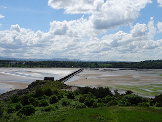
On the shore at Braefoot Point there stands an old pier.  I made my way out onto it and the wind, which had been getting up all day, battered me this way and that, making it difficult to even keep my balance.  The sea was rough, being whipped up by the wind and I understood how it could easily overwhelm a small boat like that which Turnbull and Ramsay had been sailing.  Feeling decidedly unsafe, despite being on dry land, I quickly made my way back and walked over to one of the battery pill boxes, which stood out on the rocks overlooking the Forth.


A photo of the pier at Braefoot Point - it is a squat stone pier built into rocks leading down to the sea.   Photograph taken by Kevin Nosferatu for the Skulferatu Project.
The pier at Braefoot Point


A photo showing the view to the pill box at Braefoot Point from the pier.  Photograph taken by Kevin Nosferatu for the Skulferatu Project.
View to the pill box at Braefoot Point


A photo of the pill box at Braefoot Point - it is a concrete, one storey building with narrow windows looking out over the sea.  Photograph taken by Kevin Nosferatu for the Skulferatu Project.
Pill box at Braefoot Point


A photo of the pill box at Braefoot Point looking out towards the sea.  Photograph taken by Kevin Nosferatu for the Skulferatu Project.
Pill box at Braefoot Point


There, in a howling gale, I left the Skulferatu that had accompanied me on my walk in a hole in the wall.


A photo of a small ceramic skull (Skulferatu 82) being held up in front of the pill box at Braefoot Point.  Photograph taken by Kevin Nosferatu for the Skulferatu Project.
Skulferatu #82


A photo of a small ceramic skull (Skulferatu 82) hidden in the wall of the pill box.  Photograph taken by Kevin Nosferatu for the Skulferatu Project.
Spot the Skulferatu


A photo of a small ceramic skull (Skulferatu 82) in a hole in the wall of the pill box. Photograph taken by Kevin Nosferatu for the Skulferatu Project.
Skulferatu #82 in a hole in the wall at the pill box


A close up photo of a small ceramic skull (Skulferatu 82) in a hole in the wall of the pill box.Photograph taken by Kevin Nosferatu for the Skulferatu Project.
Skulferatu #82 in a hole in the wall at the pill box


Google Map showing the location of Skulferatu #82
Map showing the location of Skulferatu #82


The coordinates for the location of the Skulferatu are –


Latitude 56.034242

Longitude -3.321253


what3words: throat.points.loved


I used the following sources for information on Braefoot Battery and Braefoot Point –


Dundee Courier - Saturday 14 May 1887


Manchester Courier and Lancashire General Advertiser - Monday 20 April 1914


Canmore

Canmore - Forth Defences, Middle, Braefoot Point Battery


Tuesday 5 April 2022

Skulferatu #65 - Anti Tank Blocks, Gosford Bay, East Lothian


During WWII numerous coastal areas around the UK were seen as being potential landing places for a sea borne invasion by the German forces.  Given this, in many of these sites, man made obstructions were put in place to hinder any possible enemy assault.  Some of these were designed to make it difficult for landing craft to get into the shore and others were designed to slow down tanks and other vehicles if they got ashore. The Anti Tank Blocks that can be seen along stretches of the East Lothian coast line were one of the obstruction methods deployed.  These were large concrete blocks that were placed around vulnerable parts of the coast to impede and delay any tanks that were landed on the shore.


A photo showing Anti Tank Blocks on the beach near Longniddry Bents.  These are large square concrete blocks and they stretch off into the distance. Photo by Kevin Nosferatu for the Skulferatu Project.
Anti Tank Blocks on beach near Longniddry Bents


A photo of the sands near Longniddry Bents.  the tide has gone out leaving curved patterns of shallow water on the beach.  Photo by Kevin Nosferatu for the Skulferatu Project.
Sands near Longniddry Bents


A photo showing Anti Tank Blocks on the beach near Longniddry Bents.  These are large concrete blocks and they  appear to have been topples over so that they are now rectangular in shape as the bases are no longer buried in the sand. Photo by Kevin Nosferatu for the Skulferatu Project.
Anti Tank Blocks on beach near Longniddry Bents


Today, there is still a row of these blocks running along from Longniddry Bents to Gosford Bay.  Many are weathered and disappearing into the sand and pebbles of the beach, but others, such as those protected by the trees within the woods at Craigielaw, are still well-preserved and whole.


A photo showing two of the anti tank blocks in the woods at Craigielaw.  There is a large deciduous tree behind them that has shed its leaves and its branches are bare.  Photo by Kevin Nosferatu for the Skulferatu Project.
Anti Tank Blocks in the woods at Craigielaw


A photo showing a line of the anti tank blocks stretching off through the woods with the bare branches of a large tree stretching out over them.   Photo by Kevin Nosferatu for the Skulferatu Project.
Anti Tank Blocks in the woods at Craigielaw


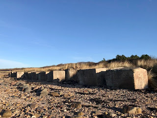
A photo showing the concrete Anti Tank Blocks on the beach at Gosford Bay.  The beach around them is white with seashells.   Photo by Kevin Nosferatu for the Skulferatu Project.
Anti Tank Blocks on the beach at Gosford Bay


A photo showing several of the Anti Tank Blocks on the beach at Gosford Bay.  they are sitting amongst the rocks by the sea.  Photo by Kevin Nosferatu for the Skulferatu Project.
Anti Tank Blocks on the beach at Gosford Bay


A photo showing the Anti Tank Blocks on the beach at Gosford Bay.  Photo by Kevin Nosferatu for the Skulferatu Project.
Anti Tank Blocks on the beach at Gosford Bay


As well as now being an interesting historical reminder of a dark and fearful time in the UK’s history, many of the crumbling blocks are now home to insect and plant life.


On my walk, I followed the row of Anti Tank Blocks along the coast and through the woods, from Longniddry to Gosford Bay. 


A photo showing the last of the Anti Tank Blocks at Gosford Bay.  It is pitted and crumbling from the effects of the sea and the weather.  Photo by Kevin Nosferatu for the Skulferatu Project.
Last of the Anti Tank Blocks at Gosford Bay


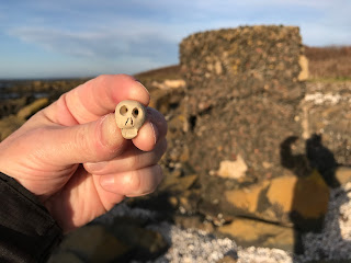
I left the Skulferatu that accompanied me in a hollow in the last block standing amongst the rocks in Gosford Bay.


A photo showing a small ceramic skull (Skulferatu #65) being held up in front of the last of the anti tank blocks at Gosford Bay.  Photo by Kevin Nosferatu for the Skulferatu Project.
Skulferatu #65


A photo showing a small ceramic skull (Skulferatu #65) in one of the pitted hollows of the last anti tank block at Gosford Bay.  Photo by Kevin Nosferatu for the Skulferatu Project.
Skulferatu #65 in a hollow in the Anti Tank Block


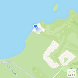
TomTom map showing location of Skulferatu #65
Map showing location of Skulferatu #65


The coordinates for the location of the Skulferatu are –


Latitude 56.004890

Longitude -2.889890


I used the following sources for information on the Anti Tank Blocks –


Canmore - Gosford Sands


Monday 19 July 2021

Skulferatu #37 - Cramond Island, Edinburgh


I only discovered the joys of the walk out to and around Cramond Island during lockdown.  It was one of these places that I had always meant to go to though never quite got round to doing it.  I had cycled and walked along the front at Cramond and passed the causeway out to the island many times but had just never ventured out there.  One of the few joys of lockdown though was discovering new places to walk and making a point of actually going to places in my locale.  So, for maybe the third time in a year I went on a stroll out there today.  Before setting out I checked the tide times, crucial to avoid getting trapped on the island and wasting the time of the local Lifeboat crew.  I then took a stroll along the causeway to the island.


The causeway out to Cramond Island is a rough concrete path, raised a few feet up from the sand.  It is covered in cockles, and I found myself dancing around the path trying not to squash them.  Running along the side of the causeway is a very distinctive looking barrier of concrete pylons, this was built in WWII as an anti-boat barrier.


Causeway out to Cramond Island, Edinburgh with large, concrete pylons stretching out along it.  Photo by Kevin Nosferatu for the Skulferatu Project.
Causeway out to Cramond Island


Concrete Pylons built in WWII as an anti-boat barrier with a cloudy sky above them.  Photo by Kevin Nosferatu for the Skulferatu Project.
Concrete Pylons built in WWII as an anti-boat barrier


Gun emplacement at the South Side of Cramond Island, by the Causeway and concrete pylons. Photo by Kevin Nosferatu for the Skulferatu Project.
Gun emplacement at the South Side of Cramond Island, by the Causeway


Gun emplacement at the South Side of Cramond Island, Edinburgh.  Photo by Kevin Nosferatu for the Skulferatu Project
Gun emplacement at the South Side of Cramond Island


View over to A view over the sea from Cramond Island to Granton gasworks with Arthur’s Seat and Edinburgh in the background.  Photo by Kevin Nosferatu for the Skulferatu Project
View over to Granton and Arthur’s Seat from Cramond Island


On the island there is a path that takes you all the way around, past a host of abandoned concrete and brick buildings.  These are the remains of the fortifications that were built here during WWII and are the buildings that housed various gun emplacements and anti-shipping searchlights.  On one of the beaches are two huge concrete blocks, these were anchor points for an anti-submarine net that stretched over to Inchcolm Island and then over to the Fife coast.  


Abandoned WWII building on Cramond Island.  The building is overgrown and disappearing into the undergrowth. Photo by Kevin Nosferatu for the Skulferatu Project
Abandoned WWII building on the island


Inside view of one of the abandoned WWII buildings on Cramond Island.  It is a concrete shell covered in graffiti.  Photo by Kevin Nosferatu for the Skulferatu Project
Inside view of one of the abandoned WWII buildings


Abandoned WWII buildings on Cramond Island, Edinburgh.  Photo by Kevin Nosferatu for the Skulferatu Project
Abandoned WWII buildings on the island


Abandoned WWII buildings on Cramond Island, Edinburgh.  Photo by Kevin Nosferatu for the Skulferatu Project
Abandoned WWII buildings on the island


View over the Forth to Fife from the empty concrete window of one of the abandoned WWII buildings on Cramond Island, Edinburgh.  Photo by Kevin Nosferatu for the Skulferatu Project
View over the Forth to Fife from one of the buildings 


Bunker at north side of Cramond Island, Edinburgh.  The outside of the wall of the bunker is colourful with graffiti. Photo by Kevin Nosferatu for the Skulferatu Project
Bunker at north side of the island


Bunkers at north side of Cramond Island, Edinburgh.  Photo by Kevin Nosferatu for the Skulferatu Project
Bunkers at north side of the island


Abandoned WWII building on north side of Cramond Island, Edinburgh.  Photo by Kevin Nosferatu for the Skulferatu Project.
Abandoned WWII building on north side of island


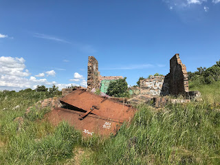
A set of large heavy doors covered in rust lie next to a small, demolished building on Cramond Island, Edinburgh.  Photo by Kevin Nosferatu for the Skulferatu Project.
Ruined building and rusting doors


Two large concrete blocks on the beach that were anchor points for an anti-submarine net.  Photo by Kevin Nosferatu for the Skulferatu Project
Concrete blocks on beach that were anchor points for an anti-submarine net


Detail of one of the concrete blocks on the beach at Cramond Island that were anchor points for an anti-submarine net.  Photo by Kevin Nosferatu for the Skulferatu Project
Detail of one of the concrete blocks


The WWII buildings left on Cramond Island pale in comparison to those that can be seen on the island of Inchmickery which sits between Cramond Island and the Fife Coast.  The island there is so covered in the concrete remains of WWI and WWII fortifications that it looks like a large battleship sitting out in the Forth.  At one point in time Inchmickery was famed for its oyster beds and the ‘rich profusion of sea-weed, mosses and lichens, on its beach and surface.’  Now these have pretty much all disappeared.


A view from Cramond Island of Inchmickery Island which is so heavily fortified that it looks like a battleship sitting out at sea.  Photo by Kevin Nosferatu for the Skulferatu Project.
Inchmickery Island


Cramond Island has a history stretching back into the mists of time.  It is believed that the Romans would have used the island during their time in Cramond, however no archaeological evidence of this has been found. 


View out over the causeway and southern gun emplacement from top of hill on Cramond Island, Edinburgh.  Photo by Kevin Nosferatu for the Skulferatu Project
View out over the causeway from top of hill on Cramond Island


In 1596 the island was the site of a duel which ended a long running feud.  The feud came about after Mary Queen of Scots had fled to England leaving behind various factions in Scotland who were hostile to each other.  Some supported the Queen, while others supported James Stewart, the Earl of Moray, who was acting as the Regent.  One of those who supported the Queen was Stephen Bruntfield, the Laird of Craighouse, while one of those who supported the Regent was Robert Moubray, Laird of Barnbougle and an arch enemy of Bruntfield.  In 1572, Moubray, who was hoping to ingratiate himself with the Regent, lay siege to Bruntfield’s castle at Craighouse.  Bruntfield held out for a while but surrendered to Moubray when he was promised by the Regent that his life would be spared, and he would keep his property and estates.  Moubray however saw Bruntfield’s surrender as a perfect opportunity to get rid of someone he despised, and while escorting him to Edinburgh, to meet with the Regent, he ran him through with his sword and murdered him.  Bruntfield’s widow was so overcome with grief at the death of her husband that she retired to her rooms within Craighouse Castle, draped them in black and never left them again.  According to those who knew her, she then spoke of nothing but having revenge on Moubray for the murder of her husband.   This obsession with revenge she passed on to each of her three sons who each took a turn in duelling with Moubray.  The eldest, Stephen, was the first to try his hand and Moubray slew him at a duel just outside Holyrood Palace.  A couple of years later, her middle son, Roger, fought a duel with Moubray and seemed to be gaining the upper hand, but he slipped and fell and Moubray struck off his head as he lay on the ground.  A few years after this, the youngest son, Henry, also challenged Moubray to a duel.  There was some debate about whether a duel could be fought given that Moubray had already fought twice over the same issue, but as Moubray was keen to fight again it was agreed that the duel could go ahead.  On Cramond Island, a spot was chosen close to the northern beach with a raised area behind it where spectators could gather.  The duel then took place, and it was bloody and long with both duellists seriously wounding each other.  Eventually as both were stumbling with fatigue Henry found a last reserve of strength, lunged with his dagger drawn at Moubray and stabbed him through the heart.  Moubray gave a sigh of surprise at having lost and fell down dead.  Henry’s mother, on hearing the news that Moubray had been killed and she had been revenged, promptly dropped down dead as well.  Henry then later married Moubray’s niece and inherited much of Moubray’s wealth and property.  


Cramond Island has also been the scene of many tragedies involving ships coming to grief on the rocks around it, or people being drowned when caught by the tide while making the crossing to and from the island.  In 1954 a Gunner who was stationed on the island, drowned while making his way back after a day’s leave.  The incoming tide caught him as he tried to wade out to the island and his body was found the next day lying in a rock pool.


For many years, the island was used for farming and grazing sheep.  Though now uninhabited, up until the 1930s people lived on the island, and an article in the West Lothian Courier of 1923 describes it as being the only inhabited island in the Forth.  It goes on to describe there being ‘several small red-tiled cottages upon the island.  In the most sheltered corner they lie, and were built, it is said, out of the remains of a large house which used to stand there.’ 


It was rumoured that there was an underground passage on the island that led, get this for a nice and vague description, ‘somewhere’.  This secret passage was described as having been lost for centuries and it is probably no surprise to hear that no trace of this has ever been found.


The island was also one of the favourite haunts of the author Robert Louis Stevenson and in his youth he and one of his friends would regularly canoe from Granton out to Cramond Island.


Cramond Island has also been the site of the DIY ‘Island of Punk’ festival.  The festival lasts for a day with the audience helping the bands to carry their equipment across the causeway to the island.  Various punk bands have played there including local Edinburgh favourites such as Oi Polloi and Bloco Vomit.


On my trek today around the island I left the Skulferatu that accompanied me in the ruined wall of the Duck House, a building that was once a shelter for shooting parties and later rented out as holiday accommodation.  Now it is little more than a wall facing out to the Forth Bridges.


Remains of the Duck House, Cramond Island.  A wall next to some rocks is all that remains of this hunting shelter come holiday accommodation.  Photo by Kevin Nosferatu for the Skulferatu Project.
Remains of the Duck House


Skulferatu #37 on Cramond Island  being held up by the Duck House.  Photo by Kevin Nosferatu for the Skulferatu Project
Skulferatu #37


Skulferatu #37 in crack in wall at the Duck House, Cramond Island, Edinburgh.  Photo by Kevin Nosferatu for the Skulferatu Project
Skulferatu #37 in crack in wall at the Duck House


Map showing location of Skulferatu #37 on Cramond Island, Edinburgh
Map showing location of Skulferatu #37


The coordinates for the location of the Skulferatu are –


Latitude 55.994815

Longitude -3.291634


I used the following sources for information on Cramond Island -


Cassels Old and New Edinburgh, Vol 3

By James Grant

1883


The Book of Scottish Story

Various Authors

1896


The Scotsman 4th June 1925

Favourite Haunts of R.L.S.


West Lothian Courier – Friday, August 3, 1923

Cramond Island – An Appreciation


Belfast Telegraph – Monday, August 16, 1954


Wikipedia

Wikipedia - Cramond Island


Article and photographs are copyright of © Kevin Nosferatu, unless otherwise specified.