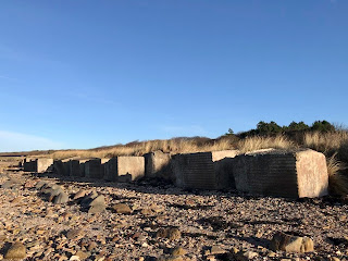
During WWII numerous coastal areas around the UK were seen as being potential landing places for a sea borne invasion by the German forces. Given this, in many of these sites, man made obstructions were put in place to hinder any possible enemy assault. Some of these were designed to make it difficult for landing craft to get into the shore and others were designed to slow down tanks and other vehicles if they got ashore. The Anti Tank Blocks that can be seen along stretches of the East Lothian coast line were one of the obstruction methods deployed. These were large concrete blocks that were placed around vulnerable parts of the coast to impede and delay any tanks that were landed on the shore.
Today, there is still a row of these
blocks running along from Longniddry Bents to Gosford Bay. Many are weathered and disappearing into the
sand and pebbles of the beach, but others, such as those protected by the trees
within the woods at Craigielaw, are still well-preserved and whole.
As well as now being an interesting
historical reminder of a dark and fearful time in the UK’s history, many of the
crumbling blocks are now home to insect and plant life.
On my walk, I followed the row of Anti
Tank Blocks along the coast and through the woods, from Longniddry to Gosford
Bay.
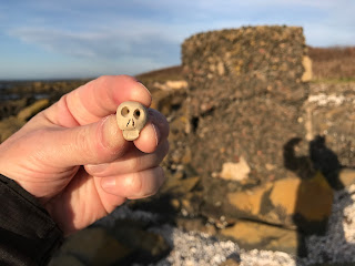
I left the Skulferatu that accompanied
me in a hollow in the last block standing amongst the rocks in Gosford Bay.
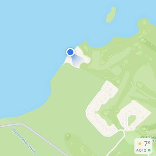
The coordinates for the location of the
Skulferatu are –
Latitude 56.004890
Longitude -2.889890
I used the following sources for information on the Anti Tank Blocks –


No comments:
Post a Comment