Showing posts with label River Tyne. Show all posts

Tuesday 23 May 2023

Skulferatu #97 - High Level Bridge, Newcastle Upon Tyne


Newcastle has always been a part of my life.  I used to have a lot of family down there, so visited often.  I still like to head down two or three times a year and have a wander around. 


For those unfamiliar with the city of Newcastle, it sits on the north bank of the River Tyne in the north east of England and is considered to be the capital of the area.  It grew up, around and over the Roman settlement of Pons Aellius, flourished and expanded during the fourteenth century as an important site in the wool trade, and then played an important role in the UK’s coal industry.  With the decline of its docks and the coal industry the city suffered like many other northern towns and cities, though through various regeneration projects it now has a diverse and thriving economy.


When I’m in Newcastle, one of the walks I like to do takes me over the High level Bridge, a double decker bridge with a railway running over the upper level.  From this bridge there are amazing views over the River Tyne to the iconic Tyne Bridge and several other bridges across the river.  There are also great views of the riverside areas of Newcastle and Gateshead.


A photograph showing a view over some rooftops to the High Level Bridge in Newcastle.  There are various chimneys and tiled roofs in the foreground with the bridge in the background.  Photograph by Kevin Nosferatu for The Skulferatu Project.
View over the rooftops to the High Level Bridge


View from Gateshead over the Tyne to Newcastle showing the High Level Bridge and the Swing Bridge.  The Swing Bridge is red and white with what looks like a small lighthouse in the centre.  Photograph by Kevin Nosferatu for The Skulferatu Project.
View of the High Level Bridge


A view of the High Level Bridge showing the River Tyne in the foreground and a wooden structure with two huts on it by the feet of the bridge.  In the far right hand corner is an old stone building which is Newcastle Castle.  Photograph by Kevin Nosferatu for The Skulferatu Project.
View of the High Level Bridge


A view from the High Level Bridge showing the Swing Bridge in the foreground and the Tyne Bridge behind that.  Photograph by Kevin Nosferatu for The Skulferatu Project.
View from the High Level Bridge to the Tyne Bridge and beyond


The view over Newcastle from the bridge always reminds me of a story Grandpa Nosferatu told me, probably because it is not that far from the area where he once lived.  Grandpa Nosferatu was born and brought up in the slums of Newcastle in the early part of the Twentieth Century, and as a young boy he lived with his family in a dingy, cramped house in the terraces by the docks.


My Grandpa’s father was a brute of a man who ruled his family with extreme violence. A man who terrorised his wife and children and expected them to obey his every word.  Basically, he was a big, nasty, aggressive bully.  As a kid Grandpa Nosferatu had learnt quickly that you never went against what his father said, or there would be dire consequences.  One of the many rules and stipulations that his father had was that his children never played in the docks. However, this was one rule Grandpa Nosferatu couldn’t help breaking, there was just too much fun to be had down there.  The place was a playground heaven for kids, what with all the boxes to climb, reels of rope, and various bits of junk lying around that just cried out to be played with.


One evening, a six or seven year old Grandpa Nosferatu headed down to the docks to meet some friends, climb boxes and play at being sailors. However, his friends never turned up. This did not deter my grandpa, who sat on top of one of the many boxes pretending that it was his ship, and he was the captain. He was suddenly disturbed out of his play by the noise of an argument. He shimmied down from the box and sneaked round to see what was going on. From a safe vantage point, he saw three men. Two were arguing with the third.  As the argument escalated the two men began to push and punch the third man. Then one of the men pulled out a knife and stabbed the third man several times.  He collapsed, lifeless, to the ground.  For a while the two other men seemed at a loss as what to do.  After some discussion they dragged the third man’s body to the edge of the dock and rolled him over into the swirling, dark waters of the Tyne.  They then hurried away, looking nervously around as they went.  My grandpa ducked down and hid for what felt like hours, too terrified to move in case the men came back and saw him.  Eventually, when he had plucked up enough courage, he left.  For a while he walked the streets in shock and facing a huge dilemma, did he go and tell the police what he'd seen and risk the wrath of his father, or did he keep quiet? The thought of his father being in a rage was so terrifying that he decided to keep quiet about what he had seen and for many years he never told a soul about the murder he witnessed at the docks.  And he really only ever told the story to highlight just how scared he had been of his father.  A fear that drove him to walk out of the family home at the age of fourteen and never return.


Anyway, back to the bridge.  The High Level Bridge was commissioned in 1845 and Robert Stephenson, the renowned engineer and son of the famous inventor George Stephenson, came up with the design for it. The stipulations he was given for the bridge were that it was to carry a railway, roadway, and a pedestrian walkway.  In order to avoid having to build a very wide and very expensive bridge, he designed it to be on two levels.  The lower level consisted of a road and two walkways, one on either side of the road, while the upper level carried the railway.  Work then began on the construction of the bridge with houses on each side of the river being demolished.  Piles were then driven into the riverbed; the approach viaducts were constructed and the ironwork was cast and put in place.  In total over 5,050 tons of iron were used in the building of the bridge and around 1.5 million bricks.  The cost of its construction, including the costs of building the approaches to the bridge and compensation to the families whose houses had to be demolished to make way for it, was estimated to be around £491,000, which translates in today’s money as being around £46 million.


The bridge was opened in 1849 by Queen Victoria and was considered to be ‘one of the finest pieces of architectural ironwork in the world.’ 


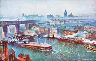
An old colour postcard of a painting showing two of the bridges across the Tyne, one of them being the High Level Bridge.  There are numerous old fashioned boats on the river and Newcastle is covered in a low smog from the many factories.  The postcard is by Tuck and is described as being a scene of The Busy Tyneside.
‘The Busy Tyneside’ – Tuck’s Postcard


Over the years, the High Level Bridge has undergone several renovations and upgrades to ensure its continued use and safety. In 2008, the bridge was refurbished at a cost of £40 million, which included strengthening work and the replacement of several components.


A view down a cycle path and roadway to the opening of the lower storey of the High Level Bridge.  Next to the bridge stands a stone building of maybe Victorian design and this is the Bridge Hotel.  Photograph by Kevin Nosferatu for The Skulferatu Project.
Newcastle entrance to the High Level Bridge


A photo showing iron pillars of the bridge running off into the distance.  They are painted a very pale brown colour.  Photograph by Kevin Nosferatu for The Skulferatu Project.
Iron Pillars


A photo of some graffiti on the bridge which consists of a sticker of a skull under which someone has drawn a suit, shirt and tie as if the skull is wearing business clothes.  Photograph by Kevin Nosferatu for The Skulferatu Project.
Graffiti skull and suit on the bridge


A photo of a padlock on a metal grill on the High Level Bridge.  The padlock is gold in colour and shaped like a love heart.  In the background is the Tyne Bridge.  Photograph by Kevin Nosferatu for The Skulferatu Project.
My heart belongs to ...


A black and white photograph showing the view along the pedestrian walkway of the High Level Bridge.  There are Victorian looking iron pillars stretching off into the distance.  Photograph by Kevin Nosferatu for The Skulferatu Project.
A view along the pedestrian walkway


A view of the High Level Bridge from Gateshead showing the bridge curving around across the Tyne to Newcastle.  Photograph by Kevin Nosferatu for The Skulferatu Project.
The High Level Bridge – Gateshead view


Today, in the howling wind, I walked over the bridge and took in the views.  I then left the Skulferatu that had accompanied me on my walk in a ledge in the ironwork, high above the Tyne.


A photo showing a hand holding up a small ceramic skull (Skulferatu 97) with a view of the metal pillars on the lower level of the High Level Bridge in the background.  Photograph by Kevin Nosferatu for The Skulferatu Project.
Skulferatu #97


A photo showing a small ceramic skull (Skulferatu 97) lying on a ledge on a large iron panel in the High Level Bridge.  Photograph by Kevin Nosferatu for The Skulferatu Project.
Skulferatu #97 on a ledge in the ironwork of the bridge


A photo showing a small ceramic skull (Skulferatu 97) lying on a ledge in the High Level Bridge.  Photograph by Kevin Nosferatu for The Skulferatu Project.
Skulferatu #97 on a ledge in the ironwork of the bridge


 TomTom Map showing the location of Skulferatu #97
Map showing the location of Skulferatu #97


The coordinates for the location of the Skulferatu are –


Latitude 54.967402

Longitude -1.609099


what3words: fact.grab.hotel


I used the following sources for information on the High Level Bridge –


Tourist Info at Site


Network Rail – The History of the High Level Bridge, Newcastle


Tuesday 6 July 2021

Skulferatu #36 - Crichton Castle, Crichton, Midlothian


Today I went for a wander out of Edinburgh and along to the ruins of Crichton Castle.  The ruins sit just outside the village of Crichton, on a terrace that overlooks the picturesque scenery of the valley of the Tyne. 


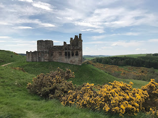
View of Crichton Castle, Midlothian on a hill with gorse bushes flowering in yellow in the foreground.  Photo by Kevin Nosferatu for the Skulferatu Project.
View of Crichton Castle


Crichton Castle from hill above.  Photo by Kevin Nosferatu for the Skulferatu Project.
Crichton Castle from hill above


The stable block with the castle in background.  Photo by Kevin Nosferatu for the Skulferatu Project.
The stable block with the castle in background


The stable block is a very ornate building that stands near to Crichton Castle, Midlothian.  Photo by Kevin Nosferatu for the Skulferatu Project.
The stable block


In the Fourteenth Century a keep was built on this spot by the Crichton family.  In the Fifteenth Century the castle building was extended around this by Sir William Crichton and then later by others who had either inherited or were granted the castle and its lands.  Sir Walter Scott wrote of the castle in his narrative poem Marmion and also wrote a history of the castle, informing his readers that – ‘it was built at different times, and with a very differing regard to splendour and accommodation.  The older part of the building is a narrow keep, or tower, such as formed the mansion of a lesser Scottish Baron; but so many additions have been made to it, that there is now a large courtyard, surrounded by buildings of different ages.  The eastern front of the court is raised above a portico, and decorated with entablatures, bearing anchors.  All the stones of this front are cut into diamond facets, the angular projections of which have an uncommonly rich appearance.  The inside of this part of the building appears to have contained a gallery of great length and uncommon elegance.  Access was given to it by a magnificent staircase, now quite destroyed…  Unfortunately, I didn’t get to see the interior of the castle today, as it was closed due to Covid restrictions.  However, I did find a drawing of the courtyard.


View of the courtyard - taken from The Castellated and Domestic Architecture of Scotland


The first recorded owner, Sir William Crichton, was a man who was remarkable for his time, having risen to prominence through politics rather than through warfare.  He became the Lord Chancellor under King James I and later he also became the guardian of James II.    He was a man involved in various intrigues and his main claim to fame, or infamy, would appear to be that he took part in organising the ‘Black Dinner’.  This was when the Sixth Earl of Douglas and his younger brother were invited to dine with young King James II and as they ate were seized, dragged away and brutally murdered.  Their great uncle, James Douglas, who had also been involved in the plot against them, then inherited their wealth and titles making him one of the most powerful men in Scotland at that time.


In the early 1480s the Crichton family fell out of favour and their lands were forfeited with the castle being given to Sir John Ramsay.  He then fell out of favour and in 1488 the castle was given to Patrick Hepburn, who later became the Earl of Bothwell.  The castle stayed with Hepburn’s family for a few generations, but in 1568 they fell out of favour, and it was again forfeited.  It was then handed over to Francis Stewart, the ‘bastard’ grandson of James V.  He carried out extensive work on the castle including having the decorative diamond faced façade added in the courtyard and a rather grand stable building built next to the castle.  However, guess what, he was then accused of witchcraft and plotting against King James VI.  He fled to Naples and in 1592 his properties, including the castle, were forfeited.  The castle was then reinstated to Stewart’s son, and he sold it on to the Hepburn’s of Humbie. It then passed through various owners who all seem to have just left it to crumble and fall into ruin.  The castle is now in the care of Historic Environment Scotland.


I left the Skulferatu that accompanied me on today’s walk in a crack in the wall on the outside of the castle.


Front entrance door to Crichton Castle.  The heavy, wooden door is closed.  Photo by Kevin Nosferatu for the Skulferatu Project.
Front entrance door to the castle


Skulferatu #36 being held up in front of the door to Crichton Castle.  Photo by Kevin Nosferatu for the Skulferatu Project.
Skulferatu #36


Skulferatu #36 in crack in wall of Crichton Castle.  Photo by Kevin Nosferatu for the Skulferatu Project.
Skulferatu #36 in crack in wall of castle


Close up of Skulferatu #36 in crack in wall of Crichton Castle.  Photo by Kevin Nosferatu for the Skulferatu Project.
Close up of Skulferatu #36 in crack in wall of castle


Map showing location of Skulferatu #36 at Crichton Castle, by Crichton, Midlothian.
Map showing location of Skulferatu #36


The coordinates for the location of the Skulferatu are –


Latitude 55.839688

Longitude -2.991259


I used the following sources for information on the castle –


The Castellated and Domestic Architecture of Scotland from the Twelfth to the Eighteenth Century

Volume One

By David MacGibbon and Thomas Ross

1887


The Ruined Castles of Midlothian

By John Dickson

1894


The Scots Magazine and Edinburgh Literary Miscellany

1st August 1808


Wikipedia – Crichton Castle

Wikipedia - Crichton Castle


Tuesday 24 November 2020

Skulferatu #7 - Hailes Castle, Traprain, Haddington


In a valley by the River Tyne (not to be confused with the River Tyne that flows through Newcastle) sits the rather pretty ruin of Hailes Castle.  On a cold winters day with a north wind cutting through my clothes like a knife of ice I went for a little walk around the castle and along the river.  From the road the castle looks rather unimposing, but as you walk through the ruins and down to the river the building becomes much more impressive.  The best views being from by or across the river.


The castle dates from the early 1200s and was built by the de Gourlay family.  The de Gourlay’s were a Northumbrian family who supported the Balliols during the Wars of Independence.  The Balliols lost the battle for the Scottish Crown and the de Gourlay’s land was confiscated and handed to Sir Adam de Hepburn.  He then extended the castle buildings.


Hailes Castle - View from Brae Heads Loan


Hailes Castle - View from banks of River Tyne

In 1546 the Lutheran preacher, George Wishart, was imprisoned in the castle after being arrested while preaching in Ormiston.  He was then handed over to Cardinal Beaton, the Archbishop of St. Andrews, and was taken to St Andrews Castle.  There, after being tried for heresy, he was burned at the stake.


Mary Queen of Scots stayed at the castle along with James Hepburn, the Fourth Earl of Bothwell.  They stopped here on their way from Dunbar to their wedding at Holyrood Palace in Edinburgh on 15 May 1567.  Their marriage was deeply unpopular, as Hepburn had been implicated in the murder a few months earlier of Mary’s husband Lord Darnley.  Shortly after Mary and Hepburn’s marriage, Mary was forced to abdicate the throne to her infant son.  Hepburn then fled the country and lived in exile in Denmark.  There he died in 1578, while imprisoned.  In 1858 his body was exhumed from the vault it had been buried in and was found to have become mummified.  In the 1970s it was supposedly an exhibit in the Edinburgh Wax Museum on the Royal Mile.


In 1650 Cromwell’s troops occupied the castle and severely damaged it.  By the mid-1900s Hailes Castle was being used as a granary and in 1926 it was taken into state care.


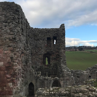
The Tower House at Hailes Castle

The Dovecot in the Tower House

The Skulferatu that accompanied me on this trip was placed in the dovecot in the tower house.


Skulferatu #7

Skulferatu #7 in Dovecot Hollow

Skulferatu #7 in Dovecot Hollow


The coordinates for the location of the Skulferatu are: Latitude 55.973236 Longitude -2.683593.


Google Map showing location of Skulferatu