Showing posts with label Skulls. Show all posts

Tuesday 16 February 2021

Skulferatu #19 - St Andrew's Kirk, Kirk Ports, North Berwick


St Andrew's Kirk, Kirk Ports, North Berwick by Kervin Nosferatu for the Skulferatu Project
St Andrew’s Kirk, Kirk Ports, North Berwick


Just off North Berwick High Street stands the rather quaint ruin of St Andrew’s Kirk.  This church was built in the 17th Century and opened on 5 June 1664.  It was built to replace St Andrew’s Old Kirk, which stood near to the sea and had been so severely damaged by a storm that it had to be abandoned.  The ruins of the Old Kirk lie near to the Scottish Seabird Centre.   


With the arrival of the railway in North Berwick in 1850, the town’s population grew substantially.  By 1873 the congregation was too large for St Andrew’s Kirk and in 1882 a new and larger church opened nearby. 


On 3 June 1883, the last service was held in St Andrew’s Kirk and shortly after this it was partly dismantled, with various fixtures and fittings being auctioned off.  However, it was decided by the church authorities to ‘allow the walls of the church to stand in order to form a picturesque ruin…’


Interior of the ruins of St Andrew’s Kirk, Kirk Ports, North Berwick by Kevin Nosferatu for the Skulferatu Project
Interior of the ruins of St Andrew’s Kirk


A view of the graveyard at Kirk Ports and the ruins of St Andrew’s Kirk by Kevin Nosferatu for the Skulferatu Project
A view of the graveyard at Kirk Ports and the ruins of St Andrew’s Kirk


Old Gravestone at Kirk Ports Graveyard, North Berwick by Kevin Nosferatu for the Skulferatu Project
Old Gravestone at Kirk Ports Graveyard


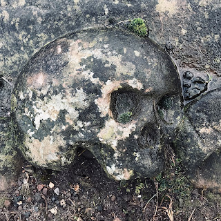
Carved skull on one of the old graves at Kirk Ports Graveyard, North Berwick by Kevin Nosferatu for the Skulferatu Project
Carved skull on one of the old graves


I placed the Skulferatu that accompanied me on today’s walk around North Berwick in a gap in the wall at the church.


Skulferatu #19 at St Andrew's Kirk, Kirk Ports, North Berwick by Kevin Nosferatu for the Skulferatu Project
Skulferatu #19


Skulferatu #19 in wall at St Andrew’s Kirk, Kirk Ports, North Berwick by Kevin Nosferatu for the Skulferatu Project
Skulferatu #19 in wall at St Andrew’s Kirk


Google Map showing location of Skulferatu #19


The coordinates for the location of the Skulferatu are –

Latitude 56.057800

Longitude -2.718484

Tuesday 26 January 2021

Skulferatu #16 - Cammo Tower, Cammo Estate, Edinburgh


Lying on the outskirts of Edinburgh, as you head North towards South Queensferry and Fife, sits Cammo Estate.  This was once a private estate, but was bequeathed to the National Trust and then given to Edinburgh Council.  It is now maintained by the council as a wilderness park.


http://www.ipernity.com/doc/buildings/35546507
Cammo House circa 1900


The remains of Cammo House, Cammo Estate, Edinburgh by Kevin Nosferatu for the Skulferatu Project
The remains of Cammo House


In the estate there are the remains of Cammo House.  This was built in 1693 for John Menzies and at that time had fourteen bedrooms, four public rooms, a smoking room, a billiards room, bathrooms, a kitchen, a wash-house, a laundry, cellars, larders, pantries and servants' accommodation.  A surrounding park and landscaped garden were then laid out around the house. 


The house went through several owners before being bought by the Clark family.  In 1909 David Bennet Clark divorced his wife Margaret Maitland-Tennent and she and her son Percival kept the house.  However, shortly after the divorce Margaret dismissed the staff and moved into a caravan with her son.  The house was left, still full of valuable paintings and antiques.  Over the years it was completely neglected and was broken into on numerous occasions.  During the break-ins it was vandalised and damaged, with various valuables also being stolen.  In 1955 Margaret died and the house was left to Percival.  He lived as a recluse with a pack of around thirty dogs, which were given a free run of the house.  On his death in 1975, the house and the estate were left to the National Trust.  In 1977 most of the house was destroyed by fire and the remains were later pulled down, leaving only the door frame and lower wall.  In 1980 the house and the estate were given to Edinburgh Council by the National Trust.


Cammo House is thought to have been the inspiration for ‘The House of Shaws’ in Robert Louis Stevenson’s novel Kidnapped.


On the estate there is also the very picturesque Cammo Tower.  This is a 19th Century Water Tower built to supply water to Cammo House.


A view of Cammo Tower, Cammo Estate, Edinburgh by Kevin Nosferatu for the Skulferatu Project
A view of Cammo Tower


Cammo Tower, Cammo Estate, Edinburgh by Kevin Nosferatu for the Skulferatu Project
Cammo Tower


A view of Cammo Tower, Cammo Estate, Edinburgh by Kevin Nosferatu for the Skulferatu Project
A view of Cammo Tower


On my wanders around the estate, I left a Skulferatu in the wall of Cammo Tower with a view of the nearby hill.


Skulferatu #16 at Cammo Tower, Cammo Estate, Edinburgh by Kevin Nosferatu for the Skulferatu Project
Skulferatu #16


Skulferatu #16 at Cammo Tower, Cammo Estate, Edinburgh by Kevin Nosferatu for the Skulferatu Project
Skulferatu #16 in wall of Cammo Tower


Google Map
Google Map showing location of Skulferatu


The coordinates for the location of the Skulferatu are:


Latitude 55.954275

Longitude -3.321390


Tuesday 12 January 2021

Skulferatu #14 - Figgate Park, Edinburgh


It has been snowing.  The snow has turned to slush and ice.  So today I didn’t venture far, my walk taking me through Portobello and up to Figgate Park and around the pond there.


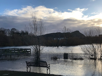
View over pond at Figgate Park to Arthur's Seat, Edinburgh by Kevin Nosferatu for the Skulferatu Project
View over pond at Figgate Park to Arthur’s Seat


Figgate Park is nestled between Portobello and Duddingston.  The main East Coast railway line from Edinburgh to London runs past the park, and it is surrounded on the other sides by various housing estates. The park is about a kilometre long and at the east end there is a large pond.  This used to be a claypit, which supplied the potteries in Portobello.  It is now a habitat for lots of birds.  The park was formally opened in 1938.


The name of the park comes from the burn that runs through it and from the old name for the land it sits in, Figgate Muir.  Figgate Muir was an area of land on the east side of Edinburgh that now forms the main part of Portobello.  In Cassells Old and New Edinburgh, Vol.3 (1883) it is described as ‘…a once desolate expanse of muir-land…which latterly was covered with whins and furze, bordered by a broad sandy beach and extending from Magdalene Bridge on the south perhaps to where Seafield now lies, on the north-west.’ 


The park was busy today with everyone doing their daily Covid walk, or slip and slide in the slushy mess of last nights snow.  Disconsolate looking ducks sat on the ice of the pond while a group of swans swam in the small area that hadn’t frozen over.  Noisy seagulls circled around hoping to spot someone throwing something edible to the other birds.  Children screamed and demanded attention from their worn out parents, while an occasional train roared past. 


Boardwalk around pond at Figgate Park, Edinburgh by Kevin Nosferatu for the Skulferatu Project
Boardwalk round pond at Figgate Park


View over pond in Figgate Park to pylons and powerlines by Kevin Nosferatu for the Skulferatu Project
View over pond to pylon and powerlines


Disconsolate Ducks and Selfish Swans on pond at Figgate Park by Kevin Nosferatu for the Skulferatu Project
Disconsolate ducks and selfish swans


I found some quiet places in the park to take a few photographs.  Then in another quiet spot, in between some reeds on the bank of the pond, I left my Skulferatu.  I placed it on some pockmarked, icy snow, so it should fall down between the reeds and into the pond when the snow melts.


Skulferatu #14 at Figgate Park, Edinburgh by Kevin Nosferatu for the Skulferatu Project
Skulferatu #14


Skulferatu #14 on snow by pond at Figgate Park, Edinburgh by Kevin Nosferatu for the Skulferatu Project
Skulferatu #14 on snow by pond


Google Map for Skulferatu Project
Google Map showing location of Skulferatu


The coordinates for the location of the Skulferatu are:

Latitude 55.949871

Longitude -3.124324 

Thursday 31 December 2020

Skulferatu #12 – Lochend Park, Edinburgh

I lived in the Abbeyhill area of Edinburgh years ago and remember the first time I stumbled across Lochend Park with it’s strange, little loch in the middle.  It was a hot, humid summers day and the loch looked almost like something from a bayou in the southern United States with the trees growing out from the water.


Lochend Loch or Restalrig Loch is really just a large puddle that sits in a natural hollow in the ground and its depth varies with the rainfall.  It used to serve as one of the main water supplies for Leith, but the water was of poor quality and often stagnant.  The locals therefore preferred to get their water from the local wells instead.


Lochend Loch with Arthur's Seat in background and Lochend House
Lochend Loch with Arthur's Seat in background and Lochend House on left of photo
 

The loch was also used for the hunting of wildfowl and King James IV of Scotland hunted there occasionally.


Lochend Loch from Cassells Old and New Edinburgh Vol 3
A drawing of Lochend Loch from Cassells Old & New Edinburgh Vol. 3 (1883)
 

Sometime in the 1570s the loch was the site of the ghostly apparition of a fairy army.  Bessie Dunlop, a midwife, and folk healer from Ayrshire was on the way to Leith and had stopped and tethered her horse by Restalrig Loch.  As she was resting, she heard ‘a tremendous sound of a body of riders rushing past her with a noise as if heaven and earth would come together…the sound swept past her and seemed to rush into the lake with a hideous rumbling noise.  All this while she saw nothing…’  (Letters on Demonology and Witchcraft, by Walter Scott).  It would seem that a ghost she regularly spoke to informed her that this was the fairies on one of their earthly processions.  Alas for poor Bessie, she was later tried and found guilty of witchcraft and in 1576 was executed on Castle Hill in Edinburgh.


Above Lochend Loch sits Lochend House, which is also known as Restalrig Castle.  The house used to belong to the Logan family, however it was confiscated from them by the Scottish Parliament in 1609, due to Robert Logan having been involved in a plot to abduct King James VI of Scotland.  From 1704 it was owned by the 6th Duke of Balmerino, Arthur Elphinstone.  He was beheaded on 18 August 1746 at Tower Hill in London for his part in the Jacobite rising if 1745.  In 1816 most of the house was pulled down and a new house was built on the site.  The property was recently renovated and is now privately owned.


Lochend House - view from Lochend Park
Lochend House, as seen from Lochend Park
 

There is a Doocot in the park which stands north from the house and next to a small, brightly coloured playground.  It provided a nesting site for several hundred pairs of pigeons, which were used for eggs and meat.  The Doocot is still popular with the local pigeons.


In 1645 the plague hit and devastated Leith, killing off around half the population (and we think we’ve got it bad with the Covid!).  There is evidence of a chimney in the Doocot and it is thought it was used as an incinerator to burn the clothing and other items of those who fell victim to the plague.  In old maps of the area, it is referred to as the ‘plague kiln’.


Doocot in Lochend Park, Edinburgh.  Photo by Kevin Nosferatu for The Skulferatu Project
Doocot in Lochend Park

Pigeon in Lochend Park Doocot by Kevin Nosferatu for The Skulferatu Project
Pigeon sheltering inside Doocot
 

I left a Skulferatu by the loch as a present for the fairies, just in case they come by again.  I hope they like it.


Skulferatu #12 at Lochend Park, Edinburgh.  Photo by Kevin Nosferatu for The Skulferatu Project
Skulferatu #12

Skulferatu #12.  Photo by Kevin Nosferatu for The Skulferatu Project
Skulferatu #12 resting on some leaves by the bank of the loch
 

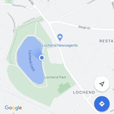
Google Map
Google Map showing location of Skulferatu

The coordinates for the location of the Skulferatu are:

Latitude 55.960842

Longitude -3.159896


Article and photographs are copyright of © Kevin Nosferatu, unless otherwise specified.


Thursday 24 December 2020

Skulferatu #11 - Hangman's Crag, Holyrood Park, Edinburgh


I was out for a walk around Holyrood Park, and while there wandered past a spot known as Hangman's Crag.  Leaving the main path, I crossed over a small fence and took a narrow path up to the top of this rocky outcrop. I have walked up here a few times before, but always in the summer when it has been dry.  Though it was steep, it was a relatively easy walk.  Not so in winter.  Everything was slippery and wet and a worked up into a mass of mud from all the thousands of people who have been walking up this path in these Covid ridden times.  Thankfully, on the most treacherous part of the path, there were lots of tree branches to hold onto.  If there hadn’t been, I’d have ended up flat on my arse in the mud.


Hangman's Crag, Holyrood Park, Edinburgh
Hangman's Crag, with Duddingston Kirk in the background

Hangman’s Crag sounds like the name came from the place being a site of execution, but actually it comes rather from the sad tale of one of Edinburgh's much hated and loathed executioners.


In the late Seventeenth Century in Edinburgh, one of the city's hangmen was a young man who had come from a wealthy and well-to-do family from Melrose in the Scottish Borders.  On his father's death, he had inherited the estate and a great deal of money.  However, the young man had extravagant tastes and wasted the whole fortune on living the high life.  When not drinking, entertaining and visiting one of the city’s many whorehouses he was gambling away vast amounts of money.  Soon he was broke.  There was no money left.  To survive he had to move to lowly lodgings and sell off his belongings, though he did keep one set of fine clothes.  The young man then had to do what no gentleman should ever have to do, he had to work for a living. So, he took the job as the city hangman.  This was a particularly odious and unpopular job at that time, as many of those sentenced to die were innocent men fallen foul of higher powers or those whose religion was not in keeping with the main orthodoxy.  Even in normal times the city hangman was seen as someone on the fringes of society, on the same level as common criminals and prostitutes.


The young man took up this office and performed his duties of execution, flogging and all the other rather unpleasant sentences ordered by the courts.  Now, a man has to be of a certain mentality to carry out these sorts of duties and not be affected or destroyed by the torment he is inflicting.   This young man found escape from the guilt of his actions and from the lowly office he now occupied in life, by donning the one set of fine clothes he had kept and mixing with the gentlefolk of Edinburgh.   He would dress up and mingle with the groups of Edinburgh society who played golf in the evenings at Bruntsfield Links, and for a few hours he could feel he was back in his place in society.  He could switch off from the haunting screams of those whose lives he was paid to end.  Those he was paid to maim or torture or humiliate.


One day while out at Bruntsfield Links, the young man was recognised by a group playing golf.  One of their friends had recently been sentenced to death for some minor offence, and they realised that the young man playing golf alongside them was none other than the man who had hanged him.  They shouted at him and pointed out to the others there who he was.  They insulted him, spat at him, threw stones at him and chased him away.  They told him never to come back, that he was a disgrace and lower than even the most common and base criminal who had dangled from his rope.    The young man ran off humiliated and ashamed.  He made his way to the quiet solitude of one of the crags overlooking Duddingston Loch.  There he contemplated his life and what he had become.  Falling into a state of great despair he threw himself off the crag to his death.  His body was then found there the next day.  After this the crag he had thrown himself from was always referred to as the Hangman’s Crag.


Hangman's Crag, Holyrood Park, Edinburgh
View up path to top of Hangman's Crag - with Crow Hill in the background

View From Hangman's Crag, Holyrood Park, Edinburgh
View from Hangman's Crag over Duddingston Loch
 

Near the top of the crag, I found a hollow in a group of rocks near the cliff edge and there I left the Skulferatu that had accompanied me on my walk.


Skulferatu 11 at Hangman's Crag, Holyrood Park, Edinburgh
Skulferatu #11

Skulferatu 11 on Hangman's Crag, Holyrood Park, Edinburgh
Skulferatu #11 in a hollow between rocks at the crags edge

Google Map
Google map showing location of Skulferatu #11

The coordinates for the location of the Skulferatu are:

Latitude 55.941027

Longitude -3.154901

Thursday 3 December 2020

Skulferatu #8 - Warriston Cemetery, Edinburgh


I do like a good wander round an old graveyard, and not just because I’m an ageing Goth.  They are great places for quiet contemplation and for getting one’s life into perspective.  As you walk round tomb after tomb of the great and the good, the self-important and the lowly it really does show you that life is just so fleeting.  That death not only comes to us all, but is also a great leveller.  Yes, some will have monuments towering up above them, but beneath they are just bones, clay or dust.  One day that is all any of us will be.  So, on that happy note, my latest walk was to and around Warriston Cemetery in Edinburgh.  This is one of my favourite of Edinburgh’s old cemeteries, as it is quiet and relatively peaceful, or was until Covid came along and everyone was looking for new places to discover and walk around.


Bridge leading into part of Warriston Cemetery

Gravestones covered in ivy
 

The cemetery is full of the graves of many of Edinburgh’s Victorian elite.  There are artists, poets, mathematicians and scientists lying in their damp graves alongside the merchants and lawyers of the city.  With the wonders of Google, you can look up lots of them and find out bits and pieces about their lives.


Gravestones in Warriston Cemetery
 

On this visit I came across the grave of the Nichol family.  I was intrigued by the few lines written about John Walter Nichol – ‘Assistant Astronomer in the Government “Venus” Expedition to Honolulu in 1874.  So, I had to look this up to see what it was all about.


Grave of John Walter Nichol at Warriston Cemetery by Kevin Nosferatu
Gravestone for Nichol Family

John Walter Nichol FRAS Assistant Astronomer in the Government Venus Expedition to Honolulu in 1874. Who died at Teignmouth on 4th November 1878, aged 35 years
Inscription for John Walter Nichol
 

In 1874 a group of British scientists travelled to Hawaii to observe the transit of Venus.  This is when the planet Venus passes directly between the sun and a ‘superior planet.’   When this happens Venus can be seen from Earth as a small, black dot moving across the sun.  The purpose of the expedition to Hawaii was to obtain an accurate estimate of the distance from the Earth to the sun.  


It would seem that the tropical climate and the insects of Hawaii did not agree with the British scientists and Nichol is mentioned in a letter by  one of his colleagues who writes that – ‘…When it became necessary to commence the computing we found the mosquitos so troublesome it was almost impossible to do anything.  Nichol presented a mass of sores over his face and hands and Ramsden couldn’t sit at the table five minutes.’  (Michael E Chauvin - The Hawaiian Journal of History – Page 199).  The scientists were also disturbed from their work on numerous occasions by King Kalakaua of Hawaii and the locals, who all took a keen interest in what they were doing.  However, despite all of this the scientists carried out their observations and detailed and noted their calculations.


A collection of the documents, photographs and sketches from this expedition were digitised and are available from the Cambridge Digital Library.  Many of the sketches depict Nichol and other members of the team, as do the photographs. These can be accessed at -


https://cudl.lib.cam.ac.uk/collections/tov/1


By coincidence, while Googling for info on John Walter Nichol I found that there was a talk by Dr Rebekah Higgitt that evening about him and the expedition to Hawaii.  For anyone interested in details of the expedition and Nichol’s life and career, this talk is now available on the Astronomical Society of Edinburgh’s website.  From this I learnt that Nichol was known as Walter, rather than John and seemed to be a popular member of the group who went out to Hawaii.  That before joining this expedition he had been a shipping clerk at Leith, before going on to work as the second Assistant at the Royal Observatory in Edinburgh.  After the expedition to Hawaii he returned to Britain with the other members of the team and they all wrote up their findings at Greenwich.  He then went to Leipzig where he studied under Professor Karl Bruhns.


On his return to Britain he died suddenly of a pulmonary infection on 4 November 1878.


I left Nichol and his family a Skulferatu.


Skulferatu # 8 at Warriston Cemetery, Edinburgh by Kevin Nosferatu
Skulferatu #8

Skulferatu #8 at Nichol family gravestone, Warriston Cemetery, Edinburgh by Kevin Nosferatu
Skulferatu #8 by the Nichol's gravestone
 

As I then walked around the graveyard, I found that on another old grave someone had left a small, handmade ceramic cat. Maybe someone else leaving little mementos?


Google Map showing location of Skulferatu
 

The coordinates for the location of the Skulferatu are: Latitude 55.968509 Longitude -3.196384.


Tuesday 24 November 2020

Skulferatu #7 - Hailes Castle, Traprain, Haddington


In a valley by the River Tyne (not to be confused with the River Tyne that flows through Newcastle) sits the rather pretty ruin of Hailes Castle.  On a cold winters day with a north wind cutting through my clothes like a knife of ice I went for a little walk around the castle and along the river.  From the road the castle looks rather unimposing, but as you walk through the ruins and down to the river the building becomes much more impressive.  The best views being from by or across the river.


The castle dates from the early 1200s and was built by the de Gourlay family.  The de Gourlay’s were a Northumbrian family who supported the Balliols during the Wars of Independence.  The Balliols lost the battle for the Scottish Crown and the de Gourlay’s land was confiscated and handed to Sir Adam de Hepburn.  He then extended the castle buildings.


Hailes Castle - View from Brae Heads Loan


Hailes Castle - View from banks of River Tyne

In 1546 the Lutheran preacher, George Wishart, was imprisoned in the castle after being arrested while preaching in Ormiston.  He was then handed over to Cardinal Beaton, the Archbishop of St. Andrews, and was taken to St Andrews Castle.  There, after being tried for heresy, he was burned at the stake.


Mary Queen of Scots stayed at the castle along with James Hepburn, the Fourth Earl of Bothwell.  They stopped here on their way from Dunbar to their wedding at Holyrood Palace in Edinburgh on 15 May 1567.  Their marriage was deeply unpopular, as Hepburn had been implicated in the murder a few months earlier of Mary’s husband Lord Darnley.  Shortly after Mary and Hepburn’s marriage, Mary was forced to abdicate the throne to her infant son.  Hepburn then fled the country and lived in exile in Denmark.  There he died in 1578, while imprisoned.  In 1858 his body was exhumed from the vault it had been buried in and was found to have become mummified.  In the 1970s it was supposedly an exhibit in the Edinburgh Wax Museum on the Royal Mile.


In 1650 Cromwell’s troops occupied the castle and severely damaged it.  By the mid-1900s Hailes Castle was being used as a granary and in 1926 it was taken into state care.


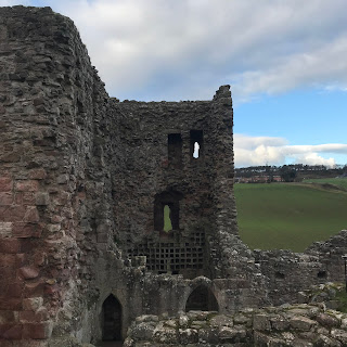
The Tower House at Hailes Castle

The Dovecot in the Tower House

The Skulferatu that accompanied me on this trip was placed in the dovecot in the tower house.


Skulferatu #7

Skulferatu #7 in Dovecot Hollow

Skulferatu #7 in Dovecot Hollow


The coordinates for the location of the Skulferatu are: Latitude 55.973236 Longitude -2.683593.


Google Map showing location of Skulferatu