Showing posts with label St Margaret. Show all posts

Tuesday 2 August 2022

Skulferatu #77 - The Oyly Well, Liberton, Edinburgh


If you were out on your travels and you stumbled across a pool of oily water, would you think that it must have some special or miraculous properties?  Probably not.  You would probably just think – Yuk, what is that?  This was not the way they thought in Medieval times though.  In the days before pollution and oil spills, science, and modern medicine, anything out of the ordinary could and often would seem to be something miraculous, something provided by God above to help us mere mortals down here on earth. So it was with the oily waters that rise from a spring in Liberton to form the Oyly Well.


A photo showing a small stone building with a metal, gated door.  This is the building that covers the Oyly Well in Liberton, Edinburgh.  Photograph by Kevin Nosferatu for the Skulferatu Project.
The Oyly Well


The Oyly Well, also known as the Balm Well, St Catherine’s Well, or the Balm Well of St Katherine, sits in what were once the grounds of St Catherine’s Chapel.  The chapel, which is now long gone, was built on the instructions of Queen Margaret (later St Margaret of Scotland) in honour of St Catherine of Sienna. 


The waters of the Oyly Well rise up from a spring that passes through the oil shale in the ground below, and this is why they are oily.  In olden times though the story went that Queen Margaret returned from Mount Sinai with some of the oil of St Catherine, and being a bit of a clumsy clod, she somehow managed to spill the oil on the spot where the spring rises.  This led to the waters becoming oily and having healing properties. 


The well soon became famous for the curative qualities of its water and was referred to locally as the Balm Well.  It was said that the oily waters could cure many skin complaints such as scabies.  They were also said to cure conditions leading to aching bones such as arthritis and rheumatism while also helping to alleviate the symptoms of gout and paralysis.  And if drunk they were supposedly good for preventing hysteria or breathing problems such as asthma.


A closer up photo showing a small stone building with a metal, gated door.  This is the building that covers the Oyly Well in Liberton, Edinburgh.  Photograph by Kevin Nosferatu for the Skulferatu Project
The Oyly Well


A view through the bars of the Oyly Well showing the stone structure inside and the oily waters.  Photograph by Kevin Nosferatu for the Skulferatu Project
The interior of the Oyly Well


The well was a big hit with the Scottish royals and was visited by various kings.  King James VI was a huge fan of the well and believed fully in the healing properties of its waters.  In 1617, on a trip back from England, where he was of course King James I, he stopped off at the well and ordered that it be properly enclosed and have a stairwell constructed down to the water so that it was easier to access.  However, in 1650 some of Cromwell’s soldiers, who were camped nearby, destroyed the structure around the well and filled it in.   During the Reformation the well was cleared of rubble and partially rebuilt, with the full structure that is there now being constructed in 1889.


A view of the interior of the Oyly Well showing the stone structure inside and the oily waters. Waters that supposedly had healing properties.   Photograph by Kevin Nosferatu for the Skulferatu Project.
The inside of the Oyly Well with its oily waters


Today the well can be found in a quiet spot in the garden at the back of a rather grand house which stands in the area where St Catherine’s Chapel once stood.  The house was built in 1806 for the architect John Simpson, and it was also the one time home of Sir William Rae, the Lord Advocate who oversaw the prosecution of the infamous body snatchers and murderers, Burke and Hare.  In its various incarnations since then the house has been a children’s home and is now a Toby Carvery restaurant.


On my visit there I sat in the early afternoon sun and watched the oily waters of the well bubble away.  Was I tempted to try them to alleviate any of my aches and pains, rub them onto my arthritic knees or have a swig to cure my wheezing hay fever?  Nah – no chance.   


A picture of the Oyly Well in its quiet spot behind some trees in the garden of the Toby Carvery on Howden Hall Road in Edinburgh.  Photograph by Kevin Nosferatu for the Skulferatu Project.
The Oyly Well can be found in a quiet spot...


I left the Skulferatu that accompanied me on my walk in a little dimple in the stone roof of the well, but then I gave into temptation and…


Alas dear reader, I did something

I shouldn’t have oughta

I threw the Skulferatu

Into the oily water…


A photo of a small ceramic skull (Skulferatu 77) being held up in front of the Oyly Well.  Photograph by Kevin Nosferatu for the Skulferatu Project.
Skulferatu #77


A photo of a small ceramic skull (Skulferatu 77) lying in a dimple on the roof of the building in which the Oyly Well sits.  Photograph by Kevin Nosferatu for the Skulferatu Project.
Skulferatu #77 sitting in a dimple on the stone roof of the well


TomTom Map showing the location of Skulferatu #77
Map showing the location of Skulferatu #77


The coordinates for the location of the Skulferatu are –


Latitude 55.902881

Longitude -3.164044


I used the following sources for information on the Oyly Well –


Canmore – Balm Well

Canmore - Balm Well


The Scotsman - Monday 11 March 1889


The Oyly Well; or a Topographico-Spagyrical Description of the Oyly-Well, at St. Catharines Chappel in the Paroch of Libberton,

By Matthew Mackail, 1664


New Statistical Account of Scotland – Volume 1

By the Ministers of the Respective Parishes, etc.

1845


Proceedings of the Society of Antiquaries of Scotland - Volume 17

‘Holy Wells’ in Scotland

By J Russell Walker

1883


Tuesday 25 May 2021

Skulferatu #31 - Malcolm Canmore's Tower, Pittencrieff Park, Dunfermline


Today, while walking through Pittencrieff Park, I went down through the grotto like glen and followed the path along Tower Burn, the stream that runs through the park.  While a blackbird sang above me, I cut round and walked up past several little caves and passageways that are all closed off by railings and gates.  I seem to remember these were all open and accessible when I was a child and have memories of squeezing through the various gaps while running madly around the place with friends and family. 


Bridge over Tower Burn in Pittencrieff Park, Dunfermline.  Photo by Kevin Nosferatu for the Skulferatu Project
Bridge over Tower Burn


A blackbird nestled in the branches of a tree in the glen in Pittencrieff Park, Dunfermline.  Photo by Kevin Nosferatu for the Skulferatu Project
Blackbird singing up above


After climbing up a steep set of stairs I turned onto the main path and then walked up the Tower Hill.  This was once the site of Malcolm Canmore’s Tower, the residence of said Malcolm Canmore. 


The name Canmore comes from the Gaelic for Great Chief, though when taught about him at school we were told it actually meant big head because he had a big head.  How true that is I don’t know, but my mental image of him has always been of a man with a massive head, much like a Bobblehead toy.  Anyway, big head or not, he was the man who killed Macbeth, and Macbeth’s son Lulach, and thus in 1058 became King Malcolm III of Scotland. In 1070 he married Margaret of Wessex, who went on to become our local saint, St Margaret of Scotland.  She was a pious Christian who established a ferry across the Firth of Forth from what is now South Queensferry to North Queensferry.  The ferry service was for pilgrims travelling to St Andrews in Fife.  Malcolm died in 1093 at the Battle of Alnwick.


There is not much is left of Malcolm Canmore’s Tower today, just the foundation stones really. 


A dirt path leads up to a low wall around what remains of the foundations of Malcolm Canmore's Tower, Pittencrieff Park, Dunfermline.  Photo by Kevin Nosferatu for the Skulferatu Project
Path up Tower Hill to remains of the tower


Remains of Malcolm Canmore’s Tower in Pittencrieff Park, Dunfermline.  Photo by Kevin Nosferatu for the Skulferatu Project
Remains of Malcolm Canmore’s Tower


View over remains of Malcolm Canmore's Tower wall towards Dunfermline Abbey.  Photo by Kevin Nosferatu for the Skulferatu Project
View over remains of tower wall towards Dunfermline Abbey


The only description recorded regarding the tower was made by John of Fordun, and this really only describes the area it sat in - ‘…by nature strongly fortified in itself, being surrounded by a very dense forest, and fortified in front with very precipitous rocks; and in the midst of it there was a beautiful plain, also fortified by rocks and rivulets, so that the expression “Not easy of access to man, and hardly to be approached by wild beasts,” might be thought applicable to it.’  However, an image of the tower was used in the burgh seal for Dunfermline and an old wax impression of this survives.  In 1790 John Baine, a Civil Engineer from Edinburgh, examined the ruins of the tower and made a sketch of how it may have looked, based on the wax seal.


Sketch of Malcolm Canmore’s Tower by John Baine from The Annals of Dunfermline and Vicinity from the Earliest Authentic Period to the Present Time AD 1069-1878
Sketch by John Baine of how Malcolm Canmore’s Tower may have looked.


The wax seal would seem to show a two storey building with an attic. According to Ebenezer Henderson, the author of ‘The Annals of Dunfermline and Vicinity’, the tower would appear to have been a ‘stately, massive building’ that was ‘about fifty-two feet from east to west and forty-eight feet from north to south…’  It would have consisted of at least twenty ‘small eleventh century apartments’ and in the attic, there would have been a host of little rooms for servants and attendants.


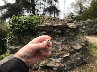
Now there is not much to show for what must have been one of the most dominant buildings in the landscape at that time.  But then what will be remain of our homes a thousand years from now?  Probably nothing more than a few foundation stones at the most.  And with that happy thought I left the Skulferatu that accompanied me on my walk under some ivy growing along the tower wall.


Skulferatu #31 at Malcolm Canmore's Tower, Pittencrieff Park, Dunfermline.  Photo by Kevin Nosferatu for the Skulferatu Project
Skulferatu #31


Skulferatu #31 hidden under ivy on the remains of Malcolm Canmore's Tower, Pittencrieff Park, Dunfermline.  Photo by Kevin Nosferatu for the Skulferatu Project
Skulferatu #31 hidden under ivy on the tower wall


Map showing location of Skulferatu #31 at Malcolm Canmore's Tower, Pittencrieff Park, Dunfermline
Map showing location of Skulferatu #31


The coordinates for the location of the Skulferatu are –


Latitude 56.069882

Longitude -3.466894


I used the following sources for information on the tower –


The Annals of Dunfermline and Vicinity from the Earliest Authentic Period to the Present Time AD 1069-1878

By Ebenezer Henderson

1879


Canmore – Malcolm Canmore’s Tower

Canmore - Malcolm Canmore's Tower


Wikipedia – articles on tower and lives of Malcolm Canmore and St Margaret of Scotland

Malcolm's Tower - Wikipedia

Malcolm III of Scotland - Wikipedia

Saint Margaret of Scotland - Wikipedia


Article and photographs are copyright of © Kevin Nosferatu, unless otherwise specified.