Tuesday, 25 May 2021

Skulferatu #31 - Malcolm Canmore's Tower, Pittencrieff Park, Dunfermline


Today, while walking through Pittencrieff Park, I went down through the grotto like glen and followed the path along Tower Burn, the stream that runs through the park.  While a blackbird sang above me, I cut round and walked up past several little caves and passageways that are all closed off by railings and gates.  I seem to remember these were all open and accessible when I was a child and have memories of squeezing through the various gaps while running madly around the place with friends and family. 


Bridge over Tower Burn in Pittencrieff Park, Dunfermline.  Photo by Kevin Nosferatu for the Skulferatu Project
Bridge over Tower Burn


A blackbird nestled in the branches of a tree in the glen in Pittencrieff Park, Dunfermline.  Photo by Kevin Nosferatu for the Skulferatu Project
Blackbird singing up above


After climbing up a steep set of stairs I turned onto the main path and then walked up the Tower Hill.  This was once the site of Malcolm Canmore’s Tower, the residence of said Malcolm Canmore. 


The name Canmore comes from the Gaelic for Great Chief, though when taught about him at school we were told it actually meant big head because he had a big head.  How true that is I don’t know, but my mental image of him has always been of a man with a massive head, much like a Bobblehead toy.  Anyway, big head or not, he was the man who killed Macbeth, and Macbeth’s son Lulach, and thus in 1058 became King Malcolm III of Scotland. In 1070 he married Margaret of Wessex, who went on to become our local saint, St Margaret of Scotland.  She was a pious Christian who established a ferry across the Firth of Forth from what is now South Queensferry to North Queensferry.  The ferry service was for pilgrims travelling to St Andrews in Fife.  Malcolm died in 1093 at the Battle of Alnwick.


There is not much is left of Malcolm Canmore’s Tower today, just the foundation stones really. 


A dirt path leads up to a low wall around what remains of the foundations of Malcolm Canmore's Tower, Pittencrieff Park, Dunfermline.  Photo by Kevin Nosferatu for the Skulferatu Project
Path up Tower Hill to remains of the tower


Remains of Malcolm Canmore’s Tower in Pittencrieff Park, Dunfermline.  Photo by Kevin Nosferatu for the Skulferatu Project
Remains of Malcolm Canmore’s Tower


View over remains of Malcolm Canmore's Tower wall towards Dunfermline Abbey.  Photo by Kevin Nosferatu for the Skulferatu Project
View over remains of tower wall towards Dunfermline Abbey


The only description recorded regarding the tower was made by John of Fordun, and this really only describes the area it sat in - ‘…by nature strongly fortified in itself, being surrounded by a very dense forest, and fortified in front with very precipitous rocks; and in the midst of it there was a beautiful plain, also fortified by rocks and rivulets, so that the expression “Not easy of access to man, and hardly to be approached by wild beasts,” might be thought applicable to it.’  However, an image of the tower was used in the burgh seal for Dunfermline and an old wax impression of this survives.  In 1790 John Baine, a Civil Engineer from Edinburgh, examined the ruins of the tower and made a sketch of how it may have looked, based on the wax seal.


Sketch of Malcolm Canmore’s Tower by John Baine from The Annals of Dunfermline and Vicinity from the Earliest Authentic Period to the Present Time AD 1069-1878
Sketch by John Baine of how Malcolm Canmore’s Tower may have looked.


The wax seal would seem to show a two storey building with an attic. According to Ebenezer Henderson, the author of ‘The Annals of Dunfermline and Vicinity’, the tower would appear to have been a ‘stately, massive building’ that was ‘about fifty-two feet from east to west and forty-eight feet from north to south…’  It would have consisted of at least twenty ‘small eleventh century apartments’ and in the attic, there would have been a host of little rooms for servants and attendants.


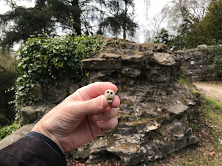
Now there is not much to show for what must have been one of the most dominant buildings in the landscape at that time.  But then what will be remain of our homes a thousand years from now?  Probably nothing more than a few foundation stones at the most.  And with that happy thought I left the Skulferatu that accompanied me on my walk under some ivy growing along the tower wall.


Skulferatu #31 at Malcolm Canmore's Tower, Pittencrieff Park, Dunfermline.  Photo by Kevin Nosferatu for the Skulferatu Project
Skulferatu #31


Skulferatu #31 hidden under ivy on the remains of Malcolm Canmore's Tower, Pittencrieff Park, Dunfermline.  Photo by Kevin Nosferatu for the Skulferatu Project
Skulferatu #31 hidden under ivy on the tower wall


Map showing location of Skulferatu #31 at Malcolm Canmore's Tower, Pittencrieff Park, Dunfermline
Map showing location of Skulferatu #31


The coordinates for the location of the Skulferatu are –


Latitude 56.069882

Longitude -3.466894


I used the following sources for information on the tower –


The Annals of Dunfermline and Vicinity from the Earliest Authentic Period to the Present Time AD 1069-1878

By Ebenezer Henderson

1879


Canmore – Malcolm Canmore’s Tower

Canmore - Malcolm Canmore's Tower


Wikipedia – articles on tower and lives of Malcolm Canmore and St Margaret of Scotland

Malcolm's Tower - Wikipedia

Malcolm III of Scotland - Wikipedia

Saint Margaret of Scotland - Wikipedia


Article and photographs are copyright of © Kevin Nosferatu, unless otherwise specified.

Tuesday, 18 May 2021

Skulferatu #30 - Seacliff House, North Berwick, East Lothian


If you have ever wandered along Seacliff Beach, you may have noticed the ruins of a gothic looking building that is almost hidden in the trees on the hill above.  These ruins are the remains of Seacliff House, a large, private mansion that once boasted having some of the best views out over the Bass Rock and the Forth.  Today, while walking to Seacliff Beach I decided to go and have a look around the ruins of the house on the hill.


The skeletal remains of Seacliff House half hidden by the trees as seen from Seacliff Beach.  Photo by Kevin Nosferatu for the Skulferatu Project.
The skeletal remains of Seacliff House half hidden by the trees


While wandering around I found that the ruins were still quite impressive, with much of the outer walls of the house remaining.  I remember walking through here a few years back and the ruined frontage of the house was mainly hidden in a mass of trees and undergrowth.  Most of this has now been cut back giving a much clearer view of what remains of the building.  There was a speculative scheme drawn up in 1992 to rebuild the house, add an extension and turn it into a spa hotel.  Thirty years later and I don’t think that plan is any further forward, but given the clearing of the trees around the building who knows…?


The ruins of Seacliff House, North Berwick, East Lothian.  Photo by Kevin Nosferatu for the Skulferatu Project.
The ruins of Seacliff House


The ruins of Seacliff House, North Berwick, East Lothian.  Photo by Kevin Nosferatu for the Skulferatu Project.
The ruins of Seacliff House


View of ruined frontage of Seacliff House, North Berwick, East Lothian.  Photo by Kevin Nosferatu for the Skulferatu Project.
View of ruined frontage of Seacliff House


One of the remaining towers of Seacliff House at North Berwick in East Lothian.  Photo by Kevin Nosferatu for the Skulferatu Project.
One of the remaining towers of the house


Detail of decorations on the tower at Seacliff House, North Berwick, East Lothian.  Photo by Kevin Nosferatu for the Skulferatu Project.
Detail of decorations on the tower


View of back of Seacliff House with the windows of rooms that would have once faced out onto a spectacular view over the Bass Rock and the Forth. Photo by Kevin Nosferatu for the Skulferatu Project.
View of back of Seacliff House


The history of this building is that the original Seacliff House was built in 1750 by Robert Colt.  In 1841, the then owner George Sligo commissioned the architect David Bryce to design a new house around the earlier building.  Bryce designed a three storey house with an attic in the Scottish Baronial style, and building work was completed later that year.  The house was then enlarged in 1850 when the estate was acquired by John Watson Laidlay. 


Laidlay was an interesting chap, one of these classic Victorian gentleman types.  He studied chemistry under Michael Faraday and then went off to work in the family business out in India.  There he ran two factories producing silk and indigo.  In his spare time, he studied various ancient languages and translated texts by Fa Hian into English (Fa Hian or Faxian was a 4th Century Chinese Buddhist monk who travelled from China to India visiting sacred Buddhist sites on his journey).  Laidlay returned to the UK in 1849 and bought the property at Seacliff.  On his death in 1885 his eldest son Andrew Laidlay inherited the property.


Andrew Laidlay was by all accounts a popular man with many friends.  He was a magistrate in East Lothian and a keen golfer.  He was also an avid reader and researcher and spent many hours in the library of his house.  Late on the night of Saturday 27 July 1907 he was reading in his library.  As the house had no electricity, he read with the aid of a paraffin lamp and would often have this up on the highest flame to give himself more light to read by.  On this night, while reading, Andrew fell asleep.  It then appears that while sleeping he knocked the lamp over and set fire to the library.  Then, in the early hours of the morning on Sunday 28 July, two of the maids who were sleeping in the room they shared were woken by a crackling sound and what also sounded like falling furniture.  Alarmed by this they got up to wake the housemaid, Effie Hamilton, who slept in another room.  They woke her and on investigating what was going on she found that smoke was beginning to billow up from the rooms below.  Effie then quickly got the other members of staff out of the house.  Once outside Effie shouted and threw stones up at the bedroom window of the Laidlay’s daughter, Theophila.  On waking, Theophila quickly went to her mother’s room and roused her.  The two of them then bound some bed sheets together and climbed from the bedroom window down to a balcony on the second storey.  A ladder was then brought round so that they could safely get down to the ground and away from the house.  In the meantime, Effie had gone back into the house to try to get to Andrew Laidlay’s bedroom, as she feared he was asleep there and had been overcome by the smoke from the fire.   However, despite a couple of valiant attempts she was beaten back by the smoke and the heat from the fire.  All she and those who had escaped from the building could then do was watch as it was engulfed by the flames.


The fire brigade was called and attended, but they had serious problems in getting any water with which to douse the flames, as there was no mains water connected to the house, the water being usually drawn from a nearby well.  They attempted to use sea water, but this was fraught with difficulties given the distance from the house to the sea.  Most of the house was soon destroyed by the fire and was left as an empty, smouldering shell.  The fire brigade did however manage to stop the flames from engulfing the kitchen and laundry block.  Once the fire was out a search was undertaken to try and find the remains of Andrew Laidlay, but the heat had been so intense at the height of the fire that nothing could be found of him.


After the fire, the ruins of the house were abandoned.  The stables and a service cottage for the house, which had not been damaged by the fire, were purchased by the Royal Navy.  During World War I they were used as the base for HMS Scottish Seacliff.  This was a secret research facility concerned with navigation training and U-boat defence.  The stables and the cottage are now privately owned.


Article and photo of Seacliff House from The Graphic – August 10, 1907.  Seacliff House, East Lothian, a great mansion of massive Gothic architecture, has been totally destroyed by fire, and with it has been burnt the body of its proprietor, Mr. Andrew Laidley...
Article and photo of Seacliff House from The Graphic – August 10, 1907


The Skulferatu that accompanied me on today’s walk was left in the hollow of a doorway wall.


Skulferatu #30 at Seacliff House, North Berwick, East Lothian. Photo by Kevin Nosferatu for the Skulferatu Project.
Skulferatu #30


Skulferatu #30 in hollow of doorway wall at Seacliff House, North Berwick, East Lothian.  Photo by Kevin Nosferatu for the Skulferatu Project.
Skulferatu #30 in hollow of doorway wall


Map showing location of Skulferatu #30 at Seacliff House, North Berwick, East Lothian.
Map showing location of Skulferatu #30


The coordinates for the location of the Skulferatu are:


Latitude 56.050131

Longitude -2.631587


I used the following sources for information on Seacliff House –


John Watson Laidlay - Wikipedia


Seacliff - Wikipedia


Seacliff House, Seacliff | Buildings at Risk Register


Seacliff House | Canmore


The Scotsman – Monday 29 July 1907


Daily Telegraph and Courier (London) - Monday 29 July 1907


The Graphic – August 10, 1907


Article and photographs are copyright of © Kevin Nosferatu, unless otherwise specified. 

Tuesday, 11 May 2021

Skulferatu #29 - Hound Point Battery, Dalmeny Estate, South Queensferry


On a sunny, but bitterly cold April morning I took a walk from Cramond, through Dalmeny Estate, to South Queensferry.  Following Cycle Route 76, I walked through the top of the estate and round and down to Hound Point.  By Fishery Cottage, I cut up the hill and through the woods to the concrete remains of the Hound Point Battery, an old First World War coastal defences site.  There I had a good look about as the trees all around swayed and creaked in the wind.


Hill view of the gun emplacement at Hound Point Battery in Dalmeny Estate, near South Queensferry. Photo by Kevin Nosferatu for the Skulferatu Project
Hill view of gun emplacement at Hound Point Battery


The remains of the magazine building sitting amongst the trees at Hound Point Battery.  Photo by Kevin Nosferatu for the Skulferatu Project
Remains of the magazine building


Remains of one of the gun emplacements at Hound Point Battery, Dalmeny Estate, near South Queensferry.  Photo by Kevin Nosferatu for the Skulferatu Project
Gun emplacement – Hound Point Battery


Remains of one of the gun emplacements at Hound Point Battery, Dalmeny Estate, near South Queensferry.  Photo by Kevin Nosferatu for the Skulferatu Project
Gun emplacement – Hound Point Battery


Remains of one of the gun emplacements at Hound Point Battery, Dalmeny Estate, near South Queensferry.  Photo by Kevin Nosferatu for the Skulferatu Project
Gun emplacement – Hound Point Battery


Hound point Battery was part of a defensive system built along the coast of the UK that stretched from Shetland to Cornwall.  Building work began on the Battery before the start of World War One and it was operational by 1914.  The Battery consisted of two gun emplacements at the top of the hill overlooking the Firth of Forth, and a magazine building to the rear and slightly further down the hill.  While it was operational the perimeter of the Battery would have been surrounded by blockhouses and a barbed wire fence.  When it was armed in 1914 the Battery had two BL 6-inch Mk VII guns, however these were removed in 1915 and transferred to another battery at Leith Docks.  The guns were then replaced in 1916 with two 12 pounder Quick Firing Naval 18cwt guns.  These were dismounted and removed in 1922.


In September 1914, the Battery at Hound Point opened fire on a suspected enemy submarine out in the Firth of Forth.  However, one of the shells fired ricocheted off the water and landed near to the Earl of Moray’s residence at Donibristle House in Dalgety Bay.  Luckily, it didn’t cause much damage other than ploughing up the lawn in front of the house.  The enemy submarine was eventually sunk by a gunner based out on Inchgarvie Island.


The Battery is now in a state of disrepair and is badly vandalised and crumbling away, much like most of the old coastal defences.  However, around the old gun emplacements there are some good views, through the trees, over the Forth.  The sort of views that make you realise why they built the Battery where they did.


I left the Skulferatu that accompanied me on today’s walk in the hollow of a tree growing out from one of the gun emplacements.


Skulferatu #29 at a gun emplacement in Hound Point Battery.  Photo by Kevin Nosferatu for the Skulferatu Project
Skulferatu #29


Skulferatu #29 in tree hollow by one of the gun emplacements at Hound Point Battery.  Photo by Kevin Nosferatu for the Skulferatu Project
Skulferatu #29 in tree hollow at Hound Point Battery


Map showing location of Skulferatu #29 by Hound Point Battery, Dalmeny Estate, South Queensferry
Map showing location of Skulferatu #29


The coordinates for the location of the Skulferatu are –


Latitude 55.999295

Longitude -3.351049


I used the following sources for information on Hound Point Battery -


Linlithgowshire Gazette – Friday, September 18, 1914


Overland China Mail – No 2386, October 31, 1914


Canmore – Forth Defences, Inner, Hound Point Battery

Canmore - Forth Defences, Inner, Hound Point Battery


Ancient Monuments UK

ancientmonuments.uk - Hound Point Battery, City of Edinburgh


Article and photographs are copyright of © Kevin Nosferatu, unless otherwise specified.


Tuesday, 4 May 2021

Skulferatu #28 - St Triduana's Chapel, Restalrig, Edinburgh


If you venture down the road from Jock’s Lodge in Edinburgh and successfully navigate one of the narrowest pavements known to man, you’ll arrive in Restalrig.  There, nestled by Marionville Fire Station on one side and a housing estate on the other, sits the churchyard of St Margaret’s Church.  If you are lucky enough to find the gates open and wander on in, you will enter a little haven of peace with lots of ornate and crumbling gravestones, ivy covered tombs and ancient looking trees.  The road through this graveyard then leads to the church, where beside it stands St Triduana’s Chapel.


View over graveyard to St Margaret’s Church and St Triduana’s Chapel, Restalrig, Edinburgh.  Photo by Kevin Nosferatu for the Skulferatu Project
View over graveyard to St Margaret’s Church and St Triduana’s Chapel


St Margaret’s Church and St Triduana’s Chapel, Restalrig, Edinburgh.  Photo by Kevin Nosferatu for the Skulferatu Project
St Margaret’s Church and St Triduana’s Chapel


St Triduana’s Chapel was built in the 1400s in the time of James III to enclose the well of St Triduana.  The building was of a unique design in that it was a two storey hexagon, the lower storey being the well house and the upper storey being a chapel.     At the time the chapel was built it was considered to be a remarkable building and Pope Innocent VIII described it as being a ‘sumptuous new work.’  Only the lower storey now survives as the chapel was destroyed in 1560 during the Reformation.  In 1906 the chapel was repaired, and a new roof added to it.


St Triduana’s Chapel, Restalrig, Edinburgh.  Photo by Kevin Nosferatu for the Skulferatu Project
St Triduana’s Chapel


Stone stairs leading down to the entrance of St Triduana's Chapel.  Photo by Kevin Nosferatu for the Skulferatu Project
Stairs leading down to chapel entrance


View of St Triduana’s Chapel, Restalrig, Edinburgh.  Photo by Kevin Nosferatu for the Skulferatu Project
View of St Triduana’s Chapel


Few nowadays have heard of St Triduana, let alone the chapel dedicated to her.  She was believed to have accompanied St Regulus to Scotland in the 4th Century when he brought over the relics of St Andrew.  They landed at Kilrymont, which is now known as St Andrews.  Triduana then made her way to Rescobie in Angus where she lived a life of reclusive prayer and worship for a while.  However, one day she came into contact with Nectan, King of the Picts.  On seeing her he was overcome by a violent passion for her and demanded that she be his.  In great fear of him she fled but was soon found by a party the King had sent out to search for her.  They told her she must return to the King with them.


‘What does so great a prince desire of me, a poor virgin dedicated only to Christ and God?’  She asked of them.


‘He desireth the most excellent beauty of thine eyes, which if he obtain not he will surely die,’ replied the leader of the group.


‘Then what he seeketh he will surely have,’ answered Triduana.  And (yes, you’ve guessed it) she plucked out her eyes, skewered them on a branch snapped from a thorny tree and handed that to the King’s men saying – ‘Take that which your Prince desireth.’  They were horrified by this and rode back to the King to present him with Triduana’s gory gift.  The King, needless to say, then gave up on his lusty pursuit of Triduana.


After blinding herself Triduana made her way to Restalrig where she lived a life dedicated to fasting and prayer.  There she was said to have cured those who were blind or had severe eye problems.  On her death she was buried where the church of St Margaret now stands.  The spring near to where she lived became a place of pilgrimage soon afterwards, as it was believed the waters that came from it were holy and could cure blindness and diseases of the eyes.


View of St Margaret’s Church and St Triduana’s Chapel, Restalrig, Edinburgh.  Photo by Kevin Nosferatu for the Skulferatu Project
View of St Margaret’s Church and St Triduana’s Chapel


Gravestone in chapel grounds with Marionville Fire Station Tower in distance.  Photo by Kevin Nosferatu for the Skulferatu Project
Gravestone in chapel grounds with Marionville Fire Station Tower in distance


Gravestone in chapel grounds with Marionville Fire Station Tower in distance.  Photo by Kevin Nosferatu for the Skulferatu Project
Gravestone in chapel grounds with Marionville Fire Station Tower in distance


St Triduana’s Chapel is currently closed to the public as it is undergoing conservation works.


I placed the Skulferatu that accompanied me on my walk today in a crack in the wall of a tomb near to the chapel.


Skulferatu #28 being held in front of St Triduana's Chapel, Restalrig, Edinburgh.  Photo by Kevin Nosferatu for the Skulferatu Project
Skulferatu #28


Skulferatu #28 in wall of tomb by St Triduana's Chapel, Restalrig, Edinburgh.  Photo by Kevin Nosferatu for the Skulferatu Project
Skulferatu #28 in wall of tomb by the chapel


Map showing location of Skulferatu #28 near St Triduana's Chapel, Restalrig, Edinburgh
Map showing location of Skulferatu #28


The coordinates for the location of the Skulferatu are:


Latitude 55.957896

Longitude -3.149796


I used the following sources for information of St Triduana’s Chapel –


Public information notice at the site of St Triduana’s Chapel


Scotsman, December 7, 1931 – article on St Triduana and the well at Restalrig by Dr T. Ratcliffe Barnett


Historic Environment Scotland Website

Historic Environment Scotland - St Triduana’s Chapel


Canmore Website

Canmore - St Triduana's Chapel, Edinburgh


Article and photographs are copyright of © Kevin Nosferatu, unless otherwise specified.