Showing posts with label Dumfries and Galloway. Show all posts

Tuesday 9 August 2022

Skulferatu #78 - Old Shack, Wanlockhead, Dumfries and Galloway


It was summer again and so I headed off on a little summer holiday to sunny Dumfries and Galloway.  A rather lovely and somewhat desolate feeling county, though one with plenty to see and do.  My first stop was back to Wanlockhead – an old lead mining village which is also the highest village in Scotland.  This is somewhere I visited last year and had also been to several times before, many decades ago, on trips with the school and also with the family of a friend.  A family who were massively into wild camping (though we just called it camping back in the Seventies), wild swimming (though we just called it swimming in a river, a lake, the sea, etc. back in the Seventies) and long, long walks over rugged countryside.  I have to say that even though I was, and still am, a lazy sod who could easily stay in bed most of the day, I did actually enjoy holidays with my friend’s family.  They were quite action packed and the walks always seemed to end at a pub, where his parents got a beer and us kids got Cola and crisps, or maybe even a packet of KP salted peanuts – a massive treat back in the Seventies.


When I was here last year, everything was hidden in swirling mountain mists and was very eerie and lonely with a sort of mystical atmosphere.  Today, on one of the hottest days of the year it all looked very different.  For someone from a colder climate everything always looks different in the sunshine though, it sort of takes on the look and the feel of somewhere more exotic.  Well, that is until you notice that everyone you pass is half naked with their bare skin in varying shades of pasty white and lobster red, as they make the best of the brief Scottish summer sun.  ‘It’s no summer ‘til ma skins peeling in red strips fae ma body’ seemed to be the common philosophy of many of those I saw out today...including myself.  Even the sheep wandering around the hills all appeared to be half naked, given that they were all newly shorn of their fleeces.  They frolicked around, some locking horns and play fighting while others kept a wary eye out, watching over passing strangers.


A photo of a row of cottages at Wanlockhead, with a hill behind them and a blue summer sky above.  Photograph by Kevin Nosferatu for the Skulferatu Project.
Miners’ Cottages at Wanlockhead


A photo of a grey looking and sort of pyramid shaped slag heap standing in green looking countryside, with hills in the background.   Photograph by Kevin Nosferatu for the Skulferatu Project.
The slag heap at New Glencrieff Mine


A photo showing a broken sign in the foreground that reads Danger Keep Out, with the slag head of New Glencrieff Mine at Wanlockhead in the background.  Photograph by Kevin Nosferatu for the Skulferatu Project.
Danger Keep Out


A photo of a group of shorn sheep standing by a small, crumbling concrete building on the hillside at Wanlockhead.  Photograph by Kevin Nosferatu for the Skulferatu Project.
Some shifty looking shorn sheep


As I was out walking today, I passed a small, tumbledown shack and had to go and have a closer look.  It was one of these buildings that is a patchwork of materials replacing all the bits that have long since rotted away.  Bits replaced so many times that the original building is probably long gone with only the space inside remaining the same.  I’m always fascinated by these sort of buildings, as even though they are built for purely practical reasons they acquire a uniqueness and a character from all the patching and repairing that goes into keeping them standing.  There is almost a love that goes into the building and keeping it there, keeping it from falling down.  Keeping it as an integral part of the history of those who use it, have used it, and of the landscape it sits in.


A photo of an old shack standing in a grassy hollow with trees around it.  Photograph by Kevin Nosferatu for the Skulferatu Project.
An old shack in a grassy hollow


A photo of an old shack standing in a grassy hollow with trees around it.  The shack is made up of a patchwork of lots of different materials such as wood, corrugated iron and piles of rocks.   Photograph by Kevin Nosferatu for the Skulferatu Project.
A patchwork of repairs


A photo of the other side of the old shack showing a broken window in a window frame lying against it and a pile of rusting wire just up from it.   Photograph by Kevin Nosferatu for the Skulferatu Project.
Old shack at Wanlockhead


Sitting in a grassy hollow in the sunlight, the shack looked almost like the fairy tale abode of some character fallen on hard times, or maybe the hovel of some wicked witch with a warty nose.  I knocked on the door at the front to see if anyone was in, but no-one answered.  Maybe they couldn’t hear me above the noise of the singing birds and buzzing insects.  Or maybe in the darkness within there were two yellow eyes staring malevolently at me, thinking how they could boil me up in their cauldron and make soup with my bones...though probably the only things watching me were a few dozen spiders and several mice, so much like being at home then.


Another photo of the shack showing the tumbledown state it is in, with holes in the roof.  Photograph by Kevin Nosferatu for the Skulferatu Project.
Tumbledown old shack


A photo from just up the hill by the shack looking down on it and the trees growing around it.  Photograph by Kevin Nosferatu for the Skulferatu Project.
Old shack in Wanlockhead


I left the Skulferatu that accompanied me on my walk in amongst a pile of rocks being used to prop up one of the walls of the shack.


A photo of a small ceramic skull (Skulferatu 78) being held up in front of the old, tumbledown shack in Wanlockhead.  Photograph by Kevin Nosferatu for the Skulferatu Project.
Skulferatu #78


A photo of a small ceramic skull (Skulferatu 78) lying amongst the rocks making up one of the walls of the old shack.   Photograph by Kevin Nosferatu for the Skulferatu Project.
Skulferatu #78 in a pile of rocks propping up the shack


A close up photo of a small ceramic skull (Skulferatu 78) lying amongst the rocks making up one of the walls of the old shack.  Photograph by Kevin Nosferatu for the Skulferatu Project.
Skulferatu #78 in a pile of rocks propping up the shack


Google Map showing the location of Skulferatu #78
Map showing the location of Skulferatu #78


The coordinates for the location of the Skulferatu are –


Latitude 55.399701

Longitude -3.789647


Tuesday 4 January 2022

Skulferatu #55 - Graveyard at Parish Church of Penpont, Keir and Tynron, Penpont, Dumfries and Galloway


Penpont is a small village in Dumfries and Galloway.  It was once an important staging post for travellers, and on the main street it has a tearoom and gallery that is still a popular stopping off point for cyclists, ramblers, locals, and tourists.


The man who may have invented the bicycle, Kirkpatrick Macmillan, lived a short distance from Penpont, and Joseph Thomson, the explorer who gave his name to Thomson’s Gazelle, was born in the village.


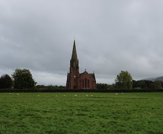
The Parish Church of Penpont, dominates the skyline of the village, and stands on a low hill above the Scaur Water.  It was designed by Charles Howitt and built in 1867 to replace the church that originally stood on the site.  The design of the church is a large cruciform in the Gothic style, with a tall tower and spire in the north-east corner.  It was constructed using local pink sandstone.


A photograph showing a view over a field to a church with a very tall spire in comparison to the building.  This is the Parish Church of Penpont, Keir and Tynron.  Photo by Kevin Nosferatu for the Skulferatu Project.
The Parish Church of Penpont


The gravestones in the graveyard date mainly from the 17th to 18th centuries, though there were some that dated from the 11th and 12th centuries.  These, however, were removed and are now in Dumfries Museum.  Among those buried in the graveyard is John Ross, a soldier who fought at the battle of Waterloo defending the Quarte Bras Farmhouse. 


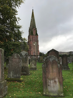
A photograph of several old and worn gravestones in Penpont Churchyard, with the Parish Church in the background.
Gravestones in Penpont Churchyard


A black and white photograph showing a detail of a memorial in Penpont Churchyard.  It is of a carved skull and crossbones, amongst other decorative images on worn stone.
Detail of memorial in Penpont Churchyard


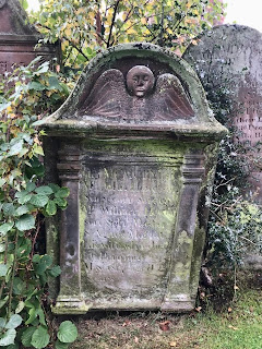
A photograph of a red stone grave with a carving at the top of a face and wings.  The grave is of a man named Samuel Hislop.
Grave of Samuel Hislop


A photograph of an old gravestone in Penpont Graveyard.  At the top is carved a round face with wings underneath.  The writing on the stone is illegible.
Gravestone at Penpont Churchyard


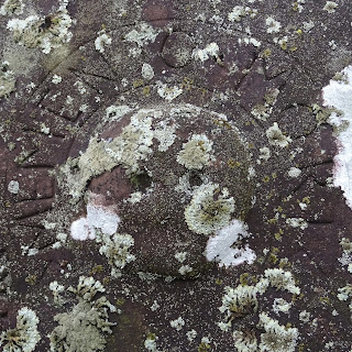
A photograph of a faded, carving of a round style skull on a gravestone.  The stone is covered in lichen and Memento Mori is carved around the skull.
Memento Mori – detail from a gravestone


A photograph of a gravestone in Penpont Graveyard.  It ists next to a fence of iron railings on which is attached a homemade sign reading - Please do not drive over graves thank you.
Please Do Not Drive Over Graves Thank You


A photograph of an old gravestone at Penpont Churchyard.  Carved on it is a head with wings underneath and below that an hourglass lying on its side as if to signify that time is up.
Gravestone at Penpont Churchyard


A photo of a table top style gravestone.  The photo shows the bottom end of the stone and the legs, between which is carved a head with wings underneath.  The gravestone is very worn.
Gravestone of Patrick Boyle


I left the Skulferatu that accompanied me on my walk in the shelter underneath a table top gravestone.  The engraving on the gravestone was badly worn, but it appeared to be the grave of one Patrick Boyle, who had died in the 1790s.  In the gap underneath there were bits of old, broken pottery, some spiders, and the lower branches of a nearby holly bush.  My Skulferatu joined them there.


A photo of a hand holding up a small, ceramic skull with the lower part of Penpont Parish Church in the background.  Skulferatu #55
Skulferatu #55


A photo of a small, ceramic skull (Skulferatu 55 lying in a grassy patch underneath one of the gravestones.  There is some old, broken pottery near to it.
Skulferatu #55 under Patrick Boyle’s gravestone


Google Map showing location of Skulferatu #55 near to the Parish Church of Penpont, Keir and Tynron.
Map showing location of Skulferatu #55


The coordinates for the location of the Skulferatu are –


Latitude 55.231176

Longitude -3.811273


I used the following sources for information –


Scotland’s Churches Trust

Penpont, Keir and Tynron Church


Penpont Heritage Centre

Penpont Heritage Centre

Tuesday 28 December 2021

Skulferatu #54 - Morton Castle, Thornhill, Dumfries and Galloway


Morton Castle is not the easiest place to find, which despite being a pain in the arse, actually adds to its charm and also to a sense of it being in a more remote and undiscovered location.  On our trip there our Sat Nav took us to a row of houses and told us we had reached our destination.  We were in fact still a couple of kilometres away, and it wasn’t until driving a bit further on and having checked the various map apps on our phones that we managed to find where we wanted to go.  A narrow, winding, single track road then led us to a small parking area.  From there it was a short walk down the path of the Morton Heritage and Nature Trail to the ruins of the castle. 


A photograph of the ruins of Morton Castle standing on a hill above Morton Loch.  Photograph by Kevin Nosferatu for the Skulferatu Project.
The ruins of Morton Castle above Morton Loch


The ruins of Morton Castle stand on the south west slopes of the Lowther Hills and overlook Morton Loch.  The castle was originally a two storeyed hall block with a four storey turreted gatehouse at the west end of the building and an angle tower at the east end.  The lower storey of the building would have consisted of a kitchen, a storage area, and a lower hall, while the first floor would have housed the great hall.  The private chambers of the lord of the castle and his family would have been in the tower at the east of the building.


A view of the ruins of Morton Castle in the distance, surrounded by a grassed area.  Photograph by Kevin Nosferatu for the Skulferatu Project.
The ruins of Morton Castle


A photo of the ruined western tower of Morton Castle with a tree at the side of it and hills in the background.  Photograph by Kevin Nosferatu for the Skulferatu Project.
Western Tower of Morton Castle


A photo showing the stone outer wall of Morton Castle leading along to a tower.  Photograph by Kevin Nosferatu for the Skulferatu Project.
View along walls of Morton Castle to the western tower


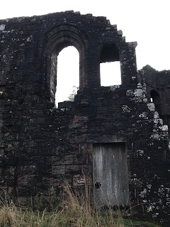
A photo of a wooden doorway and a ruined wall with two empty windows above the door.  This is one of the outer walls of Morton Castle.  Photograph by Kevin Nosferatu for the Skulferatu Project.
Doorway into the rear wall of the castle


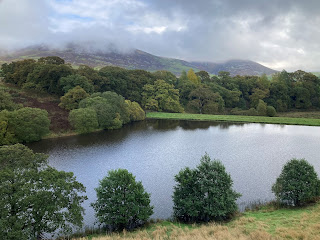
A view of a body of water surrounded by grass and a wooded area.  This being a view from the entrance into Morton Castle.  Photograph by Kevin Nosferatu for the Skulferatu Project.
View of Morton Loch from the castle


Sketch of the ruins of Morton Castle circa 1886 - taken from the book The Castellated and Domestic Architecture of Scotland from the Twelfth to the Eighteenth Century by David MacGibbon and Thomas Ross, published in 1886
Sketch of the ruins of Morton Castle circa 1886 (MacGibbon and Ross)


The site on which the castle sits is thought to have been where a stronghold was built by Dunegal, Lord of Nithsdale in the Twelfth Century.  These lands were later granted to Thomas Randolph, the nephew of King Robert I.  The castle itself is believed to have been built in the early Fourteenth Century and was mentioned in 1357 in a treaty with England to release King David II from captivity.  The treaty called for the demolition of several castles in South West Scotland, Morton Castle being one of them.  It is unclear how much of the castle was demolished at that time. 


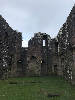
A photo showing the interior walls of the ruins of Morton Castle.  The floor of the castle is an area of cut grass.  Photograph by Kevin Nosferatu for the Skulferatu Project.
Interior of the castle facing towards the eastern tower


A photo showing a ruined wall - it is curved and in it are doorways and windows.  Photograph by Kevin Nosferatu for the Skulferatu Project.
Ruins of the Eastern Tower


A photo showing a view through a hole in the shape of a spade in a wooden door in the eastern tower of Morton Castle.  It shows some trees and a body of water.  Photograph by Kevin Nosferatu for the Skulferatu Project.
View out of the doorway in the eastern tower


A photograph of a view over Morton Loch showing trees in the foreground and hills in the background.  This being a view from the eastern tower of Morton Castle.  Photograph by Edie Lettice for the Skulferatu Project.
View from eastern tower of castle over Morton Loch


A photograph showing graffiti carved into the wood of one of the castle doors.  It is mainly initials and dates.  Photograph by Kevin Nosferatu for the Skulferatu Project.
Graffiti on one of the castle doors


In 1372 the castle and the lands around it were passed through marriage to the Douglas family, who later became Earls of Morton.  It is believed that parts of the castle were rebuilt in the early Fifteenth Century.  The castle was then leased out to another branch of the Douglas family, though does not seem to have been their primary residence and may have been used mainly as a hunting lodge.  It appears that it later fell into disuse and by 1714 was abandoned.  Much of the stone was then taken away and used for constructing farm buildings.  The castle was acquired by the Duke of Queensberry and was later passed down to the Dukes of Buccleuch.  It then passed into state care under a guardianship agreement in 1975.


I left the Skulferatu that accompanied me on my trip in a crack in one of the outside walls of the castle.


A photo of a small ceramic skull (Skulferatu 54) being held up.  The ruins of Morton Castle are in the background.  Photograph by Kevin Nosferatu for the Skulferatu Project.
Skulferatu #54


A photo showing a small ceramic skull (Skulferatu 54) in a crack in the outside wall of Morton Castle.  Photograph by Kevin Nosferatu for the Skulferatu Project.
Skulferatu #54 in crack in exterior wall of the castle


A photo showing a close up of a small ceramic skull (Skulferatu 54) in a crack in the outside wall of Morton Castle.  Photograph by Kevin Nosferatu for the Skulferatu Project.
Skulferatu #54 in crack in exterior wall of the castle


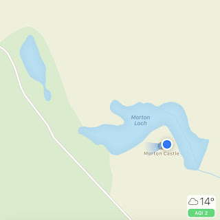
TomTom Map showing location of Skulferatu #54
Map showing location of Skulferatu #54


The coordinates for the location of the Skulferatu are –


Latitude 55.274466

Longitude -3.747266


I used the following sources for information on Morton Castle –


Historic Environment Scotland – Statement of Significance Morton Castle

Morton Castle Statement of Significance


Canmore – Morton Castle

Morton Castle | Canmore


Information Boards at Site


The Castellated and Domestic Architecture of Scotland from the Twelfth to the Eighteenth Century

By David MacGibbon and Thomas Ross

1886