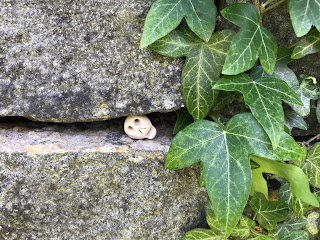
Tuesday, 28 September 2021

Skulferatu #45 - The Drying Green, Glasgow Green, Glasgow


As part of a job I once had, I was required every so often to work in a building very close to Glasgow Green.  At lunchtimes, or anytime I could sneak off, I would go for a wander around the Green, often in the drizzle or rain when I would seem to have the whole park to myself.


The McLennan Arch at the Saltmarket entrance to Glasgow Green.  A photo showing a large, stone arch with trees and a path leading under and through it.  Photo by Kevin Nosferatu for The Skulferatu Project.
The McLennan Arch at the Saltmarket entrance to Glasgow Green


Today, I walked through the park in bright sunshine and through crowds of sunbathers to an area, opposite the building that use to house Templeton’s Carpet Factory.  I had always assumed that the 36 cast iron clothes poles here were an artwork, a sculpture that was a social commentary on the lives of the women of Glasgow, but in actual fact they are real clothes poles and used to be hung with washing lines.  The area in which they stand is known as the Drying Green, which was, as the name suggests, where laundry could be hung out to dry.


The Drying Green – opposite the Templeton Building.  The photo shows an area of lawn with black clothes poles in it and a short distance behind these is the large and ornate, red brick building of the old Templeton's Carpet Factory.  Photo by Kevin Nosferatu for The Skulferatu Project.
The Drying Green – opposite the Templeton Building


Glasgow Green itself was gifted to the people of Glasgow by Bishop William Turnbull in the 1450s and one of the many ways it was used by the locals was to wash their clothing in the Clyde and then hang it out to dry on the Green. 


The Drying Green I visited today was in use up until 1977.  There were several wash houses, or steamies, nearby in which the women of Glasgow could wash their laundry before hanging it out to dry.  The people of Glasgow still retain the right to dry their laundry here.


The Drying Green.  A photo showing a aet of black clothes poles on a lawn area with the trees and paths of Glasgow Green in the background.  Photo by Kevin Nosferatu for The Skulferatu Project.
The Drying Green


A photo of the black, iron clothes poles at the Drying Green with the trees and paths of Glasgow Green in the distance.  Photo by Kevin Nosferatu for The Skulferatu Project.
Clothes poles at the Drying Green


A photo of the black, iron Drying Green clothes poles on a grassy area in front of the red brick building that used to house Templeton's Carpet Factory.  Photo by Kevin Nosferatu for The Skulferatu Project.
Drying Green clothes poles


In 2016 the clothes poles did become an artwork when the artist Penny Anderson incorporated them into her installation ‘Words of Washerwoman’.  The work consisted of 28 white muslin sheets hanging on newly strung washing lines.  Each of the sheets had imagined and real testimonies from witnesses to happenings on the Green through the many years in which the women of Glasgow used the area to wash and dry their laundry.


I left the Skulferatu that accompanied me on today’s walk in the cracked bark of a tree standing next to the Drying Green.


Skulferatu #45 - a photo of a small, ceramic skull being held up with trees and a grassy area in the background with some blurry and indistinct clothes poles.  Photo by Kevin Nosferatu for The Skulferatu Project.
Skulferatu #45


A photo of Skulferatu #45 in the cracked, green bark of a tree by the Drying Green on Glasgow Green.  Photo by Kevin Nosferatu for The Skulferatu Project.
Skulferatu #45 in cracked bark of tree by the Drying Green


Map showing the location of Skulferatu #45


The coordinates for the location of the Skulferatu are –


Latitude 55.850467

Longitude -4.235520


I used the following sources for information on the Drying Green –


Glasgow Green Heritage Trail

Glasgow City Council

PDF file available from –

Glasgow City Council - (glasgow.gov.uk)


The Peoples History of Glasgow

By John K McDowall

1899


The Herald – 27 August 2016

Washing Line Art on Glasgow Green

By Jan Patience


Tuesday, 21 September 2021

Skulferatu #44 - Glasgow Necropolis, Glasgow


I had never been to Glasgow Necropolis before this visit.  It’s one of these places I’ve always meant to go to, but for some reason I’d assumed it was miles out of Glasgow City Centre.  It is not.  It is only about a twenty-five minute walk from Queen Street Railway Station.  So, after deciding that I had to explore more of Glasgow, I made my way up there.  On reaching Glasgow Cathedral I crossed over the Bridge of Sighs, so called because of the countless number of funeral processions that crossed over it, and made my way over into the cemetery.


The Bridge of Sighs leading into Glasgow Necropolis.  A photo showing the bridge that leads into the Necropolis with a hill and tombs in the background.  Photo by Kevin Nosferatu for The Skulferatu Project.
The Bridge of Sighs leading into Glasgow Necropolis


The graveyard is quite spectacular with its huge monuments to many eminent Victorians, most of whom no-one remembers now.  Such is the way; we are all soon forgotten.  In a hundred years from now only a handful of us will be remembered and most of us won’t even merit a footnote in the history books written about our era…but I digress. 


On my wanders around I passed a memorial to William Miller.  The name meant nothing to me, but the inscription enlightened me that he was the author of Wee Willie Winkie and that is a nursery rhyme that I, along with many others, remember from our childhood.  Well, the first verse anyway, I don’t think the nursery rhymes books I had went any further than that verse, which went –


Wee Willie Winkie runs through the town,

Upstairs and downstairs in his night-gown,

Rapping at the window, crying through the lock,

Are the children all in bed, for now it’s eight o’clock?


This is actually a pretty anglicised version compared to the original, which also gives the children’s bedtime as being a bit later, but then maybe the kids in Victorian era Glasgow got to stay up late, who knows?  Anyway, it goes -


 Wee Willie Winkie rins through the town,

Up stairs and doon stairs in his nicht-gown,

Tirling at the window, crying at the lock,

Are the weans in their bed, for it’s now ten o’clock?


As a child I always thought this rhyme was about a flasher.  I assume because Willie and Winkie were two words that I knew as meaning penis.  Also, because in the nursery rhymes book I had, Willie Winkie was depicted in his long night gown and flashers, we were always told, wore long raincoats, so the two somehow became intertwined.  Ah, those innocent days back in the 1970s.


Memorial to William Millar, author of Wee Willie Winkie.  The photo shows a gravestone type memorial with an image of William Millar in the centre.  Photo by Kevin Nosferatu for The Skulferatu Project.
Memorial to William Millar, author of Wee Willie Winkie


I then made my way round and up to the top of the hill.  It is here that one can find some of the more spectacular monuments in the Necropolis, along with the most Glaswegian looking Jesus I’ve ever seen.


Archibald Douglas Monteath Mausoleum - a photo of a large and ornate building that looks like an old style church from Jerusalem or some other place in the Holy Land.  Photo by Kevin Nosferatu for The Skulferatu Project.
Archibald Douglas Monteath Mausoleum


View over gravestones and memorials - the photo shows in the foreground the statue of a sitting woman looking up to the sky.  Part of her face has been chipped off.  Photo by Kevin Nosferatu for The Skulferatu Project.
View over gravestones and memorials


A photo showing various gravestones, monuments and memorials in Glasgow Necropolis.  Photo by Kevin Nosferatu for The Skulferatu Project.
View over gravestones and memorials


A photo of the view to top of Glasgow Necropolis with lots of ornate tombs and a statue of  John Knox in the distance.  Photo by Kevin Nosferatu for The Skulferatu Project.
View to top of Necropolis and John Knox statue


A photo of the ornate tomb of John Henry Alexander – Proprietor and manager of the Theatre Royal, Glasgow. Photo by Kevin Nosferatu for The Skulferatu Project.
Tomb of John Henry Alexander – Proprietor and manager of the Theatre Royal, Glasgow


Detail from tomb of John Henry Alexander.  A photo of a carving of a face and musical instruments with a banner stating 'comedy' at the side.  Photo by Kevin Nosferatu for The Skulferatu Project.
Detail from tomb of John Henry Alexander


A photo of three carved saintly figures on a tomb - they have been spray painted a yellow/gold colour.  Photo by Kevin Nosferatu for The Skulferatu Project.
Carved saintly figures on tomb - spray painted


a photo showing a view of Glasgow Cathedral from the Necropolis.  The cathedral is in a half frame of trees growing in and around the Necropolis.  Photo by Kevin Nosferatu for The Skulferatu Project.
View of Glasgow Cathedral from the Necropolis


Tombs on the top of the hill - a photo of three of the more elaborate tombs sitting on top of the hill at Glasgow Necropolis.  Photo by Kevin Nosferatu for The Skulferatu Project.
Tombs on the top of the hill


A photo of three marble angels in a tombstone.  they appear to be grieving for the loss of those buried within the tomb.  Photo by Kevin Nosferatu for The Skulferatu Project.
Angels grieving the loss of some Victorian worthy


Photo of a carving of the head of Jesus in the top centre of a gravestone.  His nose is chipped.  “It is finished.” Hear him cry, Learn of Jesus Christ to die. Burial place of Isaac and Mary Blackwood. Photo by Kevin Nosferatu for The Skulferatu Project.
“It is finished.” Hear him cry, Learn of Jesus Christ to die.

Burial place of Isaac and Mary Blackwood


Lamb of God - a photo of a statue of a lamb sitting on top of a gravestone.  Photo by Kevin Nosferatu for The Skulferatu Project.
Lamb of God


Glasgow Necropolis stands in an area of land that was originally called Craig’s Park, but which after being planted with Fir trees in the 1700s was then called (roll of drums) Fir Park.  The statue of John Knox, at the top of the hill, was erected in 1825, prior to the area becoming a cemetery.  Glasgow Necropolis was officially opened in 1833 as a place for public interment, though a small Jewish Cemetery had been established in the lower grounds in 1832. Many of the great and the good of Victorian Glasgow are buried here with ostentatious tombs or gravestones marking their burial plots, though there are also several thousand unmarked graves of the less well known or celebrated.


I left the Skulferatu that accompanied me on today’s walk in a gap in a wall overlooking the lower grounds of the Necropolis.


Skulferatu #44 - a photo of a small ceramic skull being held in a hand with gravestones, grass and trees in the background.  Photo by Kevin Nosferatu for The Skulferatu Project.
Skulferatu #44


Photo shows Skulferatu #44, a small, ceramic skull,  in gap in the wall at Glasgow Necropolis. Ivy hangs down the side of the wall.  Photo by Kevin Nosferatu for The Skulferatu Project.
Skulferatu #44 in gap in wall at Glasgow Necropolis


Google Map showing location of Skulferatu #44
Map showing location of Skulferatu #44


The coordinates for the location of the Skulferatu are –


Latitude 55.863343

Longitude -4.232009


I used the following sources for information on Glasgow Necropolis –


Sketches of Glasgow Necropolis

By George Blair

1857


The Peoples History of Glasgow

By John K McDowall

1899


The Oxford Dictionary of Nursery Rhymes

Edited by Iona and Peter Opie

Oxford University Press

1992


Wikipedia – Glasgow Necropolis

Wikipedia - Glasgow Necropolis


Article and photographs are copyright of © Kevin Nosferatu, unless otherwise specified.


Tuesday, 14 September 2021

Skulferatu #43 - Rosyth Doocot, Rosyth, Fife


Walking away from Rosyth Castle, across an abandoned rail track and up a wooded hill, I came across Rosyth Doocot almost hidden amongst the trees.


Rosyth Doocot, hidden amongst the trees - photo shows the roof of an old, stone building sticking up from amongst a copse of trees.  Photo by Kevin Nosferatu for the Skulferatu Project.
Rosyth Doocot, hidden amongst the trees


A photo of Rosyth Doocot - a large stone building standing amongst the trees.  Photo by Kevin Nosferatu for the Skulferatu Project.
Rosyth Doocot


The Doocot is from the Sixteenth Century and has over one thousand five hundred stone nesting boxes inside for pigeons.  It must have been a pretty smelly place in its day, but the pigeons were a year round source of meat and eggs for the local community.


The Doocot is now empty except for some discarded beer cans and a couple of chairs sitting inside.  The chairs give it a slightly surrealist feeling and I half expected a couple of actors to appear from the side shadows and perform ‘Waiting for Godot’ or something of that ilk.


Photo of the interior of the Doocot with over one thousand five hundred stone nesting boxes inside for pigeons.  Two blue chairs sit inside the doocot facing out towards the entrance door.  Photo by Kevin Nosferatu for the Skulferatu Project.
Interior of the Doocot


On the lintel above the door are the remains of a carving of a serpent.  This represents the old biblical saying of – ‘Be ye wise as serpents and harmless as doves.’


Entrance to Doocot, with remains of carved serpent on lintel above the door, which is a symbol for the Biblical saying - Be ye wise as serpents and harmless as doves. Photo by Kevin Nosferatu for the Skulferatu Project.
Entrance to Doocot, with remains of carved serpent on lintel above the door


View of Dovecot and Details from 'The Castellated and Domestic Architecture of Scotland from the Twelfth to the Eighteenth Century, Volume One'  by David MacGibbon and Thomas Ross.  Published 1887
View of Dovecot and Details from The Castellated and Domestic Architecture of Scotland


I left a Skulferatu in the wall of the Doocot.


A photo of Skulferatu #43 being held up in someone's hand  and in the background are trees and the stone building Rosyth Doocot. Photo by Kevin Nosferatu for the Skulferatu Project.
Skulferatu #43


Skulferatu #43 in hole in wall at Rosyth Doocot. Photo by Kevin Nosferatu for the Skulferatu Project.
Skulferatu #43 in hole in wall at Rosyth Doocot


Google Map showing location of Skulferatu #43
Map showing location of Skulferatu #43


The coordinates for the location of the Skulferatu are –


Latitude 56.024808

Longitude -3.429101


I used the following sources for information on Rosyth Doocot –


The Castellated and Domestic Architecture of Scotland from the Twelfth to the Eighteenth Century, Volume One

By David MacGibbon and Thomas Ross

1887


Tourist Information at site

Tuesday, 7 September 2021

Skulferatu #42 - Rosyth Castle, Port of Rosyth, Rosyth, Fife


You have to go a bit out of your way to reach Rosyth Castle, unless you work at the Port of Rosyth, as the castle is right at the entrance to the docks there.  It is also a bit unclear if you are actually permitted to walk around the grounds, as there is a great big sign warning you that you are entering private property and trespassing is not allowed.  However, I asked the security guy at the entrance to the docks, and he said that it was fine to walk around the castle grounds but to beware of the seagulls.  A warning I pretty quickly heeded as almost as soon as I walked through the entrance, they started to screech at me, and divebomb me.   I stuck close to the walls and kept away from the several young seagulls who were strolling around the far side of the castle towards the docks.


Rosyth Castle hidden amongst construction site buildings and Rosyth Dockyard.  Photo by Kevin Nosferatu for the Skulferatu Project
Rosyth Castle hidden amongst construction sites and Rosyth Dockyard


A view of the ruined stone keep of Rosyth Castle.  Photo by Kevin Nosferatu for the Skulferatu Project
A view of the keep of Rosyth Castle


A photo of Rosyth Castle with huge blue circular structures behind it on which cables to be laid on the sea bed are rolled up into as well as views of other buildings in the dockyard.  Photo by Kevin Nosferatu for the Skulferatu Project
Rosyth Castle with dockyard in background


Rosyth Castle - holiday destination of Mary, Queen of Scots and rumoured home of Oliver Cromwell's grandmother.  Photo by Kevin Nosferatu for the Skulferatu Project
Rosyth Castle


Rosyth Castle dates from around 1450 and was built for Sir David Stewart.  It originally stood on a small island in the Forth that was connected to the mainland by an artificial causeway.  At high tide it was surrounded by the sea and cut off from the mainland. During the building of Rosyth Dockyard, the land around the castle was reclaimed and the castle now sits some distance from the sea. 


Like most castles in Scotland, Mary Queen of Scots is believed to have spent some time here, though rather than being here as a prisoner, it is thought she holidayed at the castle on several occasions.  It was also rumoured that Oliver Cromwell’s grandmother had been born at the castle and had lived there for several years.  If there is any truth to this rumour, then things came full circle in 1651 when the castle was occupied briefly by Cromwell’s troops and maybe even by Cromwell himself.


The castle remained in Stewart hands until it was sold in the late Seventeenth Century and eventually ended up being owned by the Earl of Hopetoun prior to being sold to the Admiralty in 1903.  The Admiralty had plans to upgrade the castle, put a roof on it and turn part of the keep into a reading room for naval officers and the rest of it into a naval museum.  However, these plans were never carried out and only some basic work was done to stop the walls from deteriorating any further.


A photo of the ruined remains of the castle walls with dockyard buildings in the background.  Photo by Kevin Nosferatu for the Skulferatu Project
Remains of the castle walls


Castle walls with fenced off area of dockyard in background. Photo by Kevin Nosferatu for the Skulferatu Project
Castle walls with fenced off area of dockyard in background


Ruins of castle walls and dockyard buildings and cranes in background. Photo by Kevin Nosferatu for the Skulferatu Project
Ruins of castle walls and dockyard in background


A photo of a seagull on the ruined keep walls of Rosyth Castle. Photo by Kevin Nosferatu for the Skulferatu Project
Seagull on castle walls


A photo of seagulls circling above the castle keep - keeping an eye on their young below and getting ready to divebomb any intruders.  Photo by Kevin Nosferatu for the Skulferatu Project
Seagulls circling above the castle


At one time there was a stone quarry near to the castle.  This quarry extended out into the sandstone under the Forth and as there was also a sandstone bed on the opposite shore, it was suspected that this stretched out across the whole of the Forth.  So, in 1806 a proposal was put forward that a tunnel be dug from an area near to Rosyth Castle over to Springfield, now part of South Queensferry, thus linking the Lothians and Fife.  As this idea was proposed before commercial train travel, the tunnel would have been created only for the use of pedestrians and horses & carts.  It was eventually decided that the costs of building the tunnel were too prohibitive and the idea was abandoned.  There was then a gap of nearly a hundred years before the Forth Bridge was built and trains could travel directly from one side of the Forth to the other.


Photograph by Valentine & Sons of Rosyth Castle with newly constructed Forth Bridge in background


Rosyth Castle as it was prior to construction of dockyard – Dundee Evening Telegraph 1929
Rosyth Castle as it was prior to construction of dockyard 


After avoiding the angry seagulls and managing to snatch a few photographs I left the Skulferatu that accompanied me on today’s walk in a gap in the wall of the castle.  I then made a hasty retreat away from my feathery foes.


A photo of Skulferatu #42 being held up with walls of castle keep on left hand side and industrial scenery from Rosyth Dockyard behind.  Photo by Kevin Nosferatu for the Skulferatu Project
Skulferatu #42


Photo of Skulferatu #42 in gap in wall at Rosyth Castle.  Photo by Kevin Nosferatu for the Skulferatu Project
Skulferatu #42 in wall at Rosyth Castle


Map showing location of Skulferatu #42


The coordinates for the location of the Skulferatu are –


Latitude 56.023686

Longitude -3.431434


I used the following sources for information on Rosyth Castle –


The Peoples Journal

Saturday October 5, 1889


Fife Free Press and Kirkcaldy Guardian

Saturday, 20 January 1906


Rosyth

by John Rupert-Jones

1917


Photograph of Rosyth Castle & Forth Bridge by Valentine & Sons

from Rosyth

by John Rupert-Jones


Photograph of Rosyth Castle as it was before construction of the dockyard

from Dundee Evening Telegraph

Thursday 28 February 1929


Article and photographs are copyright of © Kevin Nosferatu, unless otherwise specified.