Tuesday, 26 April 2022

Skulferatu #68 - Stobsmill Gunpowder Works, Gorebridge


It was one of those warm, winter days, when the sun is out, and you feel that spring might come early.  A good day for a walk.  Having recently come across some maps of walks around Gore Glen, by Gorebridge, I decided to follow one and have a nice woodland walk.  So, I took a train from Edinburgh to Gorebridge and set out.  However, my map reading skills and sense of direction are so bad that I ended up doing a bizarre route that took me to the back of some sewage works and then on to a path that looked like it had been made by deer rather than people, which led up a steep embankment and into some grounds I probably wasn’t meant to be in.  Finally I ended up back in Gorebridge and then back on the proper path again.  I followed this and ended up in the woods where I came across the ruins of the Stobsmill Gunpowder Works.


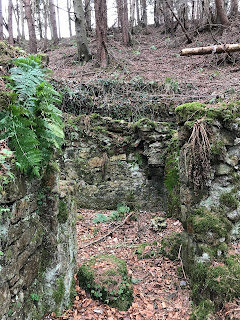
A photo of the ruins of one of the buildings from the  Stobsmill Gunpowder Works in Gorebridge.  Photo by Kevin Nosferatu for the Skulferatu Project.
Ruins of one of the gunpowder works buildings


A photo of the ruins of one of the buildings from the  Stobsmill Gunpowder Works in Gorebridge.  Photo by Kevin Nosferatu for the Skulferatu Project.
Ruins of one of the gunpowder works buildings


I wandered around the crumbling remains of the buildings that once housed a thriving and somewhat dangerous industry.  The stone walls were being subsumed back into nature and were moss covered with ferns growing from the gaps and cracks.  Birds sang in the trees above and water bubbled in the nearby stream.  It was all very different a couple of hundred years ago when there would have been dozens of men at work in and around the buildings, and water wheels would have been churning away to power the whole operation.


A photo of a collapsed stone structure in the Stobsmill Gunpowder Works in Gorebridge.  It is covered in ferns and moss.  Photo by Kevin Nosferatu for the Skulferatu Project.
Ruined structure in one of the buildings


A photo of a collapsed stone structure in the Stobsmill Gunpowder Works in Gorebridge.  It is covered in ferns and moss.  Photo by Kevin Nosferatu for the Skulferatu Project.
Stones moss covered with ferns growing from the gaps and cracks


A photo of a collapsed wall of one of the Stobsmill Gunpowder Works buildings in Gorebridge.  Photo by Kevin Nosferatu for the Skulferatu Project.
Collapsed walls of one of the buildings


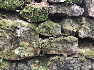
A photo of the remains of one of the stone walls of the buildings for the Stobsmill Gunpowder Works in Gorebridge.  Photo by Kevin Nosferatu for the Skulferatu Project.
Remains of walls of one of the buildings


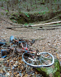
A photo of a rather battered looking abandoned bicycle lying in the woods in front of the ruins of one of the Stobsmill Gunpowder Works buildings in Gorebridge.Photo by Kevin Nosferatu for the Skulferatu Project.
Abandoned bike by walls of one of the buildings


In 1794 the works at Stobsmill were constructed for the Hitchener and Hunter Company to start producing gunpowder.  You might think that this was a company well versed in the production of such an explosive material, but no, it was the venture of William Hitchener, a millwright, and John Hunter, a farmer.  They were both originally from Surrey and had applied there for a licence to produce gunpowder but had been turned down as they lacked the necessary skills or experience to run such a dangerous business. Somehow, they had found their way to Gorebridge where, along with a more experienced partner, John Merrick, they applied for and were successful in gaining a licence to manufacture gunpowder.


The works were constructed in an isolated area within the shelter of a valley near to Gorebridge.  The valley was used as a natural barrier in case an explosion occurred, and artificial mounds were created and planted with trees to lessen any explosion that might happen.  The works were built by the Gore Water, with the river being channelled and used to drive the ten waterwheels that powered them. 


A photo of a shallow river, the Gore Water, running through woodland by the Stobsmill Gunpowder Works in Gorebridge.  Photo by Kevin Nosferatu for the Skulferatu Project.
The Gore Water running by the gunpowder works buildings


The gunpowder produced at the works was exported all around the world and was used by the British Army during the Napoleonic Wars.


Advert for gunpowder produced at Stobsmill which reads - New Improved Chemical Gunpowder. HITCHENER and HUNTER, while they gratefully acknowledge the support they have obtained from the Noblemen and Gentlemen who have used their Gunpowder, have again to solicit their attention this article, made on the new improved chemical principle, which combines the properties quickness ignition with cleanness and 'strength.' H. & H having received the unqualified approbation of sportsmen with confidence recommend their gunpowder to the public. J. Carter & Co. of Liverpool, will have a supply for the trade by the beginning of July. Stobs Mills, near Fushie Bridge, N. B. 23rd June, 1829.
Advert for gunpowder produced at Stobsmill from the Chester Chronicle, 17 July 1829


As you might expect in an era when health and safety concerns were minimal, there were quite a few accidents at the works and several large explosions.  In 1803 an explosion occurred that killed John Hunter, who was in his garden when a large stone from the blast tore off his arm.  Two of the men working at the mill were also killed in that explosion.


On the morning of 18 February 1825 an explosion occurred that was so big it could be heard in Fife, and it rattled the windows of those living in Edinburgh, eight miles away.  It was also reported that the shockwave from the explosion caused the church bells in Dalkeith, some five miles away, to start ringing and that a ploughman working in a field almost a mile away was thrown thirty yards by the force of the blast.  Luckily, he was unharmed.  While in the nearby village of Gorebridge the windows of all the houses were blown in.


Shortly before the explosion, two of the workmen at the mill, Richard Cornwall and Walter Thomson, had been busy loading casks of gunpowder from the ‘Drying Room’ on to a horse drawn waggon.  The casks were then to be taken to a store in another building a short distance away.  Cornwall, at some point went back into the ‘Drying Room’ to retrieve more casks, while Thomson was loading them on to the waggon.  Something then triggered a huge explosion in the ‘Drying Room’, which in turn also caused the store to explode.  These buildings were completely destroyed and both Cornwall and Thomson were blown to pieces.  A report at the time describes how the mangled fragments of the men’s bodies were found scattered around over the distance of a mile and that it was impossible to tell which of the fragments belonged to which man.  Other workers on the site were reported to have been blown to the ground, with some throwing themselves into the river in search of safety.  While the body of the horse that had been with the waggon was found thirty yards from the explosion and the trees all around were shattered and broken.  Some passers-by, who had been on the high road at the time of the explosion described a huge column of black smoke rising up from the valley and large stones being thrown up from it, like a volcano.


It was reckoned that about 60 barrels of gunpowder had exploded, each of these containing 112 lbs (51 kg) of powder. So in total over 3000kg of gunpowder.  You would think that given an explosion of that enormity the mills might close down, but no, given a business that lucrative and that vital to war, Empire, etc., they carried on.  Then in 1827 there was another explosion…


On Saturday 29 September 1827 at around seven thirty in the morning the residents of Gorebridge were woken by a loud blast when the ‘Corning House’ (the building in which the powder was separated into granules) at the gunpowder works exploded.  The horrific scene that met those who hurried to the ruined building to help was described graphically in a report of the incident by the Caledonian Mercury –


‘…the three men who were employed in the premises at the time…were killed by the explosion.  One of the unfortunate men had his legs torn from his body; another his belly torn open, and his entrails hanging out; and the third was blown into the water at a considerable distance from the Mill, where he was found dead about an hour after.  Search was immediately made for the members which were severed from the bodies: but when found, they were so dreadfully mutilated, that it was impossible to know to which the different members belonged.  When looking around the scene of this terrible visitation, it seemed as if some destroying angel had been there, doing his work of desolation and death.  The premises wherein the explosion took place…lay in one heap of ruins; the surrounding trees were stript of their foliage; and the grass was burnt black and bare…’


Now, you may be thinking that given the amount of accidents at Stobsmill, those working there were a bit careless, or that the owners were unduly lax over health and safety, and uncaring when it came to their workforce.  However, it seems that explosions at gunpowder factories were not that uncommon, that they were just one of the dangers of working in that trade.  A few days after the explosion at Stobsmill, there was an explosion at the premises of Messrs Pigou & co, a Powder Mill in Dartford, Kent.  Three workmen were also killed in that explosion.


Anyway, the buildings at Stobsmill were repaired and work carried on.  Then on Wednesday 21 March 1838, at around six thirty in the morning there was another explosion.  The working day had begun around half an hour earlier and the workforce was spread out throughout the site engaged in their various tasks.  In the ‘Corning House’ two men, Robertson, and West, were busy at work when there was a huge blast that destroyed the building.  Their colleagues ran to the smoking ruins and in the rubble they found Robertson.  He was still breathing but died shortly after from his wounds.  The body of West was then found ‘at some distance’ from the building.  A report of the incident in The Scotsman notes that the damage to the buildings and machinery was significant and that ‘the loss to the proprietor must be considerable – insurance on property of this nature being of course out of the question.’  No shit Sherlock!


Again the buildings were repaired, and work carried on until around 1861 when the mills finally closed.  Now all that is left of them are the ruins in the woodland of the Gore Glen.  A place so peaceful that it is hard to imagine that it was once a site of heavy industry and several tragic, fatal, and devastating accidents.


I left the Skulferatu that had accompanied me on my walk in a moss and lichen covered hollow in one of the walls.


A photo of a small ceramic skull (Skulferatu 68) being held up in front of the ruins of part of the Stobsmill Gunpowder Works in Gorebridge.  Photo by Kevin Nosferatu for the Skulferatu Project.
Skulferatu #68


A photo of a small ceramic skull (Skulferatu 68) in the wall of one of the ruined buildings of Stobsmill Gunpowder Works in Gorebridge.  Photo by Kevin Nosferatu for the Skulferatu Project.


A photo of a small ceramic skull (Skulferatu 68) in the wall of one of the ruined buildings of Stobsmill Gunpowder Works in Gorebridge.  Photo by Kevin Nosferatu for the Skulferatu Project.
Skulferatu #68 in a moss and lichen covered hollow in one of the walls.


Google map showing location of Skulferatu #68
Map showing location of Skulferatu #68


The coordinates for the location of the Skulferatu are –


Latitude 55.83960

Longitude -3.051440


I used the following sources for information on Stobsmill Gunpowder Works -


The Statistical Accounts of Scotland 1791-1845, Vol 1

Temple, County of Edinburgh (Page 53)


Gorebridge Community Development Trust

https://gorebridge.org.uk/heritage/stobsmill-gunpowder-works-an-introduction/


The Scots Magazine

Tuesday, 1 March 1825


Caledonian Mercury

Saturday, 19 February 1825


Caledonian Mercury

Monday, 1 October 1827


The Scotsman

Wednesday, 28 March 1838


Article and photographs are copyright of © Kevin Nosferatu, unless otherwise specified.

Tuesday, 19 April 2022

Skulferatu #67 - Newbyres Castle, Gorebridge, Midlothian


There are many castles in Scotland that are now not much more than a few stones.  Newbyres Castle is one of these.  There is not much left of it now, and its glory days are long gone.  It is now no more than two sides of a low wall and a bramble covered mound standing in a small wildlife garden by the village of Gorebridge.  However, back in its heyday the castle was a substantial and rather picturesque tower house. 


A photo of the ruins of Newbyres Castle - a rather dull looking ruined wall surrounded by rather dull looking plants that have died back in winter.  Photo by Kevin Nosferatu for the Skulferatu Project
The rather unimpressive remains of Newbyres Castle


A photo of the ruined walls of Newbyres Castle - they are low and the stones green with moss.  Photo by Kevin Nosferatu for the Skulferatu Project
Part of the outside walls of Newbyres castle


A photo of the ruined walls of Newbyres Castle - they are low and the stones green with moss.  Photo by Kevin Nosferatu for the Skulferatu Project
Part of the outside walls of Newbyres Castle


A photo of a bramble covered mound in the wildlife park by Gorebridge, that is the site on which Newbyres Castle once stood.  Photo by Kevin Nosferatu for the Skulferatu Project
This bramble covered mound covers the area where the castle once stood


Newbyres Castle was built in the mid-16th Century for Michael Borthwick of Glengelt.  He had acquired the land in 1543 from James Haswell, the Abbot of the abbey at Newbattle.  The castle was built as an L shaped tower with a courtyard around it.  It had a vaulted ground floor and numerous gun loops on the upper floors.  From his new, fortified home, Borthwick oversaw his coal mining operations in the area. 


In 1624 the castle was sold to Sir James Dundas of Arniston, who was the Governor of Berwick.  After his death, the house became the main residence of his widow Mary Hume, Lady Arniston.  She had a reputation locally as a very hospitable host and on one occasion a guest of hers was prosecuted for drunkenness after being a bit rowdy and potty mouthed while making his way home.  The charge against him was later found ‘Not Proven’.  Nowadays, we might look back at the goings on in Newbyres Castle and see it as a bit of a ‘party house’.  The 17th Century equivalent of the house on the street that at weekends always has music pounding out until the early hours of the morning with lots of inebriated people coming and going.


A sketch of Newbyres Castle as it would have looked in its heyday, taken from The Castellated and Domestic Architecture of Scotland from the Twelfth to the Eighteenth Century  Volume Three  By David MacGibbon and Thomas Ross.
A sketch of Newbyres Castle as it would have been in its heyday


A sketch of the ruins of Newbyres Castle from The Arniston Memoirs, Three Centuries of a Scottish House, 1571-1838  By George W T Omond.
A sketch of the ruins of Newbyres Castle from The Arniston Memoirs


A sketch of the ruins of the castle circa 1879, taken from The Castellated and Domestic Architecture of Scotland from the Twelfth to the Eighteenth Century  Volume Three  By David MacGibbon and Thomas Ross.
A sketch of the ruins of the castle circa 1879


At some point the castle was abandoned as a home and was left to decay and crumble away.  A large part of the tower, including the staircase collapsed in 1881.  In 1963 most of the remaining walls were demolished by Midlothian Council due to fears for public safety.


On a walk that took me through Gorebridge, I stopped off at the remains of the castle.  I walked to the top of the pile of overgrown rubble and wondered if I zoomed back to a few hundred years ago, what room I’d be standing in, and who would be there?  Maybe I’d bump into Lady Arniston, and she would offer me a nip of something nice to drink.  On a cold day like today, it would be most welcome.


I left a Skulferatu in a gap in the remaining chunk of the castle walls.


A photo of a small ceramic skull (Skulferatu 67) being held up with the ruins of Newbyres Castle in the background.  Photo by Kevin Nosferatu for the Skulferatu Project
Skulferatu #67


A photo of a small ceramic skull (Skulferatu 60) in a gap in the stone walls of Newbyres Castle, Gorebridge.  Photo by Kevin Nosferatu for the Skulferatu Project
Skulferatu #67 in a gap in the castle walls


A photo of a small ceramic skull (Skulferatu 60) in a gap in the stone walls of Newbyres Castle, Gorebridge.  Photo by Kevin Nosferatu for the Skulferatu Project
Skulferatu #67 in a gap in the castle walls


A photo of a small ceramic skull (Skulferatu 60) in a gap in the stone walls of Newbyres Castle, Gorebridge.  Photo by Kevin Nosferatu for the Skulferatu Project
Skulferatu #67 in a gap in the castle walls


TomTom map showing location of Skulferatu #67
Map showing location of Skulferatu #67


The coordinates for the location of the Skulferatu are -


Latitude 55.84185

Longitude -3.048500


I used the following sources for information on the castle –


The Castellated and Domestic Architecture of Scotland from the Twelfth to the Eighteenth Century

Volume Three

By David MacGibbon and Thomas Ross

1889

(Sketches – Fig. 477 & Fig. 478)


Newbyres Castle: The Story So Far

https://gorebridge.org.uk/heritage/newbyres-castle-the-story-so-far/


The Arniston Memoirs, Three Centuries of a Scottish House, 1571-1838

By George W T Omond

1887

(Sketch of Newbyres Tower)


Public Information Board at Site


Tuesday, 12 April 2022

Skulferatu #66 - Disused Pier and Ship Loading Bay, Preston Hill Quarry, Inverkeithing, Fife

When out for walks along the Fife Costal Path I often stumble across the ruins of the heavy industry that once thrived in this area.  There are pieces of machinery of indeterminate use, the remains of old buildings and piers, structures sitting out and decaying away in the water, and broken metal things that may have once been something useful but are now so rusted away it is difficult to say what they were.


A photo of the remains of a pier like structure standing in the middle of the open water of the Forth Estuary.  Photo by Kevin Nosferatu for the Skulferatu Project.
Decaying remains of an old pier in the Forth


A photo of a concrete structure with a door frame type thing at the end.  It appears to be an old loading bay.  In the background is the Forth Rail Bridge.  Photo by Kevin Nosferatu for the Skulferatu Project.
Concrete structure sitting on shore of the Forth


Just outside of Inverkeithing there are the rather striking remains of what looks like a disused, iron pier jutting out into the Forth. 


A photo of a long, thin metal pier like structure jutting out from the land and into the waters of the Forth.  Photo by Kevin Nosferatu for the Skulferatu Project.


These are the remnants of a conveyer belt and loading bay for Preston Hill Quarry.  It was once used to load stone from the quarry on to ships.  The quarry was closed down many years ago and the pier and loading bay have been left to just rust away.


A photo of a long, thin metal pier like structure jutting out from over rocks and into the waters of the Forth.  Photo by Kevin Nosferatu for the Skulferatu Project.
Disused pier and ship loading bay for Preston Hill Quarry


A photo underneath the pier showing the metal struts stretching out into the sea.   Photo by Kevin Nosferatu for the Skulferatu Project.
Underneath the disused pier for the conveyer belt


A photo up through the rusting iron struts of the disused pier.  Photo by Kevin Nosferatu for the Skulferatu Project.
The rusting iron struts of the pier


A photo up through the pier showing metal struts and barbed wire.  Photo by Kevin Nosferatu for the Skulferatu Project.
Iron and barbed wire underneath the pier


I found a path through the thorny bushes that took me underneath the rusting metal structure and while I took some photographs a heron watched me warily from the water below.


A photo of a heron standing in the waters of the Forth.  Photo by Kevin Nosferatu for the Skulferatu Project.
A heron watched me warily


I then took a wander over to the old quarry site.  It is now full of water and is a popular place with the local diving community for training and underwater photography.  I tried my hand at a bit of underwater photography by sticking an old and supposedly waterproof camera into the water to take a photo of the reeds growing below the surface. It sort of worked and the camera only fizzed and hissed a little bit.


A photo showing a sign post stating that it is illegal to fly tip or dump in the area, by this sign are several concrete fence posts, though the fence is now gone and behind these can be seen the cliffs of Preston Hill Quarry.  Photo by Kevin Nosferatu for the Skulferatu Project.
Entrance to Preston Hill Quarry


A photo showing cliffs around a body of water - this being the old Preston Hill Quarry.  Photo by Kevin Nosferatu for the Skulferatu Project.
Preston Hill Quarry


A photo of some plants growing underwater in the quarry.  Photo by Kevin Nosferatu for the Skulferatu Project.
Plants growing underwater in the quarry


A photo from the hill above Preston Hill Quarry looking over the quarry site.  Photo by Kevin Nosferatu for the Skulferatu Project.
A view out over the quarry site


There are now plans afoot to fill in the quarry site and turn the area around it into a housing development.  I got the impression from some stickers on signposts and lampposts along the path leading up to the quarry that this is not a particularly popular idea.


I wandered back round from the quarry to the old pier and loading bay.  The sun was bright in the sky and all around was a haze of light reflected on a calm sea.


A photo of the disused pier and ship loading bay for Preston Hill Quarry.  Photo by Kevin Nosferatu for the Skulferatu Project.
Disused pier and ship loading bay for Preston Hill Quarry


A photo of the disused pier and ship loading bay for Preston Hill Quarry.  Photo by Kevin Nosferatu for the Skulferatu Project.
Disused pier and ship loading bay for Preston Hill Quarry


I left the Skulferatu that had accompanied me on my walk in the iron struts of the pier supports.


A photo showing a small ceramic skull (Skulferatu #66) being held up in front of the disused pier and loading bay.  Photo by Kevin Nosferatu for the Skulferatu Project.
Skulferatu #66


A photo showing a small ceramic skull (Skulferatu #66) sitting in the rusting struts of the pier.   Photo by Kevin Nosferatu for the Skulferatu Project.
Skulferatu #66 in the iron struts of the pier


TomTom map showing location of Skulferatu #66
Map showing location of Skulferatu #66


The coordinates for the location of the Skulferatu are –


Latitude 56.02553

Longitude -3.38618


Tuesday, 5 April 2022

Skulferatu #65 - Anti Tank Blocks, Gosford Bay, East Lothian


During WWII numerous coastal areas around the UK were seen as being potential landing places for a sea borne invasion by the German forces.  Given this, in many of these sites, man made obstructions were put in place to hinder any possible enemy assault.  Some of these were designed to make it difficult for landing craft to get into the shore and others were designed to slow down tanks and other vehicles if they got ashore. The Anti Tank Blocks that can be seen along stretches of the East Lothian coast line were one of the obstruction methods deployed.  These were large concrete blocks that were placed around vulnerable parts of the coast to impede and delay any tanks that were landed on the shore.


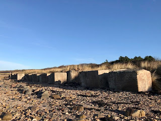
A photo showing Anti Tank Blocks on the beach near Longniddry Bents.  These are large square concrete blocks and they stretch off into the distance. Photo by Kevin Nosferatu for the Skulferatu Project.
Anti Tank Blocks on beach near Longniddry Bents


A photo of the sands near Longniddry Bents.  the tide has gone out leaving curved patterns of shallow water on the beach.  Photo by Kevin Nosferatu for the Skulferatu Project.
Sands near Longniddry Bents


A photo showing Anti Tank Blocks on the beach near Longniddry Bents.  These are large concrete blocks and they  appear to have been topples over so that they are now rectangular in shape as the bases are no longer buried in the sand. Photo by Kevin Nosferatu for the Skulferatu Project.
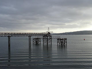
Anti Tank Blocks on beach near Longniddry Bents


Today, there is still a row of these blocks running along from Longniddry Bents to Gosford Bay.  Many are weathered and disappearing into the sand and pebbles of the beach, but others, such as those protected by the trees within the woods at Craigielaw, are still well-preserved and whole.


A photo showing two of the anti tank blocks in the woods at Craigielaw.  There is a large deciduous tree behind them that has shed its leaves and its branches are bare.  Photo by Kevin Nosferatu for the Skulferatu Project.
Anti Tank Blocks in the woods at Craigielaw


A photo showing a line of the anti tank blocks stretching off through the woods with the bare branches of a large tree stretching out over them.   Photo by Kevin Nosferatu for the Skulferatu Project.
Anti Tank Blocks in the woods at Craigielaw


A photo showing the concrete Anti Tank Blocks on the beach at Gosford Bay.  The beach around them is white with seashells.   Photo by Kevin Nosferatu for the Skulferatu Project.
Anti Tank Blocks on the beach at Gosford Bay


A photo showing several of the Anti Tank Blocks on the beach at Gosford Bay.  they are sitting amongst the rocks by the sea.  Photo by Kevin Nosferatu for the Skulferatu Project.
Anti Tank Blocks on the beach at Gosford Bay


A photo showing the Anti Tank Blocks on the beach at Gosford Bay.  Photo by Kevin Nosferatu for the Skulferatu Project.
Anti Tank Blocks on the beach at Gosford Bay


As well as now being an interesting historical reminder of a dark and fearful time in the UK’s history, many of the crumbling blocks are now home to insect and plant life.


On my walk, I followed the row of Anti Tank Blocks along the coast and through the woods, from Longniddry to Gosford Bay. 


A photo showing the last of the Anti Tank Blocks at Gosford Bay.  It is pitted and crumbling from the effects of the sea and the weather.  Photo by Kevin Nosferatu for the Skulferatu Project.
Last of the Anti Tank Blocks at Gosford Bay


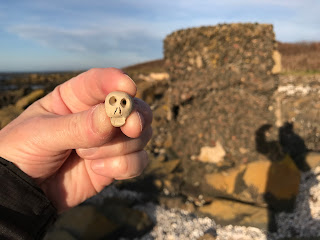
I left the Skulferatu that accompanied me in a hollow in the last block standing amongst the rocks in Gosford Bay.


A photo showing a small ceramic skull (Skulferatu #65) being held up in front of the last of the anti tank blocks at Gosford Bay.  Photo by Kevin Nosferatu for the Skulferatu Project.
Skulferatu #65


A photo showing a small ceramic skull (Skulferatu #65) in one of the pitted hollows of the last anti tank block at Gosford Bay.  Photo by Kevin Nosferatu for the Skulferatu Project.
Skulferatu #65 in a hollow in the Anti Tank Block


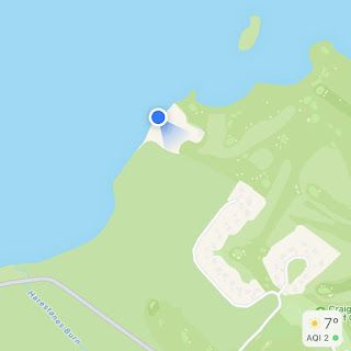
TomTom map showing location of Skulferatu #65
Map showing location of Skulferatu #65


The coordinates for the location of the Skulferatu are –


Latitude 56.004890

Longitude -2.889890


I used the following sources for information on the Anti Tank Blocks –


Canmore - Gosford Sands