Showing posts with label East Lothian. Show all posts

Tuesday 18 May 2021

Skulferatu #30 - Seacliff House, North Berwick, East Lothian


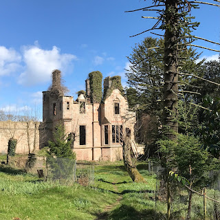
If you have ever wandered along Seacliff Beach, you may have noticed the ruins of a gothic looking building that is almost hidden in the trees on the hill above.  These ruins are the remains of Seacliff House, a large, private mansion that once boasted having some of the best views out over the Bass Rock and the Forth.  Today, while walking to Seacliff Beach I decided to go and have a look around the ruins of the house on the hill.


The skeletal remains of Seacliff House half hidden by the trees as seen from Seacliff Beach.  Photo by Kevin Nosferatu for the Skulferatu Project.
The skeletal remains of Seacliff House half hidden by the trees


While wandering around I found that the ruins were still quite impressive, with much of the outer walls of the house remaining.  I remember walking through here a few years back and the ruined frontage of the house was mainly hidden in a mass of trees and undergrowth.  Most of this has now been cut back giving a much clearer view of what remains of the building.  There was a speculative scheme drawn up in 1992 to rebuild the house, add an extension and turn it into a spa hotel.  Thirty years later and I don’t think that plan is any further forward, but given the clearing of the trees around the building who knows…?


The ruins of Seacliff House, North Berwick, East Lothian.  Photo by Kevin Nosferatu for the Skulferatu Project.
The ruins of Seacliff House


The ruins of Seacliff House, North Berwick, East Lothian.  Photo by Kevin Nosferatu for the Skulferatu Project.
The ruins of Seacliff House


View of ruined frontage of Seacliff House, North Berwick, East Lothian.  Photo by Kevin Nosferatu for the Skulferatu Project.
View of ruined frontage of Seacliff House


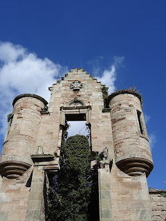
One of the remaining towers of Seacliff House at North Berwick in East Lothian.  Photo by Kevin Nosferatu for the Skulferatu Project.
One of the remaining towers of the house


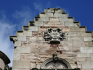
Detail of decorations on the tower at Seacliff House, North Berwick, East Lothian.  Photo by Kevin Nosferatu for the Skulferatu Project.
Detail of decorations on the tower


View of back of Seacliff House with the windows of rooms that would have once faced out onto a spectacular view over the Bass Rock and the Forth. Photo by Kevin Nosferatu for the Skulferatu Project.
View of back of Seacliff House


The history of this building is that the original Seacliff House was built in 1750 by Robert Colt.  In 1841, the then owner George Sligo commissioned the architect David Bryce to design a new house around the earlier building.  Bryce designed a three storey house with an attic in the Scottish Baronial style, and building work was completed later that year.  The house was then enlarged in 1850 when the estate was acquired by John Watson Laidlay. 


Laidlay was an interesting chap, one of these classic Victorian gentleman types.  He studied chemistry under Michael Faraday and then went off to work in the family business out in India.  There he ran two factories producing silk and indigo.  In his spare time, he studied various ancient languages and translated texts by Fa Hian into English (Fa Hian or Faxian was a 4th Century Chinese Buddhist monk who travelled from China to India visiting sacred Buddhist sites on his journey).  Laidlay returned to the UK in 1849 and bought the property at Seacliff.  On his death in 1885 his eldest son Andrew Laidlay inherited the property.


Andrew Laidlay was by all accounts a popular man with many friends.  He was a magistrate in East Lothian and a keen golfer.  He was also an avid reader and researcher and spent many hours in the library of his house.  Late on the night of Saturday 27 July 1907 he was reading in his library.  As the house had no electricity, he read with the aid of a paraffin lamp and would often have this up on the highest flame to give himself more light to read by.  On this night, while reading, Andrew fell asleep.  It then appears that while sleeping he knocked the lamp over and set fire to the library.  Then, in the early hours of the morning on Sunday 28 July, two of the maids who were sleeping in the room they shared were woken by a crackling sound and what also sounded like falling furniture.  Alarmed by this they got up to wake the housemaid, Effie Hamilton, who slept in another room.  They woke her and on investigating what was going on she found that smoke was beginning to billow up from the rooms below.  Effie then quickly got the other members of staff out of the house.  Once outside Effie shouted and threw stones up at the bedroom window of the Laidlay’s daughter, Theophila.  On waking, Theophila quickly went to her mother’s room and roused her.  The two of them then bound some bed sheets together and climbed from the bedroom window down to a balcony on the second storey.  A ladder was then brought round so that they could safely get down to the ground and away from the house.  In the meantime, Effie had gone back into the house to try to get to Andrew Laidlay’s bedroom, as she feared he was asleep there and had been overcome by the smoke from the fire.   However, despite a couple of valiant attempts she was beaten back by the smoke and the heat from the fire.  All she and those who had escaped from the building could then do was watch as it was engulfed by the flames.


The fire brigade was called and attended, but they had serious problems in getting any water with which to douse the flames, as there was no mains water connected to the house, the water being usually drawn from a nearby well.  They attempted to use sea water, but this was fraught with difficulties given the distance from the house to the sea.  Most of the house was soon destroyed by the fire and was left as an empty, smouldering shell.  The fire brigade did however manage to stop the flames from engulfing the kitchen and laundry block.  Once the fire was out a search was undertaken to try and find the remains of Andrew Laidlay, but the heat had been so intense at the height of the fire that nothing could be found of him.


After the fire, the ruins of the house were abandoned.  The stables and a service cottage for the house, which had not been damaged by the fire, were purchased by the Royal Navy.  During World War I they were used as the base for HMS Scottish Seacliff.  This was a secret research facility concerned with navigation training and U-boat defence.  The stables and the cottage are now privately owned.


Article and photo of Seacliff House from The Graphic – August 10, 1907.  Seacliff House, East Lothian, a great mansion of massive Gothic architecture, has been totally destroyed by fire, and with it has been burnt the body of its proprietor, Mr. Andrew Laidley...
Article and photo of Seacliff House from The Graphic – August 10, 1907


The Skulferatu that accompanied me on today’s walk was left in the hollow of a doorway wall.


Skulferatu #30 at Seacliff House, North Berwick, East Lothian. Photo by Kevin Nosferatu for the Skulferatu Project.
Skulferatu #30


Skulferatu #30 in hollow of doorway wall at Seacliff House, North Berwick, East Lothian.  Photo by Kevin Nosferatu for the Skulferatu Project.
Skulferatu #30 in hollow of doorway wall


Map showing location of Skulferatu #30 at Seacliff House, North Berwick, East Lothian.
Map showing location of Skulferatu #30


The coordinates for the location of the Skulferatu are:


Latitude 56.050131

Longitude -2.631587


I used the following sources for information on Seacliff House –


John Watson Laidlay - Wikipedia


Seacliff - Wikipedia


Seacliff House, Seacliff | Buildings at Risk Register


Seacliff House | Canmore


The Scotsman – Monday 29 July 1907


Daily Telegraph and Courier (London) - Monday 29 July 1907


The Graphic – August 10, 1907
 

Article and photographs are copyright of © Kevin Nosferatu, unless otherwise specified. 

Tuesday 13 April 2021

Skulferatu #26 - Saltcoats Castle, Gullane, East Lothian


When I go cycling from Edinburgh to North Berwick, I like to take the coastal road and enjoy the scenic route.  Just before I reach Gullane, I turn off from the road and take the bumpy path along the John Muir Way and cut down to the rather spectacular ruin of Saltcoats Castle.  On a sunny day it’s relaxing just to sit in the castle grounds, rehydrate and take in the great view.


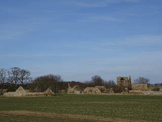
The tower of Saltcoats Castle can be seen in the distance with ruined cottage and outbuildings around it.  Photo by Kevin Nosferatu for the Skulferatu Project.
Saltcoats Castle with ruined cottage and outbuildings


The Tower of Saltcoats Castle can be seen through the overgrown outer area of the castle courtyard.  Photo by Kevin Nosferatu for the Skulferatu Project.
Tower of Saltcoats Castle seen through overgrown outer area of the castle


The history of this rather marvellous ruin starts with a legend of daring and bravery, or the needless slaughter of a wild animal, depending on your point of view.  The story goes something like this…


…back in the mists of time, when the lands that now make up East Lothian were sparsely populated and thick with forest and wild beasts, there was a huge, wild boar that terrorised the area.     This beast was enraged by anybody it saw on its territory and had chased, gouged and maimed a dozen or so people.  Soon it got to the stage where those in the villages were terrified of travelling to market, the peasants working the fields were terrified as they worked, the landlords in their stately homes were terrified of walking outside in their gardens and those travelling from Edinburgh towards England took a long route round to avoid the area.  The King, on learning what was going on, offered a large reward to anyone who could kill the boar and rid the land of its menace.  Many tried and died in their attempts.  The boar always seemed to be one step ahead of them and ambushed many a brave hunter, slicing through their weak and mortal bodies with sharp tusks that seemed to be made of steel.  Soon the boar was being seen as more than just a beast, it was a demon sent from Hell or a punishment from God.  The churches rang out their bells and the holy prayed in hope that the good Lord would end their torment.  But he didn’t.


Then along came a young man from the Livington family.  His family had fallen on hard times and he had decided that to improve their lot he would take on the challenge of killing the boar.  First of all, he set about preparing for the task and had a special glove made of thick leather.  The inside of this glove was heavily padded with down.  He also had a steel helmet, body armour and a sword made for the task.  Expensive though this was, he persuaded the craftsmen who made the pieces for him that he would pay them when he had killed the boar.  Such was his self confidence in completing this task that they all agreed to this and he was soon ready to go on the hunt for the deadly beast.


On a summer’s morning young Livington set off out into the forest.  As he went, he would call out every so often in order to attract the boar.  However, it was almost as if the beast could sense him and his purpose, and for hours Livington walked without seeing any sign of it.  Growing weary from walking, Livington stopped near a stream and drank from it.  He sat by it for a while and decided to give up for the day and to start his hunt again the next morning.  As he rose to make his way back out of the forest, he heard something crashing through the undergrowth.  It drew nearer and nearer.  Livington drew his sword and readied himself.  With a roar the boar burst through the undergrowth to where Livington stood.  The creature was huge with tusks like sabres and eyes that glowed red like the hot coals of a fire.  For a moment it stood still staring at Livington, then it stamped at the ground, snarled, and rushed at him with tusks out.  Like a matador, Livington spun to the side and the boar charged past.  It came to a skidding halt and turned again to face him.  It’s eyes burning with anger and hate it let out a roar and charged at him.  Livington once more sidestepped the boar as it reached him, howling with frustrated rage it turned and came at him again.  As it was almost on top of him Livington thrust his gloved arm down into its mouth.  The shock of this caused the beast to stumble and fall, taking both it and Livington to the ground.  The beast, unable to move its head enough to gouge Livington with its tusks, kicked out at him, catching him several times about the body and denting the armour he wore.  In this onslaught Livington almost lost grip of his sword, but just managing to keep hold of it he thrust it up and through the beast’s heart.  The beast let out a groan, almost human, then sighing it died by Livington’s side.  Exhausted, Livington lay by it and prayed a prayer of thanks to the Almighty Lord above.


A group of five woodsmen, had bravely ventured that day into the forest to chop wood, and had heard the commotion.  Cautiously they approached to see what was going on and saw Livington lying beside the body of the boar.  Thinking that he must have died in the fight, they went over to offer prayers for him.  On seeing that he was alive and suffering from no fatal wounds, they helped the exhausted man to his feet.  They then cut and stripped a large branch and tied the body of the boar to this.  Four of the woodsmen carried it out, while one carried Livington on his shoulders.  As they walked out through the forest, they came across a den of six squealing little piglets. The six little piglets mama boar had been protecting from those who encroached on her territory.  These were gathered up, placed in a sack, and handed to Livington.


On hearing that the boar was dead, villagers from all around came out in celebration.  That night Livington and the villagers, from landlord to peasant, all feasted on suckling pig and wild boar sausages, black pudding, and roast pork.  All washed down with local ales and fine wines imported from afar. 


A few days later the King heard that the boar had been killed.  For Livington’s act of bravery and ridding the land of the terrible beast the King granted him the lands from Gullane Point to North Berwick Law.  It was on the land acquired by Livington, near to Gullane, that Saltcoats Castle was built.


Up until the 1790s the helmet said to be worn by Livington when he slayed the boar hung in the church at Dirleton in East Lothian.  When the church was being repaired the helmet was removed for safekeeping and was lost.


At the mouth of the Peffer there is a small stream that goes by the name of Livington’s Ford.  It is here that Livington supposedly slew the wild boar. 


Anyway, let’s get back to the castle…the name of Saltcoats Castle is thought to come from the fact that it stands on ground that was in ancient times a salt marsh.  The castle is a Sixteenth Century courtyard castle that rose to a height of three storeys.  It was enclosed by a wall and in the grounds, there would have been an extensive garden and orchard.  There was also at one time a bowling green to the east of the castle, though all signs of this have been lost as it has been ploughed over numerous times and become part of the surrounding fields.


The castle was built in around 1590 for Patrick Livington and his wife Margaret Fettis of Fawside.  In the early 1700s the castle and estate were acquired by the Hamilton family when James Hamilton of Pencaitland married ‘the heiress of Saltcoats’, Margaret Menzies.  The castle was inhabited until around the late 1790s, the last tenant being a Mrs Carmichael, who died there.  It was then left uninhabited for several years.  Around 1810 much of the stonework was removed to build farm steadings and walls.  The ruined cottage which stands at the side of the castle was built around this time and on its front wall there is a panel taken from the castle with the coat of arms of Patrick Livington carved into it.


The stone Tower of the ruins of Saltcoats Castle, Gullane, East Lothian.  Photo by Kevin Nosferatu for the Skulferatu Project.
Tower of Saltcoats Castle


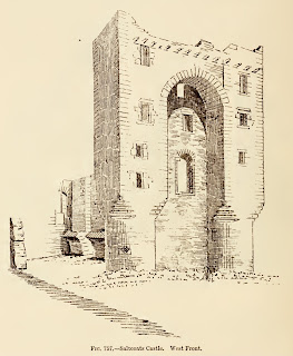
Sketch of Saltcoats Castle tower taken from The Castellated and Domestic Architecture of Scotland from the Twelfth to the Eighteenth Century Volume Four by David MacGibbon and Thomas Ross 1887
Sketch of Saltcoats Castle from ‘The Castellated and Domestic Architecture of Scotland’ - 1887


Side view of the castle ruins and tower from across the remains of what was once a walled orchard and garden.  Photo by Kevin Nosferatu for the Skulferatu Project.
Side view of castle ruins and tower


 Side view of Saltcoats Castle tower.  Photo by Kevin Nosferatu for the Skulferatu Project.
Side view of castle tower


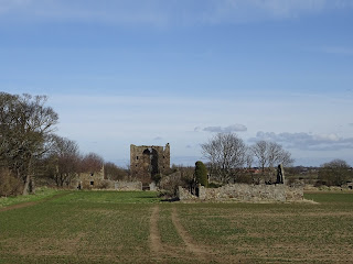
A view of Saltcoats Castle and the ruins of farm steadings, taken from a distance with a newly planted field in the foreground.  Photo by Kevin Nosferatu for the Skulferatu Project.
View of castle and ruins of farm steadings


Saltcoats Castle has now been designated as a scheduled monument.


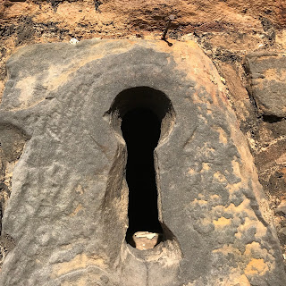
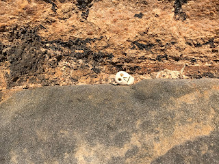
The Skulferatu that accompanied me today was left on a ledge above the keyhole window on the tower.


View of a hand holding Skulferatu #26, with part of the tower of Saltcoats Castle in the background.  Photo by Kevin Nosferatu for the Skulferatu Project.
Skulferatu #26


A photograph of a keyhole window in the castle tower with a Skulferatu in the top left hand corner on the window ledge.  Photo by Kevin Nosferatu for the Skulferatu Project.
Spot the Skulferatu 


Close up of Skulferatu #26 on window ledge of keyhole window in the tower of Saltcoats Castle.  Photo by Kevin Nosferatu for the Skulferatu Project.
Close up of Skulferatu #26 on window ledge


Google Map showing location of Skulferatu #26
Map showing location of Skulferatu #26


The coordinates for the location of the Skulferatu are:


Latitude 56.026982

Longitude -2.827307


I used the following sources for information on the castle –


The Castellated and Domestic Architecture of Scotland from the Twelfth to the Eighteenth Century

Volume Four

By David MacGibbon and Thomas Ross

1887


Lamp of Lothian or the History of Haddington form the earliest times to 1844

by James Miller

1900


St Baldred of the Bass and Other Poems

By James Miller

Oliver and Boyd

1824


Wikipedia – Saltcoats Castle

Saltcoats Castle - Wikipedia


Canmore – Saltcoats Castle

Canmore - Saltcoats Castle, Gullane


Article and photographs are copyright of © Kevin Nosferatu, unless otherwise specified. 

Tuesday 9 March 2021

Skulferatu #22 - Ash Disposal Area, Levenhall, Musselburgh, East Lothian


In the summer I often cycle from Edinburgh to North Berwick.  Rather than take the roads all the way there I tend to veer off and take the more scenic route along the John Muir Way.  It is more relaxing and offers up lots of great views around the coast and across the Forth over to Fife.


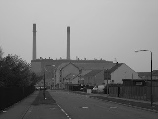
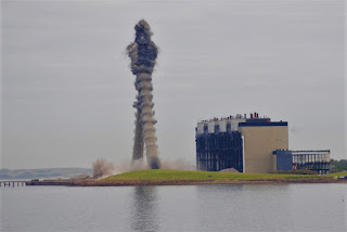
Just outside Musselburgh, at the back of the racecourse, the route of the John Muir Way takes you through the Ash Disposal Areas or Ash Lagoons, as they are also known.  These were created by the disposal of pulverised fuel ash from the coal fired power station that was at Cockenzie.  This power station was operational from 1967 until 2013, when it was decommissioned.  It was demolished in 2015.  


A view of Cockenzie Power Station from Prestonpans.  Photo by Kevin Nosferatu for the Skulferatu Project
A view of Cockenzie Power Station from Prestonpans


Demolition of Cockenzie Power Station chimneys in 2015.  Photo by Kevin Nosferatu for the Skulferatu Project
Demolition of power station chimneys in 2015


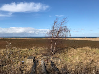
Some of the Ash Lagoons have been restored and landscaped as wildlife areas, with pools of water created to attract wading birds.  The one that always gets my attention though is yet to be landscaped.  It was, until a few years ago, a grey, crumbly looking mound.  On hot and windy summer days I would cycle past and my eyes would sting in the fine, grey dust that blew off from it.  On rainy days my bike and my legs would be coated with a slimy grey mud.  Then a few years ago some planting took place and there was a whole summer when the lagoon bloomed with hundreds of thousands of poppies.  Now it has returned to a desolate look, though a desolate look with various grasses and scrub.


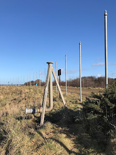
Silver Birch tree and pipes in the Ash Lagoon, Musselburgh.  Photo by Kevin Nosferatu for the Skulferatu Project
Silver Birch tree and pipes in the Ash Lagoon


A view over the Ash Lagoon to Prestongrange.  Photo by Kevin Nosferatu for the Skulferatu Project
A view over the Ash Lagoon to Prestongrange


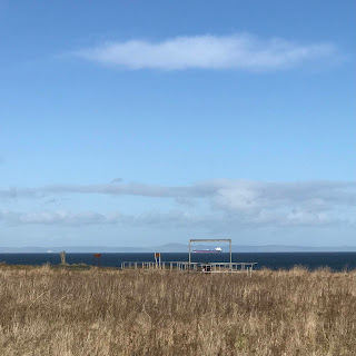
Looking out over the Forth from the Ash Lagoons, Musselburgh.  Photo by Kevin Nosferatu for the Skulferatu Project
Looking out over the Forth


Poles around part of Ash Lagoon, Musselburgh.  Photo by Kevin Nosferatu for the Skulferatu Project
Poles around part of Ash Lagoon


Left over apparatus rusting away in the Ash lagoons at Musselburgh.  Photo by Kevin Nosferatu for the Skulferatu Project
Left over apparatus rusting away


View over Forth to Fife from the Ash Lagoons, Musselburgh.  Photo by Kevin Nosferatu for the Skulferatu Project
View over Forth to Fife


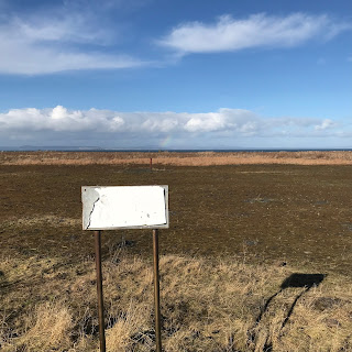
Remains of sign that use to warn against walking over the mound of ash at the Ash Lagoons, Musselburgh.  Photo by Kevin Nosferatu for the Skulferatu Project
Remains of sign that use to warn against walking over the mound of ash


Round the top and at the edges of this mound of ash there runs a path.  There used to be signs all round warning people not to walk over the ash as it was dangerous and unstable.  These are now so rusted and faded that they are unreadable.  Lots of people walk over the ash now, but I think it was compacted and made safe…though I may be wrong about that.  If one day it swallows up a walker or two, then we’ll all know it wasn’t safe and be thankful it wasn’t us.


Poles and pipe at side of the Ash Lagoon, Musselburgh.  Photo by Kevin Nosferatu for the Skulferatu Project
Poles and pipe at side of the Ash Lagoon


View over grass and industrial remnants in the Ash Lagoon, Musselburgh.  Photo by Kevin Nosferatu for the Skulferatu Project
View over grass and industrial remnants in the Ash Lagoon


View over Ash Lagoon with Arthur’s Seat in the distance.  Photo by Kevin Nosferatu for the Skulferatu Project
View over Ash Lagoon with Arthur’s Seat in the distance


There are plans for this area to be landscaped to extend the wildlife haven that has already been created. 


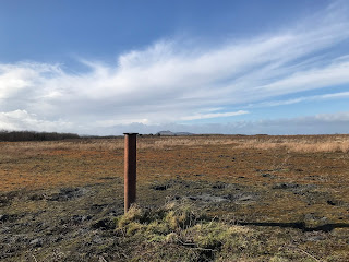
Pipe in the centre of the Ash Lagoon, Musselburgh.  Photo by Kevin Nosferatu for the Skulferatu Project
Pipe in the centre of the Ash Lagoon


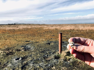
The Skulferatu that accompanied me today was left by a pipe sticking out of the compacted ash.


Skulferatu #22 at Ash Lagoons, Musselburgh.  Photo by Kevin Nosferatu for the Skulferatu Project
Skulferatu #22


Skulferatu #22 by pipe in Ash Lagoon, Musselburgh.  Photo by Kevin Nosferatu for the Skulferatu Project
Skulferatu #22 by pipe in Ash Lagoon


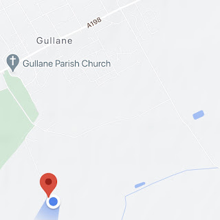
Google Map showing location of Skulferatu #22 (Map shows Lagoon as being an area of water – it is not)
Google Map showing location of Skulferatu #22

(Map shows Lagoon as being an area of water – it is not)


The coordinates for the location of the Skulferatu are –

Latitude 55.950414

Longitude -3.014697


Tuesday 16 February 2021

Skulferatu #19 - St Andrew's Kirk, Kirk Ports, North Berwick


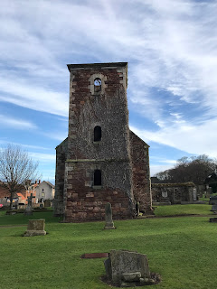
St Andrew's Kirk, Kirk Ports, North Berwick by Kervin Nosferatu for the Skulferatu Project
St Andrew’s Kirk, Kirk Ports, North Berwick


Just off North Berwick High Street stands the rather quaint ruin of St Andrew’s Kirk.  This church was built in the 17th Century and opened on 5 June 1664.  It was built to replace St Andrew’s Old Kirk, which stood near to the sea and had been so severely damaged by a storm that it had to be abandoned.  The ruins of the Old Kirk lie near to the Scottish Seabird Centre.   


With the arrival of the railway in North Berwick in 1850, the town’s population grew substantially.  By 1873 the congregation was too large for St Andrew’s Kirk and in 1882 a new and larger church opened nearby. 


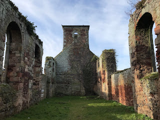
On 3 June 1883, the last service was held in St Andrew’s Kirk and shortly after this it was partly dismantled, with various fixtures and fittings being auctioned off.  However, it was decided by the church authorities to ‘allow the walls of the church to stand in order to form a picturesque ruin…’


Interior of the ruins of St Andrew’s Kirk, Kirk Ports, North Berwick by Kevin Nosferatu for the Skulferatu Project
Interior of the ruins of St Andrew’s Kirk


A view of the graveyard at Kirk Ports and the ruins of St Andrew’s Kirk by Kevin Nosferatu for the Skulferatu Project
A view of the graveyard at Kirk Ports and the ruins of St Andrew’s Kirk


Old Gravestone at Kirk Ports Graveyard, North Berwick by Kevin Nosferatu for the Skulferatu Project
Old Gravestone at Kirk Ports Graveyard


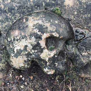
Carved skull on one of the old graves at Kirk Ports Graveyard, North Berwick by Kevin Nosferatu for the Skulferatu Project
Carved skull on one of the old graves


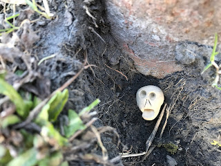
I placed the Skulferatu that accompanied me on today’s walk around North Berwick in a gap in the wall at the church.


Skulferatu #19 at St Andrew's Kirk, Kirk Ports, North Berwick by Kevin Nosferatu for the Skulferatu Project
Skulferatu #19


Skulferatu #19 in wall at St Andrew’s Kirk, Kirk Ports, North Berwick by Kevin Nosferatu for the Skulferatu Project
Skulferatu #19 in wall at St Andrew’s Kirk


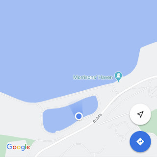
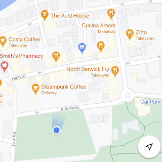
Google Map showing location of Skulferatu #19


The coordinates for the location of the Skulferatu are –

Latitude 56.057800

Longitude -2.718484

Tuesday 19 January 2021

Skulferatu #15, St Baldred's Cradle, Peffer Sands, East Lothian


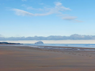
The thing I love about working in East Lothian is that there are so many beautiful places nearby to go for a lunchtime walk.  My walk today was along Peffer Sands, which is a great big sandy beach with lots of sand dunes.  It is a quiet and isolated spot with amazing views over the Forth and down to the Bass Rock.   


View down Peffer Sands to the Bass Rock by Kevin Nosferatu for the Skulferatu Project
View down Peffer Sands to the Bass Rock


I walked along the beach and up onto the rocky outcrop at the southern end of the beach.  This area is known as St Baldred’s Cradle. 


View from St Baldred's Cradle, East Lothian by Kevin Nosferatu for the Skulferatu Project
View from St Baldred’s Cradle


View over rocks at St Baldred's Cradle by Kevin Nosferatu for the Skulferatu Project
View over rocks at St Baldred’s Cradle


Here St Baldred is believed to have spent some years in a remote hermitage.  He obviously liked the view if he came here, as it’s still pretty remote and out of the way.  There is supposedly an ancient cairn here, but I’ve never actually seen it.  However, I do find this is often the case with ancient landmarks, unless they are pointed out to me, I just don’t see them.    


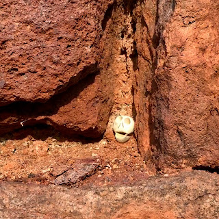
Today’s Skulferatu was left in a crack in one of the rocky outcrops overlooking the Bass Rock.


Skulferatu #15 at St Baldred's Cradle, East Lothian by kevin Nosferatu for the Skulferatu Project
Skulferatu #15


Skulferatu #15 in rocks at St Baldred's Cradle, East Lothian by Kevin Nosferatu for the Skulferatu Project
Skulferatu #15 in rocks at St Baldred’s Cradle


Google Map showing location of Skulferatu #15 at St Baldred's Cradle, East Lothian
Google Map showing location of Skulferatu


The coordinates for the location of the Skulferatu are:


Lattitude 56.023742

Longitude -2.584464