Showing posts with label ceramic. Show all posts

Thursday 17 December 2020

Skulferatu #10 - Scott Tower, Corstorphine Hill, Edinburgh


If you drive out of Edinburgh on Queensferry Road and head towards South Queensferry, the Forth Bridges and Fife, you pass Corstorphine Hill.  From the road it looks like nothing much, as all you can see is a scruffy area behind an old stone wall, with bushes and some towering trees.  There is no real sense of what lies behind this.  However, if you park up your car somewhere convenient and walk to the muddy path just off Queensferry Road, you enter a peaceful woodland haven.  Within a few yards it is hard to believe that just behind you is a noisy, polluted highway.


Old quarry on Corstorphine Hill
One of the old quarry sites on Corstorphine Hill

View from Corstorphine Hill of Forth Bridges and hills of Fife


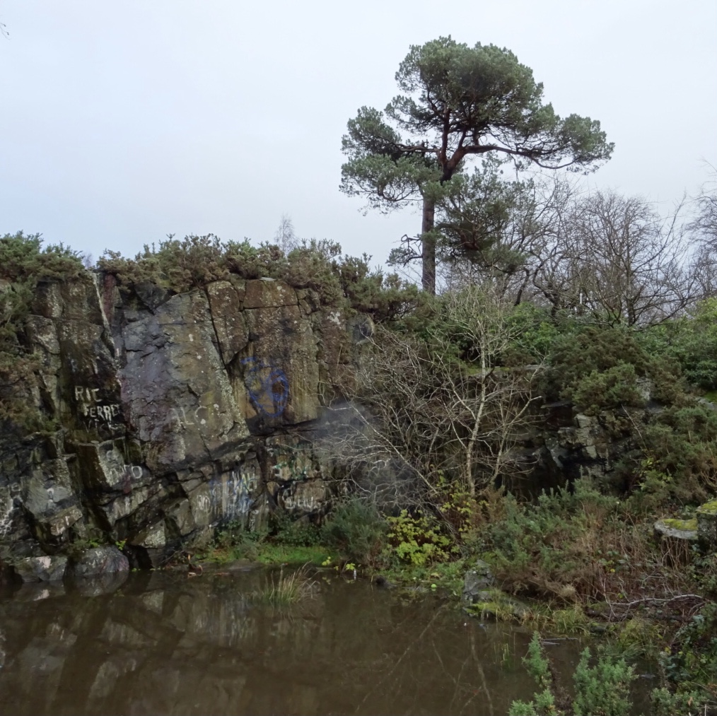
When walking into the woodland from Queensferry Road, one of the first things you pass is Barnton Quarry.  The area is now fenced off.  It is a disused, stone quarry that was later used as a military command centre and nuclear bunker.  The bunker was built in 1952 and in the early 1960s was redesigned as a Regional Seat of Government.  This meant that in the event of a nuclear war up to 400 politicians and civil servants could shelter there, while the rest of us fried in the nuclear explosion or died in the nuclear fallout.  The site remained operational up until the early 1980s.  At the time of writing it is being renovated and converted into a museum and education centre.


So anyway, I slipped and slid in my inadequate footwear up through slimy paths of mud and dead leaves.  Around me birds sang in the woodland canopy up above.  Then after a bit further walking, I could see an old, stone tower emerging through the trees. 


Scott Tower, Corstorphine Hill, Edinburgh by Kevin Nosferatu
Scott Tower through the trees

Stairs leading up to Scott Tower on Corstorphine Hill, Edinburghg by Kevin Nosferatu
Stairs leading up hill to Scott Tower

This Victorian oddity is the Scott Tower (also known as Corstorphine Tower or Clermiston Tower) and was built in 1871 to commemorate the centenary of the birth of Sir Walter Scott.  A bit greedy you might think, considering that there was already the Scott Monument in central Edinburgh to celebrate his life.  However nowadays it is hard to comprehend the fame of this Edinburgh born novelist, poet, playwright and historian.  The man’s novels were international bestsellers.  In fact, it was said that some of his novels outsold the Bible, which at that time was quite something.  Nowadays his work, to the modern reader, seems very turgid and boring.  I did try to read his novel Waverley once for a university course, but soon gave up and did the work on a novel by Daniel Defoe instead.  Moll Flanders – a much easier read.


Scott Tower, Corstorphine Hill, Edinburgh.  Picture by Kevin Nosferatu
Scott Tower, Corstorphine Hill, Edinburgh

Scott Tower through the trees. Photo by Kevin Nosferatu
Scott Tower through the trees
 

Scott Tower is situated at the top of Corstorphine Hill and is twenty metres tall.  It is usually locked, but pre-Covid was open occasionally to the public.  I’ve never managed to get to it when it has been open, but have been told that the views from it are quite amazing.  One day I will get up there and take a few photos.


Today’s Skulferatu was left in a hollow in a tree not far from the entrance to the tower.


Skulferatu #10 - Scott Tower, Corstorphine Hill, Edinburgh by Kevin Nosferatu
Skulferatu #10

Skulferatu #10 left in hollow of tree at Corstorphine Hill, Edinburgh by Kevin Nosferatu
Skulferatu #10 left in hollow in tree

Google Map showing location of Skulferatu #10

The coordinates for the location of the Skulferatu are: Latitude 55.951069  Longitude -3.272677.

Tuesday 24 November 2020

Skulferatu #7 - Hailes Castle, Traprain, Haddington


In a valley by the River Tyne (not to be confused with the River Tyne that flows through Newcastle) sits the rather pretty ruin of Hailes Castle.  On a cold winters day with a north wind cutting through my clothes like a knife of ice I went for a little walk around the castle and along the river.  From the road the castle looks rather unimposing, but as you walk through the ruins and down to the river the building becomes much more impressive.  The best views being from by or across the river.


The castle dates from the early 1200s and was built by the de Gourlay family.  The de Gourlay’s were a Northumbrian family who supported the Balliols during the Wars of Independence.  The Balliols lost the battle for the Scottish Crown and the de Gourlay’s land was confiscated and handed to Sir Adam de Hepburn.  He then extended the castle buildings.


Hailes Castle - View from Brae Heads Loan


Hailes Castle - View from banks of River Tyne

In 1546 the Lutheran preacher, George Wishart, was imprisoned in the castle after being arrested while preaching in Ormiston.  He was then handed over to Cardinal Beaton, the Archbishop of St. Andrews, and was taken to St Andrews Castle.  There, after being tried for heresy, he was burned at the stake.


Mary Queen of Scots stayed at the castle along with James Hepburn, the Fourth Earl of Bothwell.  They stopped here on their way from Dunbar to their wedding at Holyrood Palace in Edinburgh on 15 May 1567.  Their marriage was deeply unpopular, as Hepburn had been implicated in the murder a few months earlier of Mary’s husband Lord Darnley.  Shortly after Mary and Hepburn’s marriage, Mary was forced to abdicate the throne to her infant son.  Hepburn then fled the country and lived in exile in Denmark.  There he died in 1578, while imprisoned.  In 1858 his body was exhumed from the vault it had been buried in and was found to have become mummified.  In the 1970s it was supposedly an exhibit in the Edinburgh Wax Museum on the Royal Mile.


In 1650 Cromwell’s troops occupied the castle and severely damaged it.  By the mid-1900s Hailes Castle was being used as a granary and in 1926 it was taken into state care.


The Tower House at Hailes Castle

The Dovecot in the Tower House

The Skulferatu that accompanied me on this trip was placed in the dovecot in the tower house.


Skulferatu #7

Skulferatu #7 in Dovecot Hollow

Skulferatu #7 in Dovecot Hollow


The coordinates for the location of the Skulferatu are: Latitude 55.973236 Longitude -2.683593.


Google Map showing location of Skulferatu


Tuesday 17 November 2020

Skulferatu #6 - Polwarth Church, Greenlaw, Berwickshire


Polwarth Church, Greenlaw Berwickshire by Kevin Nosferatu
Polwarth Church

I remember this church from my childhood, as I walked out to it a few times with my Grandpa.  He worked in one of the nearby villages and would check on the church every so often to make sure all was in order.  Back then the key was kept above the main door so that anyone passing by could pop in to shelter or pray.  Useful when it was pouring with rain outside.  As a kid I was always fascinated by the two barred windows at the back of the church.  Sitting at ground level these windows gave a view into the crypts below, where on a good day, if you got your head into just the right position you could see some of the coffins inside.  Grandpa always said he would get hold of the keys for the crypt and show us down there, but never did.  No doubt if he had I would have been disappointed, as I was hoping to see stacks of skeletons everywhere rather than just and a few more crumbling coffins.


The first records of Polwarth Church are from 1242 when the Bishop of St Andrews, David de Bernham, consecrated the church and dedicated it to St Mungo.  The church was almost completely rebuilt in 1703.


In 1683, Sir Patrick Hume hid for four weeks in the crypt at the church after being implicated in the Rye House Plot. This was a plot to assassinate King Charles II and his brother.  His daughter, Grizel (Lady Grizel Baillie), smuggled him food while he was in hiding.  Hume and his family then fled to the Netherlands only returning to Scotland after the Glorious Revolution when King William of Orange took the crown in both England and Scotland.


The church closed in 2004 and was sold off by the Church of Scotland.  It is now privately owned.


Polwarth Church, Greenlaw, Berwickshire by Kevin Nosferatu
Front view of Polwarth Church

Gravestone in the Churchyard

Coffins in crypt at Polwarth Church, Greenlaw, Berwickshire
View of two coffins in the crypt


The Berwickshire poet, Robert McLean Calder (1841 to 1895) wrote a poem about the church and its congregation.  It is far too long and a little bit dull to quote in full, so here is one verse for your delectation –


What a quiet spot is the auld kirk-yaird,

That is a' thro' the week deserted,

Except when some mourner's wail is heard

By the grave o' some dear departed!

E'en noo on this joyous Sabbath morn

Nae jarrin' noise to the ear is borne,

For the talk is as meek as the faces worn

When they gang to the Kirk at Polart.


The full poem can be found at –

http://scotstext.org/roughs/robert_mclean_calder/robert_mclean_calder.asp


The Skulferatu that accompanied me on this trip was placed into a gap in the drystone wall at the back of the churchyard.


View from back of churchyard

Skulferatu #6 at Polwarth Church by Kevin Nosferatu
Skulferatu #6

Skulferatu #6 at Polwarth Church, Greenlaw by Kevin Nosferatu
Skulferatu #6 left in gap in drystone wall


The coordinates for the location of the Skulferatu are: Latitude 55.738498, Longitude -2.399870.


Map of location of Skulferatu


Tuesday 10 November 2020

Skulferatu #5 - Barns Ness Lighthouse, Dunbar

There are many lovely walks around the coast of East Lothian.  One of these takes you from Dunbar and round to Torness Nuclear Power Station and beyond.  This walk takes you past Barns Ness Lighthouse, which sits just up from the sea on a large expanse of Marram Grass.


Barns Ness Lighthouse


Barns Ness Lighthouse and Cottage

The lighthouse was designed by two of the Lighthouse Stevensons, the brothers David and Charles Stevenson (both cousins of the author Robert Louis Stevenson).  It was constructed between 1899 and 1901 and was manned by two lighthouse keepers until 1966, when it was electrified.   Only a single keeper was then required.  The lighthouse was fully automated in 1986 and after a review of lighthouses, was deactivated in 2005.  It was sold in 2006 and the lighthouse cottage is now a holiday rental.


During the Second World War the lighthouse was machine gunned by a passing German plane, however it was not damaged by this.


A view of the lighthouse


I walked out to the lighthouse from Dunbar on a cold and sunny afternoon.  The sky was a pale blue with white and grey clouds skiffing through it, while the sea was a still and calm blue black.  All the colours of winter coming into their own.


Skulferatu #5


Skulferatu left at base of lighthouse tower


I left a Skulferatu at the base of the lighthouse where if faces out to the sea.


Google Map showing location of Skulferatu


The coordinates for the location of the Skulferatu are – 

Latitude 55.987216

Longitude -2.445305.


Thursday 5 November 2020

Skulferatu #4 - Granton Harbour, Eastern Breakwater, Edinburgh


I walked out from Leith to the Eastern Breakwater at Granton Harbour.  I took the path along the Water of Leith and then went down Trinity Path and on to Lower Granton Road, where I followed the coastline along to Wardie Bay.  The sun was out, but the wind was a raging howl.  The clouds above me zoomed over the sky, as if they were making up for the lack of aircraft in these Covid riddled times.  The tide was high, and the air tasted of the salt spray from the water.


Granton Eastern Breakwater from Wardie Bay 


The walk along the Eastern Breakwater is one I only discovered recently, as though I’ve passed it many times on the bus, I had always assumed it would be closed to the public.  Given that its rather exposed and the walk is a bit uneven, it will probably be closed for ‘health and safety’ reasons at some point in the future!


The harbour at Granton consists of three parts, the main harbour, Granton Harbour Breakwater and the Eastern Breakwater.  The main harbour is now mainly used by leisure craft and the Royal Forth Yacht Club is based there, the Granton Harbour Breakwater is closed off due to construction in that area, while the Eastern Breakwater is a popular spot with local fishermen.  However, the harbour once had a busy and industrious past.  It opened in 1838 and the construction was funded by the 5th Duke of Buccleuch.  The lighthouse engineer, Robert Stevenson (grandfather of the famous author Robert Louis Stevenson) then oversaw the construction of the outer breakwaters.  These were completed in 1863.  The harbour became a port for the export of coal, the import of esparto grass, used in making paper, and a large fishing fleet was also resident there.


In 1847 the Edinburgh and Northern Railway operated a ferry service from Granton Harbour to Burntisland in Fife.  In 1850 they opened the first roll-on-roll-off railway ferry in the world and this allowed a direct rail link from Edinburgh to Dundee without passengers having to leave the train.  This service ended in 1890 with the opening of the Forth Bridge.


Warning sign at entrance to Eastern Breakwater

On the Eastern Breakwater I was blasted by the wind as I carefully made my way along the walkway.  There is a narrow walkway on either side of the jutting, uneven stones that make up the main part of the structure.  Here and there are rusting moorings and chains and there are a couple of small, crumbling buildings.  The buildings are both now sealed, but up until recently were open.  There was little in them other than discarded beer cans, fishing line and the smell of stale piss.


View along Eastern Breakwater

One of the buildings on Eastern Breakwater

At the end of the Breakwater I reached a white, box structure.  I don’t have a clue what this is, but assume it was a lighthouse of sorts at one point.  There I found a circular hole in the wall which was a perfect place to leave a Skulferatu.  So, I left one there.


End of the pier – Eastern Breakwater

Skulferatu #4

Skulferatu #4 in hole in wall in lighthouse

I then struggled back along towards the shore as the wind tried to whip my feet away from me and the low winter sun dazzled my eyes.  Overhead seagulls soared and screeched their eerie calls to one another.


Map showing location of Skulferatu


The coordinates for the location of the Skulferatu are – Latitude 55.987863 Longitude -3.220660.

Tuesday 27 October 2020

Skulferatu #3 - Eagle Rock, South Queensferry


My Covid reading for the last few weeks has been ‘I, Claudius’ and ‘Claudius the God’ by Robert Graves.  So, immersed in stories of ancient Rome and the Emperor who conquered a large part of Britain, I thought I’d take a walk out to Eagle Rock.  As a child, one of my friend’s and I had often played on the beach, in the area of the rock.  The Historic Scotland plaque pointing out the eagle was not in place at the time and we hadn’t really noticed or paid any attention to the carving on the rock.  Then one day my friend’s dad pointed out the eagle and told us it dated from the time of the Romans.  The rock then sort of took on a magical significance, imbued with all that ancient history, and we would often imagine ourselves as Roman legionnaires in a foreign and hostile land.


Eagle Rock


The eagle on Eagle Rock is a very worn carving, which is thought to date from around AD 140 to the early AD 200s.  At this time, the Romans occupied nearby Cramond and had a fort there.  It is unclear whether the eagle was a piece of Roman graffiti art or if it had any religious significance.


The worn carving of the eagle and Historic Scotland Plaque


To get to the rock I walked through Cramond and then over the old bridge which took me on to the road to Lord Rosebery’s estate.  On the estate there is a well-worn path that follows the coast around to South Queensferry.  Despite it being a warm day with the sun out, the path was a muddy sludge from the recent rain.  So, slipping and sliding I made my way down to the short stretch of beach by Eagle Rock.  Overhead a single plane flew, its wheels down and engine roaring as it came into land at nearby Edinburgh Airport.  A reminder of the time before Covid when planes would be roaring overhead every few minutes as they came into land or were taking off.  


View of Eagle Rock looking over the Forth to Fife


On the beach the tide was out and some kids played while their parents laid out a picnic on a battered looking old rug.  They waved hello as I walked past them and along to Eagle Rock.  There, I walked around and took a few photos before looking for a suitable place to leave the Skulferatu.  There was a nice, pocked ledge below the eagle, so I left it there and walked off to rejoin the path and make my way home.


Skulferatu #3


Skulferatu #3 in situ


The coordinates for the location of the Skulferatu are – 


Latitude 55.982954 

Longitude -3.308492  


Google Map showing location of Skulferatu


Article and photographs are copyright of © Kevin Nosferatu, unless otherwise specified.