Showing posts with label ruins. Show all posts

Tuesday 19 April 2022

Skulferatu #67 - Newbyres Castle, Gorebridge, Midlothian


There are many castles in Scotland that are now not much more than a few stones.  Newbyres Castle is one of these.  There is not much left of it now, and its glory days are long gone.  It is now no more than two sides of a low wall and a bramble covered mound standing in a small wildlife garden by the village of Gorebridge.  However, back in its heyday the castle was a substantial and rather picturesque tower house. 


A photo of the ruins of Newbyres Castle - a rather dull looking ruined wall surrounded by rather dull looking plants that have died back in winter.  Photo by Kevin Nosferatu for the Skulferatu Project
The rather unimpressive remains of Newbyres Castle


A photo of the ruined walls of Newbyres Castle - they are low and the stones green with moss.  Photo by Kevin Nosferatu for the Skulferatu Project
Part of the outside walls of Newbyres castle


A photo of the ruined walls of Newbyres Castle - they are low and the stones green with moss.  Photo by Kevin Nosferatu for the Skulferatu Project
Part of the outside walls of Newbyres Castle


A photo of a bramble covered mound in the wildlife park by Gorebridge, that is the site on which Newbyres Castle once stood.  Photo by Kevin Nosferatu for the Skulferatu Project
This bramble covered mound covers the area where the castle once stood


Newbyres Castle was built in the mid-16th Century for Michael Borthwick of Glengelt.  He had acquired the land in 1543 from James Haswell, the Abbot of the abbey at Newbattle.  The castle was built as an L shaped tower with a courtyard around it.  It had a vaulted ground floor and numerous gun loops on the upper floors.  From his new, fortified home, Borthwick oversaw his coal mining operations in the area. 


In 1624 the castle was sold to Sir James Dundas of Arniston, who was the Governor of Berwick.  After his death, the house became the main residence of his widow Mary Hume, Lady Arniston.  She had a reputation locally as a very hospitable host and on one occasion a guest of hers was prosecuted for drunkenness after being a bit rowdy and potty mouthed while making his way home.  The charge against him was later found ‘Not Proven’.  Nowadays, we might look back at the goings on in Newbyres Castle and see it as a bit of a ‘party house’.  The 17th Century equivalent of the house on the street that at weekends always has music pounding out until the early hours of the morning with lots of inebriated people coming and going.


A sketch of Newbyres Castle as it would have looked in its heyday, taken from The Castellated and Domestic Architecture of Scotland from the Twelfth to the Eighteenth Century  Volume Three  By David MacGibbon and Thomas Ross.
A sketch of Newbyres Castle as it would have been in its heyday


A sketch of the ruins of Newbyres Castle from The Arniston Memoirs, Three Centuries of a Scottish House, 1571-1838  By George W T Omond.
A sketch of the ruins of Newbyres Castle from The Arniston Memoirs


A sketch of the ruins of the castle circa 1879, taken from The Castellated and Domestic Architecture of Scotland from the Twelfth to the Eighteenth Century  Volume Three  By David MacGibbon and Thomas Ross.
A sketch of the ruins of the castle circa 1879


At some point the castle was abandoned as a home and was left to decay and crumble away.  A large part of the tower, including the staircase collapsed in 1881.  In 1963 most of the remaining walls were demolished by Midlothian Council due to fears for public safety.


On a walk that took me through Gorebridge, I stopped off at the remains of the castle.  I walked to the top of the pile of overgrown rubble and wondered if I zoomed back to a few hundred years ago, what room I’d be standing in, and who would be there?  Maybe I’d bump into Lady Arniston, and she would offer me a nip of something nice to drink.  On a cold day like today, it would be most welcome.


I left a Skulferatu in a gap in the remaining chunk of the castle walls.


A photo of a small ceramic skull (Skulferatu 67) being held up with the ruins of Newbyres Castle in the background.  Photo by Kevin Nosferatu for the Skulferatu Project
Skulferatu #67


A photo of a small ceramic skull (Skulferatu 60) in a gap in the stone walls of Newbyres Castle, Gorebridge.  Photo by Kevin Nosferatu for the Skulferatu Project
Skulferatu #67 in a gap in the castle walls


A photo of a small ceramic skull (Skulferatu 60) in a gap in the stone walls of Newbyres Castle, Gorebridge.  Photo by Kevin Nosferatu for the Skulferatu Project
Skulferatu #67 in a gap in the castle walls


A photo of a small ceramic skull (Skulferatu 60) in a gap in the stone walls of Newbyres Castle, Gorebridge.  Photo by Kevin Nosferatu for the Skulferatu Project
Skulferatu #67 in a gap in the castle walls


TomTom map showing location of Skulferatu #67
Map showing location of Skulferatu #67


The coordinates for the location of the Skulferatu are -


Latitude 55.84185

Longitude -3.048500


I used the following sources for information on the castle –


The Castellated and Domestic Architecture of Scotland from the Twelfth to the Eighteenth Century

Volume Three

By David MacGibbon and Thomas Ross

1889

(Sketches – Fig. 477 & Fig. 478)


Newbyres Castle: The Story So Far

https://gorebridge.org.uk/heritage/newbyres-castle-the-story-so-far/


The Arniston Memoirs, Three Centuries of a Scottish House, 1571-1838

By George W T Omond

1887

(Sketch of Newbyres Tower)


Public Information Board at Site


Tuesday 1 March 2022

Skulferatu #61 - Craiglockhart Castle, Glenlockhart Road, Edinburgh


It was one of those days that promises to be warm but ends up freezing your ears off.  I found this out as I went for a stroll around the slippery and sludgy mud paths of Craiglockhart Hill.  The higher up I got, the more my ears stung with the cold breeze.  If only I’d thought to bring a hat with me, just in case.  Coming down off the hill I made my way over to the grounds of Napier University and the ruins of Craiglockhart Castle.


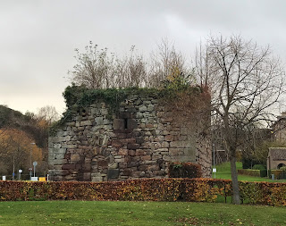
A photo showing a squat, square stone building, Craiglockhart Castle, that is in ruins.  There is a doorway blocked off with stone and in the distance many signs and lampposts as the ruin sits by the car park of Napier University in Edinburgh.   Photo by Kevin Nosferatu for the Skulferatu Project.
The ruins of Craiglockhart Castle


A photo showing the stone wall of Craiglockhart Castle and within the wall is the pattern of the doorway now blocked off with stone and above that, to the right, there is a slit window. Photo by Kevin Nosferatu for the Skulferatu Project.
The doorway to the castle


A photo showing vegetation growing out the top of Craiglockhart Castle. Photo by Kevin Nosferatu for the Skulferatu Project.
The roof of the castle – overgrown with vegetation


A photo showing a squat, square stone building, Craiglockhart Castle, that is in ruins.  There is a doorway blocked off with stone and vegetation grows out of the top of the building. Photo by Kevin Nosferatu for the Skulferatu Project.
The ruins of Craiglockhart Castle


Some castles are just ruins, others are completely f*cked.  Craiglockhart Castle is one of the latter.  Not much remains of the castle now, it is just a crumbling square of stone walls with some vegetation growing out of it.  To be honest, it wasn’t really ever much of a castle, but was more just a small, four storey tower house with pretentions.  Now only the first storey and part of the second storey remain.


A photo showing a view of the ruins Craiglockhart Castle with the road to the car park running past it.  Photo by Kevin Nosferatu for the Skulferatu Project.
The ruins of Craiglockhart Castle


A photo showing a view of the ruins Craiglockhart Castle and a slit window within the stone walls. Photo by Kevin Nosferatu for the Skulferatu Project.
The ruins of Craiglockhart Castle


A photo showing a view of the ruins Craiglockhart Castle with a slit window in the walls and vegetation growing out from the top of it. Photo by Kevin Nosferatu for the Skulferatu Project.
The ruins of Craiglockhart Castle


A photo showing a view of the ruins Craiglockhart Castle in the grounds of Napier University, Edinburgh. Photo by Kevin Nosferatu for the Skulferatu Project.
The ruins of Craiglockhart Castle


Not much is known about the history of the castle, and theories about it are that it was either built for the Kincaid family in the 12th Century or in the 15th Century for the Lockharts of Lee.  Nobody really knows and its story is now lost in the mists of time.  I’m sure many interesting things happened here, intrigues, love affairs, scandals, and deaths.  Maybe it was even the site of the first contact between man and traveller from outer space, but we will never know, as all the memories of this building are now gone.  Gone with those who once lived here.  Gone and forgotten.


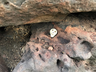
And on that cheery note, I left the Skulferatu that accompanied me on my walk in one of the many thousands of gaps and holes in the crumbling walls of the castle.


A picture of a small ceramic skull (Skulferatu 61) being held up with Craiglockhart Castle in the background. Photo by Kevin Nosferatu for the Skulferatu Project.
Skulferatu #61


A picture of a small ceramic skull (Skulferatu 61) in an indentation in the worn stone of the walls of Craiglockhart Castle. Photo by Kevin Nosferatu for the Skulferatu Project.
Skulferatu #61 in a gap in the castle walls


A close up picture of a small ceramic skull (Skulferatu 61) in an indentation in the worn stone of the walls of Craiglockhart Castle. Photo by Kevin Nosferatu for the Skulferatu Project.
Skulferatu #61 in a gap in the castle walls


TomTom Map showing location of Skulferatu #61 at Craiglockhart Castle, Edinburgh
Map showing location of Skulferatu #61


The coordinates for the location of the Skulferatu are –


Latitude 55.919290

Longitude -3.238320


I used the following sources for information on Craiglockhart Castle –


Canmore

Craiglockhart Castle | Canmore


Gazetteer for Scotland

Craiglockhart Castle: Overview of Craiglockhart Castle (scottish-places.info)


The Castellated and Domestic Architecture of Scotland from the Twelfth to the Eighteenth Century

Volume Three

By David MacGibbon and Thomas Ross

1887


Tuesday 26 October 2021

Skulferatu #47 - Seafield Tower, Kirkcaldy, Fife


The walk along the Fife Coastal Path, from Kinghorn to Seafield Tower, takes you up and down a narrow trail and past some spectacular scenery of jagged rocks and crashing waves.  There are lots of tiny coves and rocky pits and hollows to explore, and on a calm day you can see colonies of seals sunning themselves on the rocks exposed at low tide.


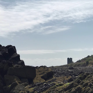
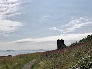
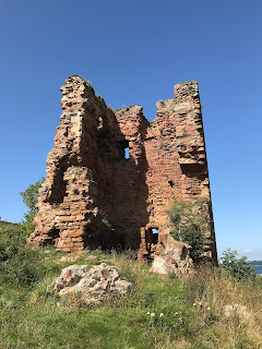
A picture of a ruined tower standing in the distance with rocks in the foreground.  This is Seafield Tower as seen from rocks by the Forth.  Photo by Kevin Nosferatu for the Skulferatu Project.
Seafield Tower as seen from rocks by the Forth


A picture of the ruins of Seafield Tower as seen from the Fife Coastal Path.  Photo by Kevin Nosferatu for the Skulferatu Project.
View of ruins of Seafield Tower from Fife Coastal Path


The ruins of Seafield Tower sit on the Fife coast between Kinghorn and Kirkcaldy.  It was built in the early to mid-sixteenth century on land that had been granted by King James II to Richard Multrare (Moultrie) in 1443.  It remained in the Moultrie family for several generations.  In 1631 the tower was sold by Robert Moultrie to James Law, the Archbishop of Glasgow for 19,700 marks (£1,095).  After the Archbishop’s death the tower went through several other owners before finally being abandoned and left to fall into ruin.  


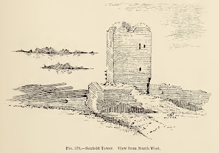
A sketch of Seafield Tower taken from The Castellated and Domestic Architecture of Scotland from the Twelfth to the Eighteenth Century Volume Three by David MacGibbon and Thomas Ross, published in 1887.
A sketch of Seafield Tower as it was circa 1887


It is thought that the ruin was used as a smugglers den for a number of years.  It was noted by David MacGibbon and Thomas Ross when they visited the tower in the late 1880s that smugglers seemed to have made alterations to the building. 


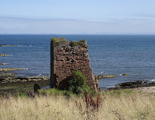
A picture of the ruins of Seafield Tower taken from the beach below.  Photo by Kevin Nosferatu for the Skulferatu Project.
Seafield Tower as seen from the beach below


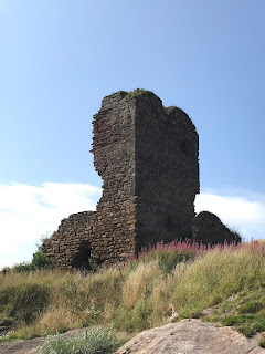
A picture of the ruins of Seafield Tower standing on the rocky outcrop the tower was built on.  Photo by Kevin Nosferatu for the Skulferatu Project.
The ruins of Seafield Tower standing on a rocky outcrop


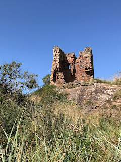
A picture showing the ruins of Seafield Tower from an angle that shows two of the outside walls have now gone leaving a clear view into the ruins of the interior of the tower.  Photo by Kevin Nosferatu for the Skulferatu Project.
The ruins of Seafield Tower


A picture of the ruins of Seafield Tower showing a view up from the beach below with sea grasses in front of the ruins of the tower.  Photo by Kevin Nosferatu for the Skulferatu Project.
The ruins of Seafield Tower


The Rev. James Taylor mentions the tower in his book ‘Historical Antiquities of Fife’.  He, however, felt it lacked any historical gravitas and wrote - ‘Passing onwards and eastwards, we come to the…tower of Seafield.  It is built upon a rocky ledge, which the waves wash, and has the broad Firth as its lawn.  Prominent for situation, the eye often turns to it, and the expectation is awakened, as if it ought to be the scene of something memorable.  But no legend of romance, no fact of history, no popular tradition, attaches to it.  It is a ruined tower by the sea and nothing more.’


A picture of the ruins of Seafield Tower looking with the sea in the background.  Photo by Kevin Nosferatu for the Skulferatu Project.
View of the ruins of Seafield Tower looking on to the Forth


A picture showing the ruined interior walls of Seafield Tower.  Photo by Kevin Nosferatu for the Skulferatu Project.
Interior walls of Seafield Tower


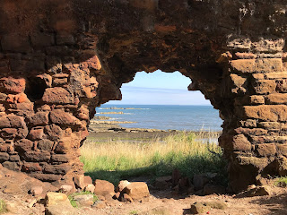
A picture showing the view out over the Forth through a doorway created in tower wall.  Photo by Kevin Nosferatu for the Skulferatu Project.
View out over the Forth through doorway created in tower wall


It would appear that the tower originally consisted of five storeys and was part of an L shape castle constructed from local red sandstone and surrounded by a wall on the landward side.  It is likely that it followed the pattern of other castles in this area with storage on the ground floor, the Great Hall on the level above that and then the upper levels all being given over to accommodation.  Much of the building has now gone, with part of the tower collapsing in a storm in 2013.


I left the Skulferatu that accompanied me on today’s walk in a gap in a wall inside the ruins of the tower.


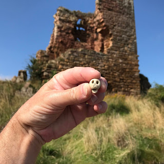
A picture showing a hand holding up a small ceramic skull with a view of Seafield Tower in the background.  Photo by Kevin Nosferatu for the Skulferatu Project.
Skulferatu #47


A picture showing Skulferatu #47 having been left in a gap in the wall of Seafield Tower, near Kirkcaldy in Fife.  Photo by Kevin Nosferatu for the Skulferatu Project.
Skulferatu #47 in a gap in the wall of the tower


Map showing the location of Skulferatu #47 at Seafield Tower, Kirkcaldy, Fife
Map showing the location of Skulferatu #47


The coordinates for the location of the Skulferatu are –


Latitude 56.084120

Longitude -3.159048


I used the following sources for information on Seafield Tower –


The Moultries

South Carolina Historical and Genealogical Magazine, Vol 5

1904


John Gray Centre – Research Guide – Old Scottish Money

Research Guides - Money


The Castellated and Domestic Architecture of Scotland from the Twelfth to the Eighteenth Century

Volume Three

By David MacGibbon and Thomas Ross

1887


Historical Antiquities of Fife, Chiefly Ecclesiastical, Connected with Some of its Districts

Volume Two

Rev. James W. Taylor

1875


The Scotsman – 8 Lesser-known castles of Scotland

11 September 2018

8 lesser-known castles of Scotland | The Scotsman


Tuesday 11 May 2021

Skulferatu #29 - Hound Point Battery, Dalmeny Estate, South Queensferry


On a sunny, but bitterly cold April morning I took a walk from Cramond, through Dalmeny Estate, to South Queensferry.  Following Cycle Route 76, I walked through the top of the estate and round and down to Hound Point.  By Fishery Cottage, I cut up the hill and through the woods to the concrete remains of the Hound Point Battery, an old First World War coastal defences site.  There I had a good look about as the trees all around swayed and creaked in the wind.


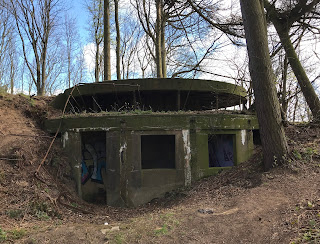
Hill view of the gun emplacement at Hound Point Battery in Dalmeny Estate, near South Queensferry. Photo by Kevin Nosferatu for the Skulferatu Project
Hill view of gun emplacement at Hound Point Battery


The remains of the magazine building sitting amongst the trees at Hound Point Battery.  Photo by Kevin Nosferatu for the Skulferatu Project
Remains of the magazine building


Remains of one of the gun emplacements at Hound Point Battery, Dalmeny Estate, near South Queensferry.  Photo by Kevin Nosferatu for the Skulferatu Project
Gun emplacement – Hound Point Battery


Remains of one of the gun emplacements at Hound Point Battery, Dalmeny Estate, near South Queensferry.  Photo by Kevin Nosferatu for the Skulferatu Project
Gun emplacement – Hound Point Battery


Remains of one of the gun emplacements at Hound Point Battery, Dalmeny Estate, near South Queensferry.  Photo by Kevin Nosferatu for the Skulferatu Project
Gun emplacement – Hound Point Battery


Hound point Battery was part of a defensive system built along the coast of the UK that stretched from Shetland to Cornwall.  Building work began on the Battery before the start of World War One and it was operational by 1914.  The Battery consisted of two gun emplacements at the top of the hill overlooking the Firth of Forth, and a magazine building to the rear and slightly further down the hill.  While it was operational the perimeter of the Battery would have been surrounded by blockhouses and a barbed wire fence.  When it was armed in 1914 the Battery had two BL 6-inch Mk VII guns, however these were removed in 1915 and transferred to another battery at Leith Docks.  The guns were then replaced in 1916 with two 12 pounder Quick Firing Naval 18cwt guns.  These were dismounted and removed in 1922.


In September 1914, the Battery at Hound Point opened fire on a suspected enemy submarine out in the Firth of Forth.  However, one of the shells fired ricocheted off the water and landed near to the Earl of Moray’s residence at Donibristle House in Dalgety Bay.  Luckily, it didn’t cause much damage other than ploughing up the lawn in front of the house.  The enemy submarine was eventually sunk by a gunner based out on Inchgarvie Island.


The Battery is now in a state of disrepair and is badly vandalised and crumbling away, much like most of the old coastal defences.  However, around the old gun emplacements there are some good views, through the trees, over the Forth.  The sort of views that make you realise why they built the Battery where they did.


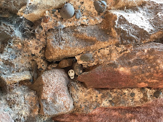
I left the Skulferatu that accompanied me on today’s walk in the hollow of a tree growing out from one of the gun emplacements.


Skulferatu #29 at a gun emplacement in Hound Point Battery.  Photo by Kevin Nosferatu for the Skulferatu Project
Skulferatu #29


Skulferatu #29 in tree hollow by one of the gun emplacements at Hound Point Battery.  Photo by Kevin Nosferatu for the Skulferatu Project
Skulferatu #29 in tree hollow at Hound Point Battery


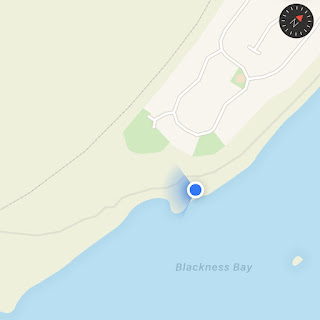
Map showing location of Skulferatu #29 by Hound Point Battery, Dalmeny Estate, South Queensferry
Map showing location of Skulferatu #29


The coordinates for the location of the Skulferatu are –


Latitude 55.999295

Longitude -3.351049


I used the following sources for information on Hound Point Battery -


Linlithgowshire Gazette – Friday, September 18, 1914


Overland China Mail – No 2386, October 31, 1914


Canmore – Forth Defences, Inner, Hound Point Battery

Canmore - Forth Defences, Inner, Hound Point Battery


Ancient Monuments UK

ancientmonuments.uk - Hound Point Battery, City of Edinburgh


Article and photographs are copyright of © Kevin Nosferatu, unless otherwise specified.


Tuesday 13 April 2021

Skulferatu #26 - Saltcoats Castle, Gullane, East Lothian


When I go cycling from Edinburgh to North Berwick, I like to take the coastal road and enjoy the scenic route.  Just before I reach Gullane, I turn off from the road and take the bumpy path along the John Muir Way and cut down to the rather spectacular ruin of Saltcoats Castle.  On a sunny day it’s relaxing just to sit in the castle grounds, rehydrate and take in the great view.


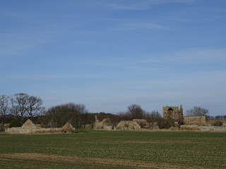
The tower of Saltcoats Castle can be seen in the distance with ruined cottage and outbuildings around it.  Photo by Kevin Nosferatu for the Skulferatu Project.
Saltcoats Castle with ruined cottage and outbuildings


The Tower of Saltcoats Castle can be seen through the overgrown outer area of the castle courtyard.  Photo by Kevin Nosferatu for the Skulferatu Project.
Tower of Saltcoats Castle seen through overgrown outer area of the castle


The history of this rather marvellous ruin starts with a legend of daring and bravery, or the needless slaughter of a wild animal, depending on your point of view.  The story goes something like this…


…back in the mists of time, when the lands that now make up East Lothian were sparsely populated and thick with forest and wild beasts, there was a huge, wild boar that terrorised the area.     This beast was enraged by anybody it saw on its territory and had chased, gouged and maimed a dozen or so people.  Soon it got to the stage where those in the villages were terrified of travelling to market, the peasants working the fields were terrified as they worked, the landlords in their stately homes were terrified of walking outside in their gardens and those travelling from Edinburgh towards England took a long route round to avoid the area.  The King, on learning what was going on, offered a large reward to anyone who could kill the boar and rid the land of its menace.  Many tried and died in their attempts.  The boar always seemed to be one step ahead of them and ambushed many a brave hunter, slicing through their weak and mortal bodies with sharp tusks that seemed to be made of steel.  Soon the boar was being seen as more than just a beast, it was a demon sent from Hell or a punishment from God.  The churches rang out their bells and the holy prayed in hope that the good Lord would end their torment.  But he didn’t.


Then along came a young man from the Livington family.  His family had fallen on hard times and he had decided that to improve their lot he would take on the challenge of killing the boar.  First of all, he set about preparing for the task and had a special glove made of thick leather.  The inside of this glove was heavily padded with down.  He also had a steel helmet, body armour and a sword made for the task.  Expensive though this was, he persuaded the craftsmen who made the pieces for him that he would pay them when he had killed the boar.  Such was his self confidence in completing this task that they all agreed to this and he was soon ready to go on the hunt for the deadly beast.


On a summer’s morning young Livington set off out into the forest.  As he went, he would call out every so often in order to attract the boar.  However, it was almost as if the beast could sense him and his purpose, and for hours Livington walked without seeing any sign of it.  Growing weary from walking, Livington stopped near a stream and drank from it.  He sat by it for a while and decided to give up for the day and to start his hunt again the next morning.  As he rose to make his way back out of the forest, he heard something crashing through the undergrowth.  It drew nearer and nearer.  Livington drew his sword and readied himself.  With a roar the boar burst through the undergrowth to where Livington stood.  The creature was huge with tusks like sabres and eyes that glowed red like the hot coals of a fire.  For a moment it stood still staring at Livington, then it stamped at the ground, snarled, and rushed at him with tusks out.  Like a matador, Livington spun to the side and the boar charged past.  It came to a skidding halt and turned again to face him.  It’s eyes burning with anger and hate it let out a roar and charged at him.  Livington once more sidestepped the boar as it reached him, howling with frustrated rage it turned and came at him again.  As it was almost on top of him Livington thrust his gloved arm down into its mouth.  The shock of this caused the beast to stumble and fall, taking both it and Livington to the ground.  The beast, unable to move its head enough to gouge Livington with its tusks, kicked out at him, catching him several times about the body and denting the armour he wore.  In this onslaught Livington almost lost grip of his sword, but just managing to keep hold of it he thrust it up and through the beast’s heart.  The beast let out a groan, almost human, then sighing it died by Livington’s side.  Exhausted, Livington lay by it and prayed a prayer of thanks to the Almighty Lord above.


A group of five woodsmen, had bravely ventured that day into the forest to chop wood, and had heard the commotion.  Cautiously they approached to see what was going on and saw Livington lying beside the body of the boar.  Thinking that he must have died in the fight, they went over to offer prayers for him.  On seeing that he was alive and suffering from no fatal wounds, they helped the exhausted man to his feet.  They then cut and stripped a large branch and tied the body of the boar to this.  Four of the woodsmen carried it out, while one carried Livington on his shoulders.  As they walked out through the forest, they came across a den of six squealing little piglets. The six little piglets mama boar had been protecting from those who encroached on her territory.  These were gathered up, placed in a sack, and handed to Livington.


On hearing that the boar was dead, villagers from all around came out in celebration.  That night Livington and the villagers, from landlord to peasant, all feasted on suckling pig and wild boar sausages, black pudding, and roast pork.  All washed down with local ales and fine wines imported from afar. 


A few days later the King heard that the boar had been killed.  For Livington’s act of bravery and ridding the land of the terrible beast the King granted him the lands from Gullane Point to North Berwick Law.  It was on the land acquired by Livington, near to Gullane, that Saltcoats Castle was built.


Up until the 1790s the helmet said to be worn by Livington when he slayed the boar hung in the church at Dirleton in East Lothian.  When the church was being repaired the helmet was removed for safekeeping and was lost.


At the mouth of the Peffer there is a small stream that goes by the name of Livington’s Ford.  It is here that Livington supposedly slew the wild boar. 
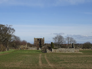
 

Anyway, let’s get back to the castle…the name of Saltcoats Castle is thought to come from the fact that it stands on ground that was in ancient times a salt marsh.  The castle is a Sixteenth Century courtyard castle that rose to a height of three storeys.  It was enclosed by a wall and in the grounds, there would have been an extensive garden and orchard.  There was also at one time a bowling green to the east of the castle, though all signs of this have been lost as it has been ploughed over numerous times and become part of the surrounding fields.


The castle was built in around 1590 for Patrick Livington and his wife Margaret Fettis of Fawside.  In the early 1700s the castle and estate were acquired by the Hamilton family when James Hamilton of Pencaitland married ‘the heiress of Saltcoats’, Margaret Menzies.  The castle was inhabited until around the late 1790s, the last tenant being a Mrs Carmichael, who died there.  It was then left uninhabited for several years.  Around 1810 much of the stonework was removed to build farm steadings and walls.  The ruined cottage which stands at the side of the castle was built around this time and on its front wall there is a panel taken from the castle with the coat of arms of Patrick Livington carved into it.


The stone Tower of the ruins of Saltcoats Castle, Gullane, East Lothian.  Photo by Kevin Nosferatu for the Skulferatu Project.
Tower of Saltcoats Castle


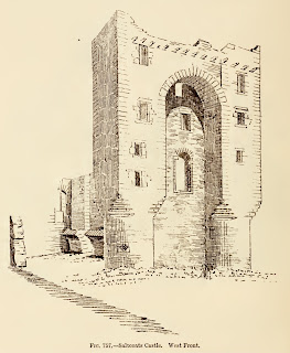
Sketch of Saltcoats Castle tower taken from The Castellated and Domestic Architecture of Scotland from the Twelfth to the Eighteenth Century Volume Four by David MacGibbon and Thomas Ross 1887
Sketch of Saltcoats Castle from ‘The Castellated and Domestic Architecture of Scotland’ - 1887


Side view of the castle ruins and tower from across the remains of what was once a walled orchard and garden.  Photo by Kevin Nosferatu for the Skulferatu Project.
Side view of castle ruins and tower


 Side view of Saltcoats Castle tower.  Photo by Kevin Nosferatu for the Skulferatu Project.
Side view of castle tower


A view of Saltcoats Castle and the ruins of farm steadings, taken from a distance with a newly planted field in the foreground.  Photo by Kevin Nosferatu for the Skulferatu Project.
View of castle and ruins of farm steadings


Saltcoats Castle has now been designated as a scheduled monument.


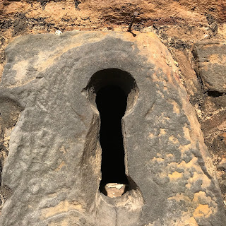
The Skulferatu that accompanied me today was left on a ledge above the keyhole window on the tower.


View of a hand holding Skulferatu #26, with part of the tower of Saltcoats Castle in the background.  Photo by Kevin Nosferatu for the Skulferatu Project.
Skulferatu #26


A photograph of a keyhole window in the castle tower with a Skulferatu in the top left hand corner on the window ledge.  Photo by Kevin Nosferatu for the Skulferatu Project.
Spot the Skulferatu 


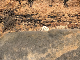
Close up of Skulferatu #26 on window ledge of keyhole window in the tower of Saltcoats Castle.  Photo by Kevin Nosferatu for the Skulferatu Project.
Close up of Skulferatu #26 on window ledge


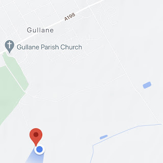
Google Map showing location of Skulferatu #26
Map showing location of Skulferatu #26


The coordinates for the location of the Skulferatu are:


Latitude 56.026982

Longitude -2.827307


I used the following sources for information on the castle –


The Castellated and Domestic Architecture of Scotland from the Twelfth to the Eighteenth Century

Volume Four

By David MacGibbon and Thomas Ross

1887


Lamp of Lothian or the History of Haddington form the earliest times to 1844

by James Miller

1900


St Baldred of the Bass and Other Poems

By James Miller

Oliver and Boyd

1824


Wikipedia – Saltcoats Castle

Saltcoats Castle - Wikipedia


Canmore – Saltcoats Castle

Canmore - Saltcoats Castle, Gullane


Article and photographs are copyright of © Kevin Nosferatu, unless otherwise specified.